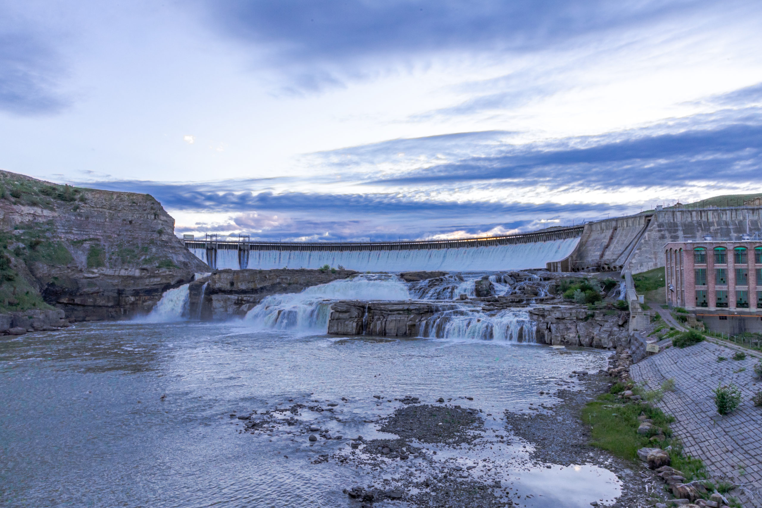
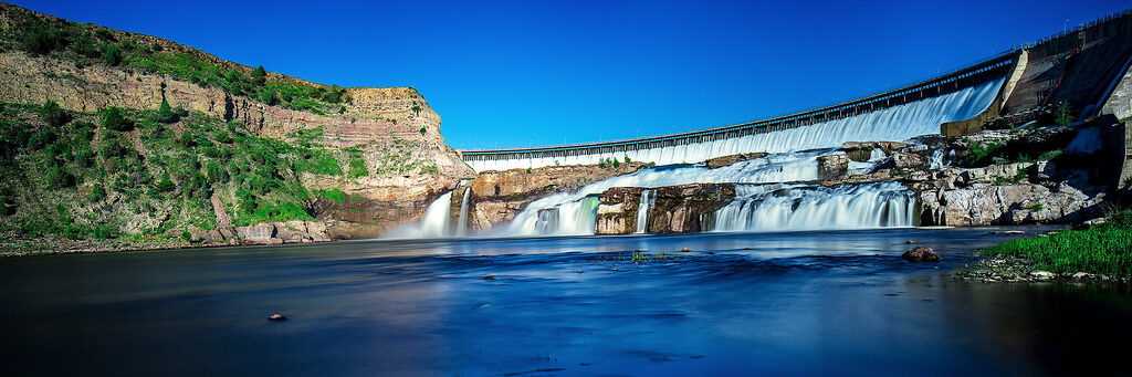
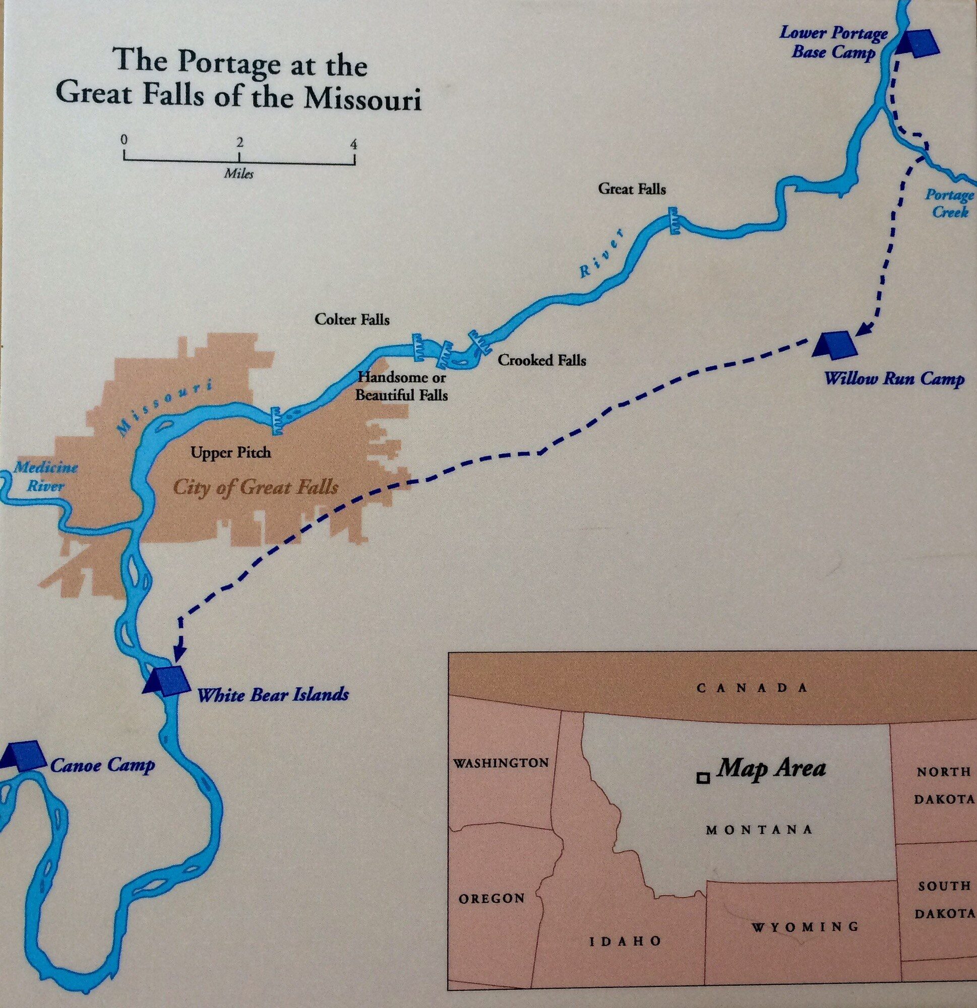
Page Feedback

Great Falls Portage

Great Falls Portage

Information

406-727-8733
Visiting the Great Falls is free of charge
lat: 47.5692148 long: -111.1240659
The Great Falls Portage is the route taken by the Lewis and Clark Expedition in 1805 to portage around the Great Falls of the Missouri River during the outbound portion of the expedition. The 18-mile portage took 31 days. The Great Falls Portage is a National Historic Landmark and ideal for history buffs, families, tours, and anyone who wants to experience the land as the Corps of Discovery saw it. From day hikes to scenic drives, Great Falls Montana offers unique experiences to learn about the expedition that transformed the West and changed the trajectory of American history.
The Great Falls Lower Portage is a High Potential Historic Site on the Lewis and Clark National Historic Trail. Anyone interested in visiting the Great Falls area today to see the Lewis and Clark history should plan their first stop at the Lewis and Clark Interpretive Center.  There they can get details and a map for visiting the 36 interpreted locations available to the tourist.  From the Center go leisurely out exploring and enjoy!
On June 13, 1805, Lewis, who had advanced ahead of the main party, heard the “agreeable sound of a fall of water” and soon “saw the spray arise above the plain like a column of smoke.” This signaled the expe­dition’s arrival at Great Falls, the first in a succession of five waterfalls that would necessitate an 18-mile overland portage. On June 16, the expedition consolidated at a lower portage camp, about one mile below Belt Creek (named Portage Creek by Lewis and Clark). They encountered Sulphur Spring, located across the river from Belt Creek, and Lewis used its waters to aid the treatment of an extremely ill Sacagawea. While encamped they surveyed a suitable portage route, constructed wagons to haul canoes and supplies, and undertook the arduous task of moving their equipment 18 miles overland to the Upper Portage Camp. By June 28, the last load was transported away from the lower camp, and the remaining supplies were cached in place. The white pirogue was left there and retrieved on the return trip in July 1806. The Great Falls Lower Portage is one of two discontinuous segments of the Great Falls Portage NHL, separated by the intrusion of Malmstrom Air Force Base. It includes the lower portage campsite, Sulphur Spring, and the northern portion of the portage route. The majority of the Great Falls Lower Portage is under private ownership. However, there are numerous state and federal public areas along the Missouri River frontage.

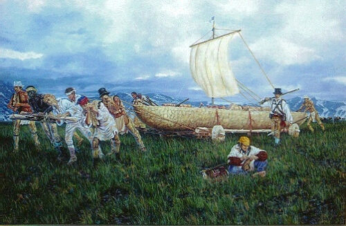
Clark had surveyed and staked out an 18-mile portage route during June 17-20, 1805. On June 22, Lewis, Clark, and a contingent of the expedition began transporting the first load of equipment, including the components of Lewis’ iron frame boat. The next day they arrived at the site selected for their upper por­tage camp, along a stretch of the Missouri River marked by three islands they named White Bear Islands. Lewis began the assemblage of his experimental boat, while Clark directed the portage endeavor. All sup­plies had been moved to the upper camp by July 2, but efforts to make the iron boat river-worthy contin­ued until July 9 when Lewis finally “relinquished all further hope of my favorite boat and ordered her to be sunk in the water, that the skins might become soft in order the better to take her in pieces tomorrow and deposit the iron fraim at this place as it could probably be of no further service to us.” Putting the failed experiment behind them, Clark and ten men traveled 14 miles upstream and fashioned two cottonwood dugout canoes. By July 13, the entire expedition relocated to the “Canoe Camp,” and finally, on July 15, resumed their journey up the Missouri.

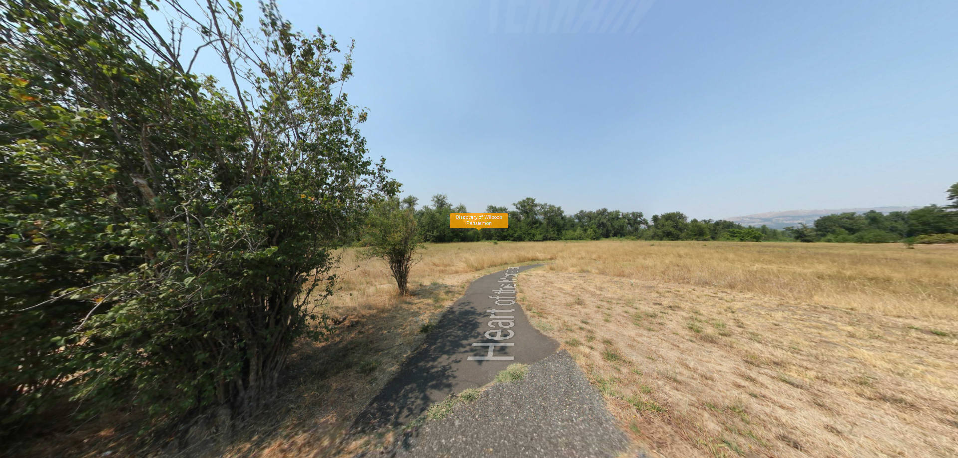
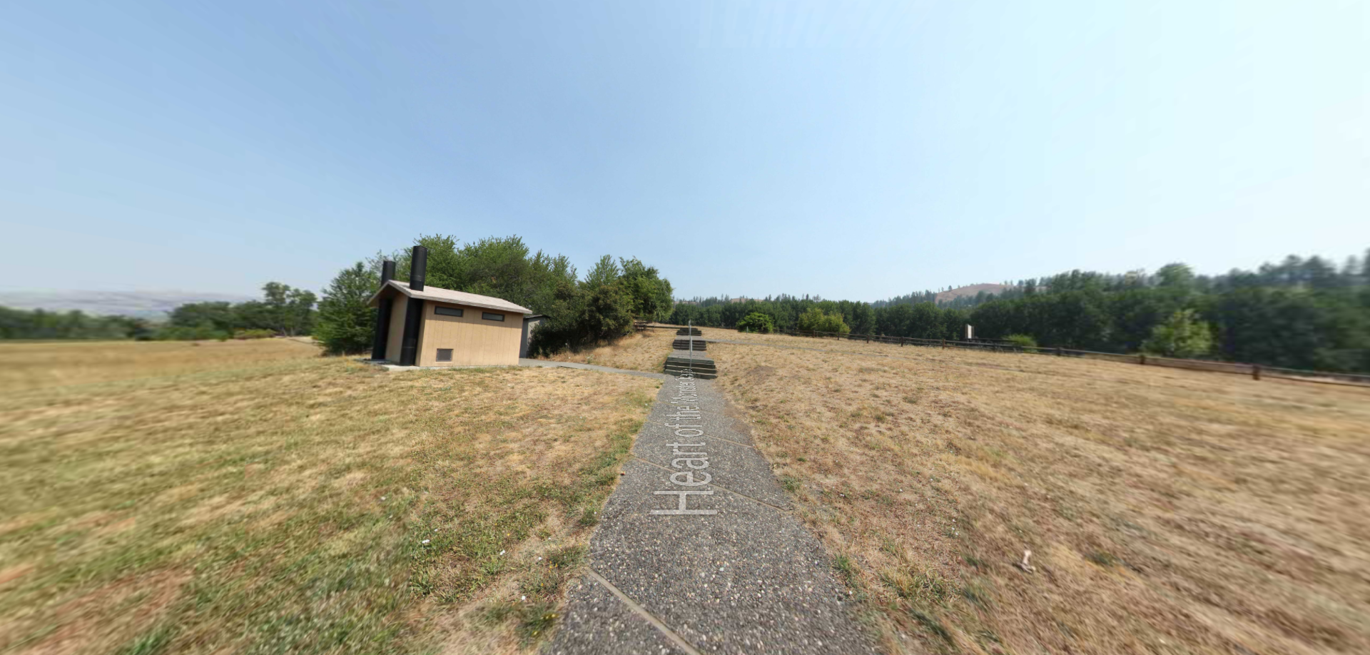
The Great Falls Upper Portage is one of two discontinuous segments of the Great Falls Portage NHL, separated by the intrusion of Malmstrom Air Force Base. It includes the upper portage campsite and the southern portion of the portage route. Great Falls Upper Portage is under mixed private ownership, but there is a public parking area with interpretive wayside exhibits and expansive viewshed of the portage route landscape located off of 40th Avenue.

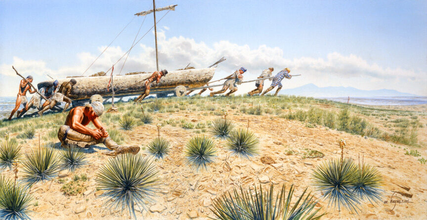
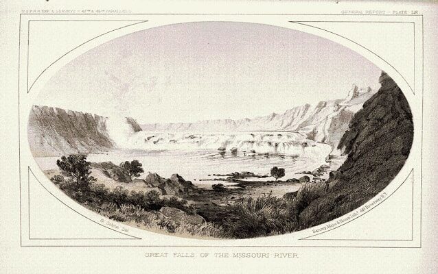
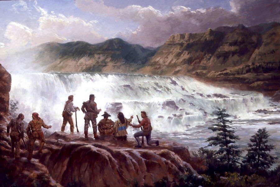
On June 13, 1805, the Great Falls Portage presented Lewis and Clark with one of the most challenging ordeals of the Expedition. The Corps needed to find a way around the falls – a journey that would require all equipment and supplies to be carried 18-miles overland. Progress was slow. The crudely-made wagons required almost constant repair. They trudged through intense heat, and prickly pear cacti tore through their moccasins. Lewis described his men’s condition:

“. . . They are obliged to halt and rest frequently for a few minute. At every halt these poor fellow tumble down and are so much fortiegued that many of them are asleep in an instant. In short their fatiegues are incredible; some are limping from the soreness of their feet, others faint and unable to stand for a few minutes, with heat and fatiegue, yet no one complains. All go with cheerfulness . . .”

Grizzly bears, rattlesnakes, and mosquitoes were a constant worry. In one afternoon Lewis’s path converged with a bear, a mountain cat or wolverine, and three bison. To Lewis, it seemed that “all the beasts of the neighbourhood had made a league to distroy me, or that some fortune was disposed to amuse herself at my expence.”

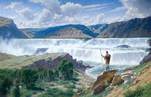
On July 15, after a month of portaging around the Great Falls, the explorers set out upstream, eager to locate the Shoshone Indians. Only a short time remained to cross the Rocky Mountains before winter and there were many great obstacles ahead.

Nearby Attractions

Distance Unit:

Nearby Trails

Distance Unit:

Heart of the Monster

lat: 45.8164674 long: -116.2673554
Heart of the Monster Overlook

lat: 45.8164674 long: -116.2673554
Send Feedback

Instagram Feed