
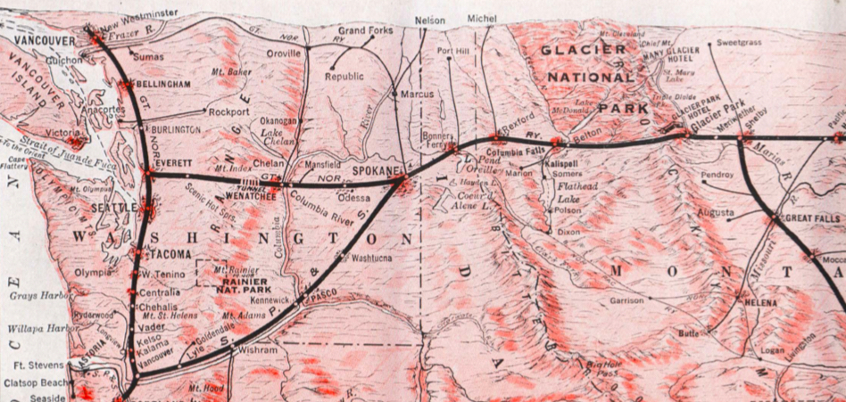
The Lewis & Clark Expedition disproved the existence of an easy, river-based Northwest Passage through the middle latitudes of North America. In the decades to follow, the Oregon Trail, the Pony Express, and various stagecoach routes allowed for difficult, dangerous, and time consuming travel by land across the continent. Not until after the Civil War was safe, reliable, quick, and relatively inexpensive transcontinental travel available in the form of railroads. The first route through the central part of the country ran well south of the northern area near the Canadian border. Once the final spike was hammered down in the Cascade Range near Scenic, Washington on January 6, 1893, the dream of James J. Hill, “The Empire Builder,” was realized with completion of the Great Northern Railway. The Mississippi River at the Twin Cities of Minneapolis-St. Paul, Minnesota was now effectively united with the Pacific coast at Everett and Seattle, Washington via the most northerly American rail route. A man-made Northwest Passage was now a reality. A related secondary line, the Spokane, Portland, and Seattle (SP&S) Railroad, split off in eastern Washington and ran southwest to follow the Columbia River valley to eventually reach the coast.
While generally north of the route Lewis & Clark and the Corps of Discovery took, the Great Northern tracks were occasionally in proximity and served as a convenient means for early travelers to visit locations associated with the pioneering 1803-06 Expedition. In 1925 and 1926, the Great Northern Railway conducted tours that unveiled several monuments to commemorate important people, places and events along the route. We are in centennial era of these tours.
This leg primarily covers the secondary, more southerly SP&S route in eastern Washington. See additional Great Northern Route itineraries to continue travel east and west of this area.
You may also like our L&C Travel Magazine!
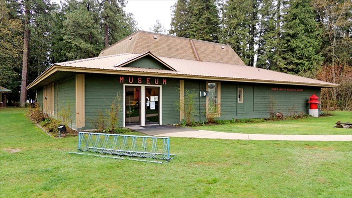
Since 1972, the Bonner County Historical Society & Museum has concentrated on local history dating back to the ice age floods, the early days of the Kalispel and Kootenai people, the fur trade, steamboat era, log drives, and stump ranches.
Departing from Sandpoint, Idaho on US 95 south, the traveler may wish to visit the resort town of Coeur d’Alene and stop to see Post Falls to the west off I-90.
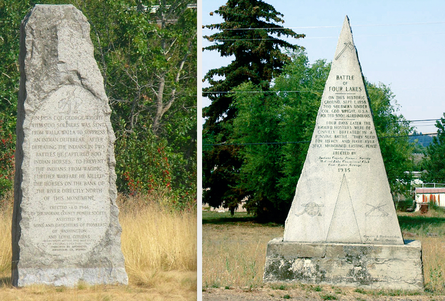
One mile inside Washington on westbound I-90, a monument that relates to the next quasi-official monument on our tour denotes the site of Horse Slaughter Camp at which Col. Wright ordered killed some 800 Indian horses in 1858. It may be accessed from the parking lot of the Spokane Valley Weigh Station. The 1946 monument stands near the Spokane River on the Centennial State Park Trail at mile marker 2.
Following the next stop, another related monument denotes the location of Four Lakes Battlefield. See below for directions.
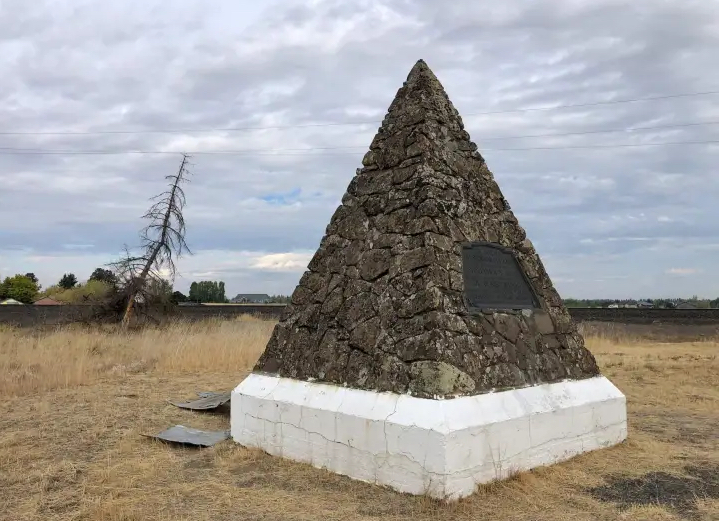
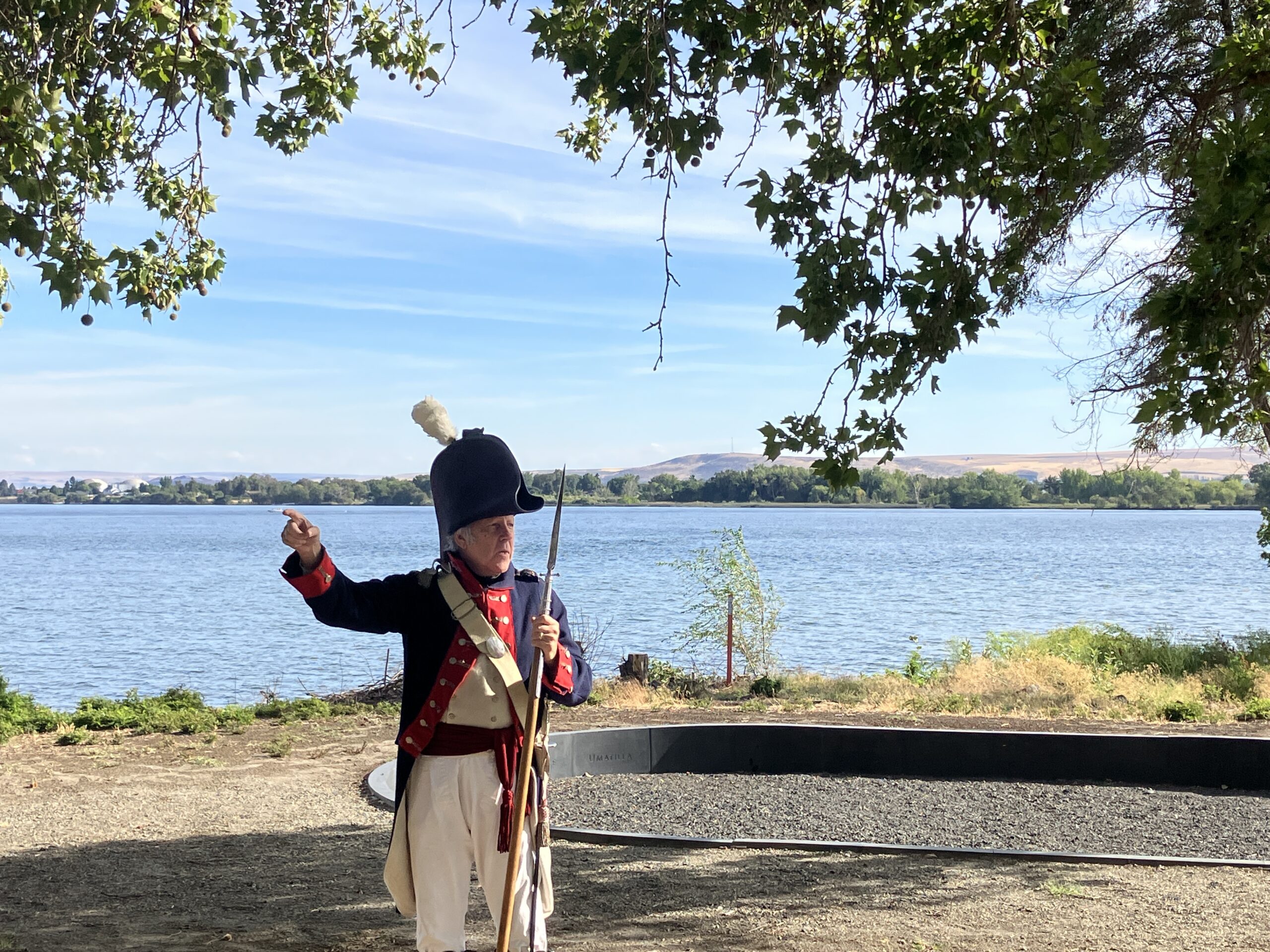
On July 23, 1926, the Great Northern Railway Columbia River Historical Expedition was on hand for the unveiling of the Spokane Plains Battlefield monument. It commemorates a battle on September 6, 1858, as part of a larger campaign to dispossess the natives of their tribal lands. Although on Great Northern right-of-way land, the stone pyramid was and is owned by the state of Washington as a State Park Heritage Site, so by the merest technicality it is not a Great Northern monument. It stands on the opposite side of US 2, north of Fairchild Air Force Base, about ten miles west of downtown Spokane. Thanks to Lauren Danner for allowing use of this photo.
A third monument erected in 1935 that commemorates the September 1, 1858 Battle of Four Lakes may be visited next. It is located southwest of Spokane just south of I-90 at Exit 270 for WA 904. Turn west onto 1st Ave. and the pyramidal monument is ahead on the left about 100 yards past the post office. See photo above.
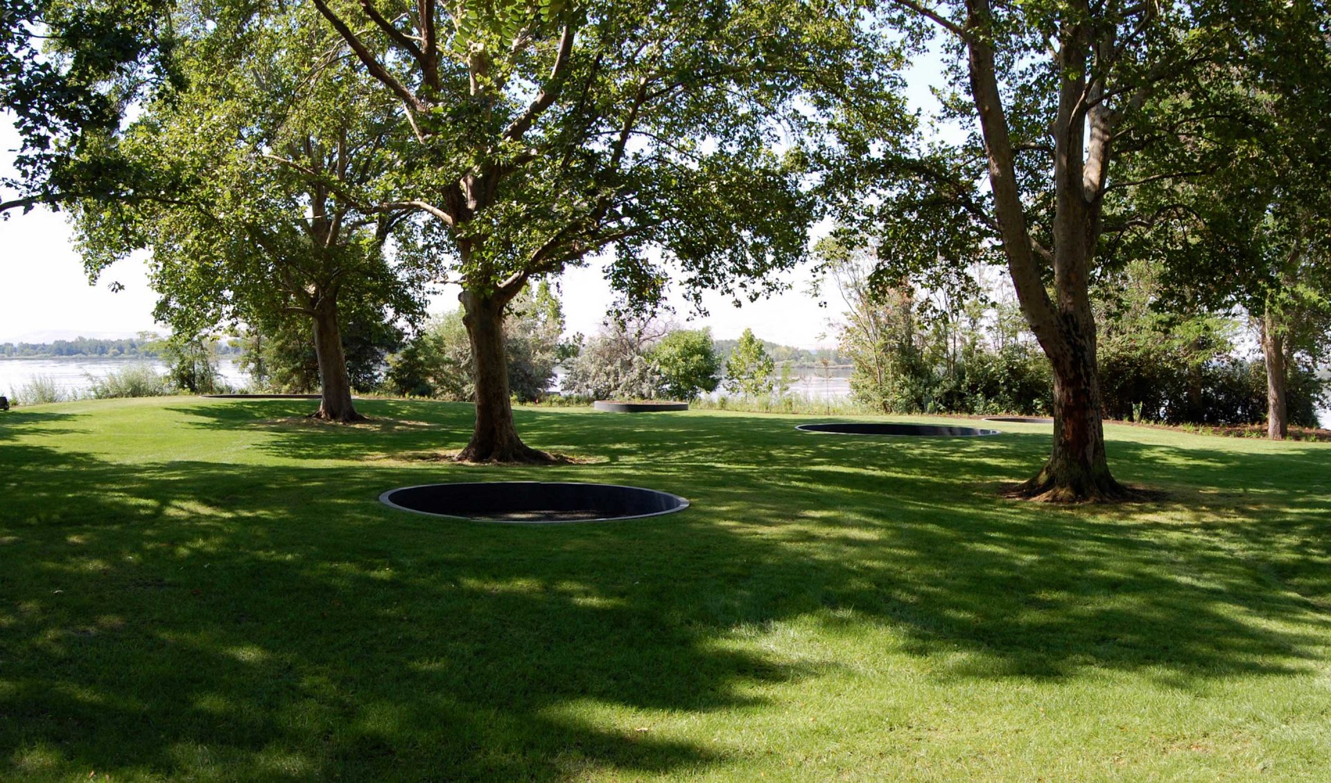
The Lewis & Clark Expedition reached the confluence of the Snake and Columbia Rivers on October 16, 1805. Today this site is the location of Sacajawea State Park, one of the jewels in the Washington State Park system and the traveler is back on the actual corridor through which the Expedition traversed. Plan to spend time going through the museum, browsing the bookstore, examining the Maya Lin Confluence Circles, and enjoying the scenery.
2503 Sacajawea Park Rd, Pasco, WA 99301, USA
0 mi
View Listing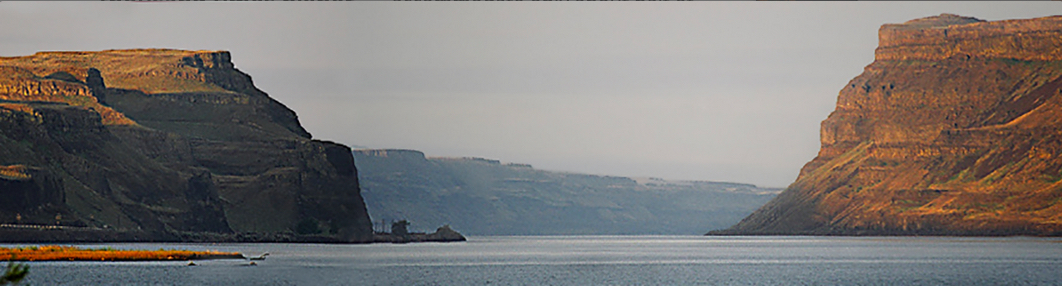
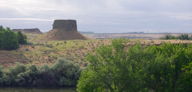
An age-old gap formed by the Columbia River was widened dramatically after the Missoula Ice Age floodwaters were temporarily backed up behind the gap about 15,000 years ago. The backflow that resulted has been named Lake Lewis by geologists. Over a matter of weeks, the water then forced its way through and enlarged the opening, the Wallula Gap, which provides a dramatic entrance to this stretch of the river. Lewis & Clark and their party passed through the area on October 19, 1805 and again on April 29, 1806 on the return journey. The Great Northern tracks hew to the north side of the gap, shown here on the right. A sensible auto route cannot be taken on the north bank, however, until west of the I-82 bridge. WA Highway 14 (Lewis & Clark Highway) can then be used to drive on the Washington side.
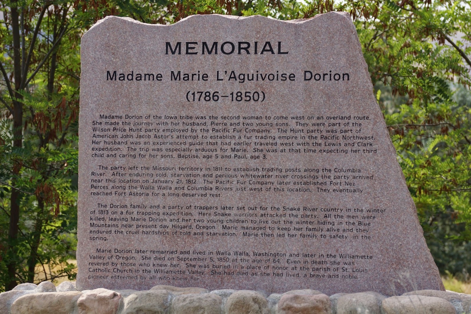
The itinerary uses Madame Dorion Memorial Park to take the driving route through Wallula Gap. She was the daughter-in-law of a French-Indian trader in South Dakota who interacted with Lewis & Clark on the Expedition. She also traveled the route of the Oregon Trail and endured many hardships while becoming the second woman after Sacagawea to reach the Pacific Coast by land. There is interpretation about her in the park accessible to the east off US 12 on the north bank of the Walla Walla River. Hiking and horse trails are also available.
On October 19, 1805, William Clark mentioned in his journal as the first notable landmark on the Columbia “a rock on the Lard. (larboard or left) …resembling a hat.” The area was occupied by the Umatilla tribe. Beginning in 1951, the rock and surrounding land were pieced together to form Hat Rock State Park.
Before encountering the I-82 bridge at Umatilla, OR, the traveler should choose on which side of the river to continue west. Please consult the two distinct Inspiration Itineraries for the Washington and Oregon sides of the Columbia Gorge for Lewis & Clark specific sites ahead and to help you decide which side to take. In either case, one should not yet go beyond US 97, and travelers in Oregon who wish to remain on the Great Northern tour should take that road onto the Sam Hill Bridge north to cross the river.
Umatilla Marina RV Park, Quincy Avenue, Umatilla, OR, USA
8 mi
View Listing
Confederated Tribes of the Umatilla Indian Reservation, Ti'mine Way, Pendleton, OR, USA
28 mi
View Listing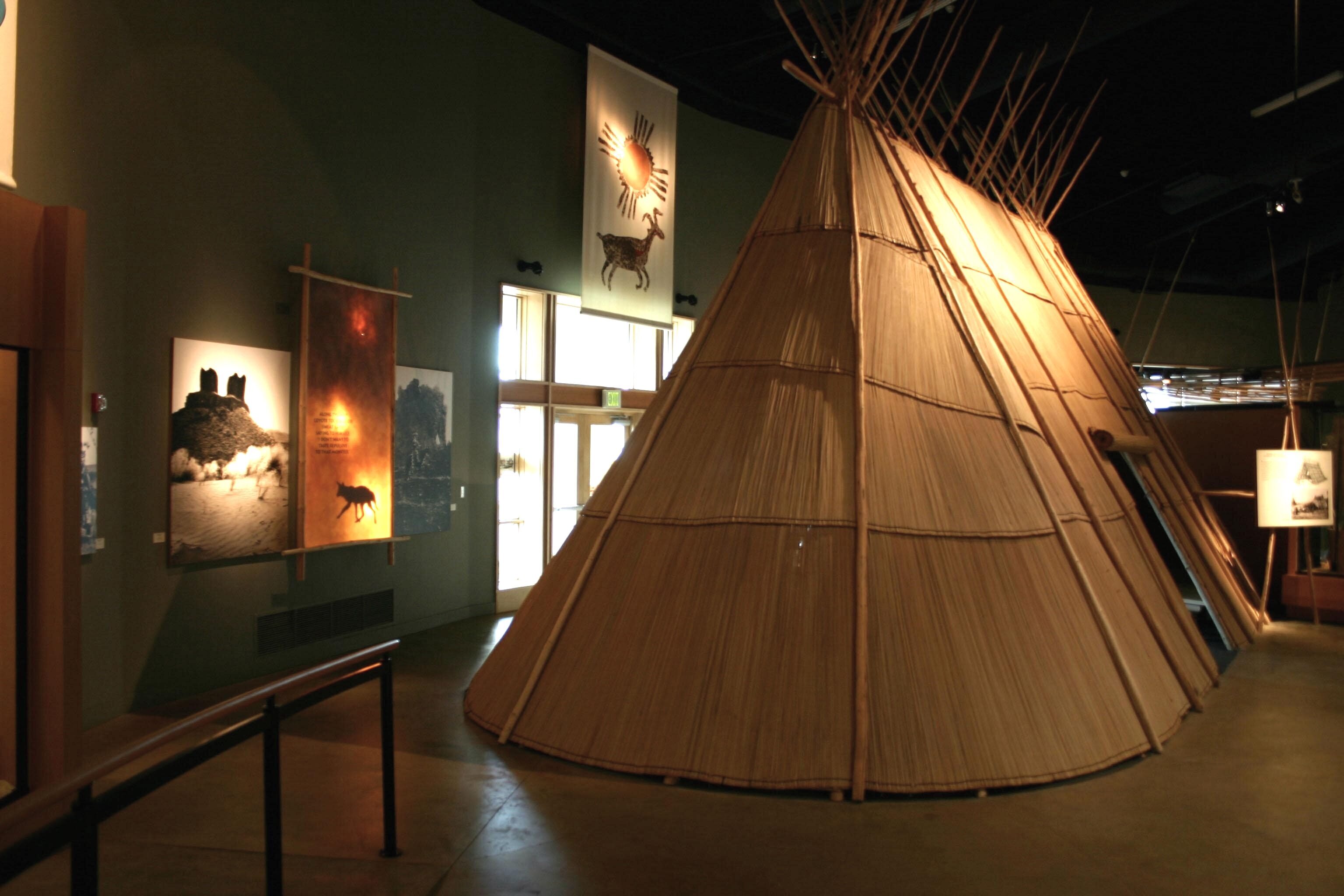
Tamastslikt Cultural Institute, Wildhorse Boulevard, Pendleton, OR, USA
30 mi
View Listing
Crow's Shadow Institute of the Arts, Saint Andrews Road, Pendleton, OR, USA
32 mi
View Listing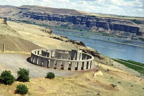
Sam Hill, who married Mary Francis Hill, the eldest daughter of James J. Hill, worked alongside his father-in-law in the railroad business. Sam became a wealthy man and built his mansion in the Columbia valley. A Quaker, he was a pacifist who constructed a Stonehenge replica as a memorial to fallen soldiers in World War I. A visionary, he played an active role in bringing about construction of modern paved roads, in particular the Columbia River Highway on the Oregon side that enabled motorists to view the many waterfalls that grace that side of the river. A bit of an eccentric, his mansion now houses an eclectic collection of the many curiosities he and his wife acquired through the years. He is not, however, the namesake of the expression, “What in the Sam Hill is going on?”
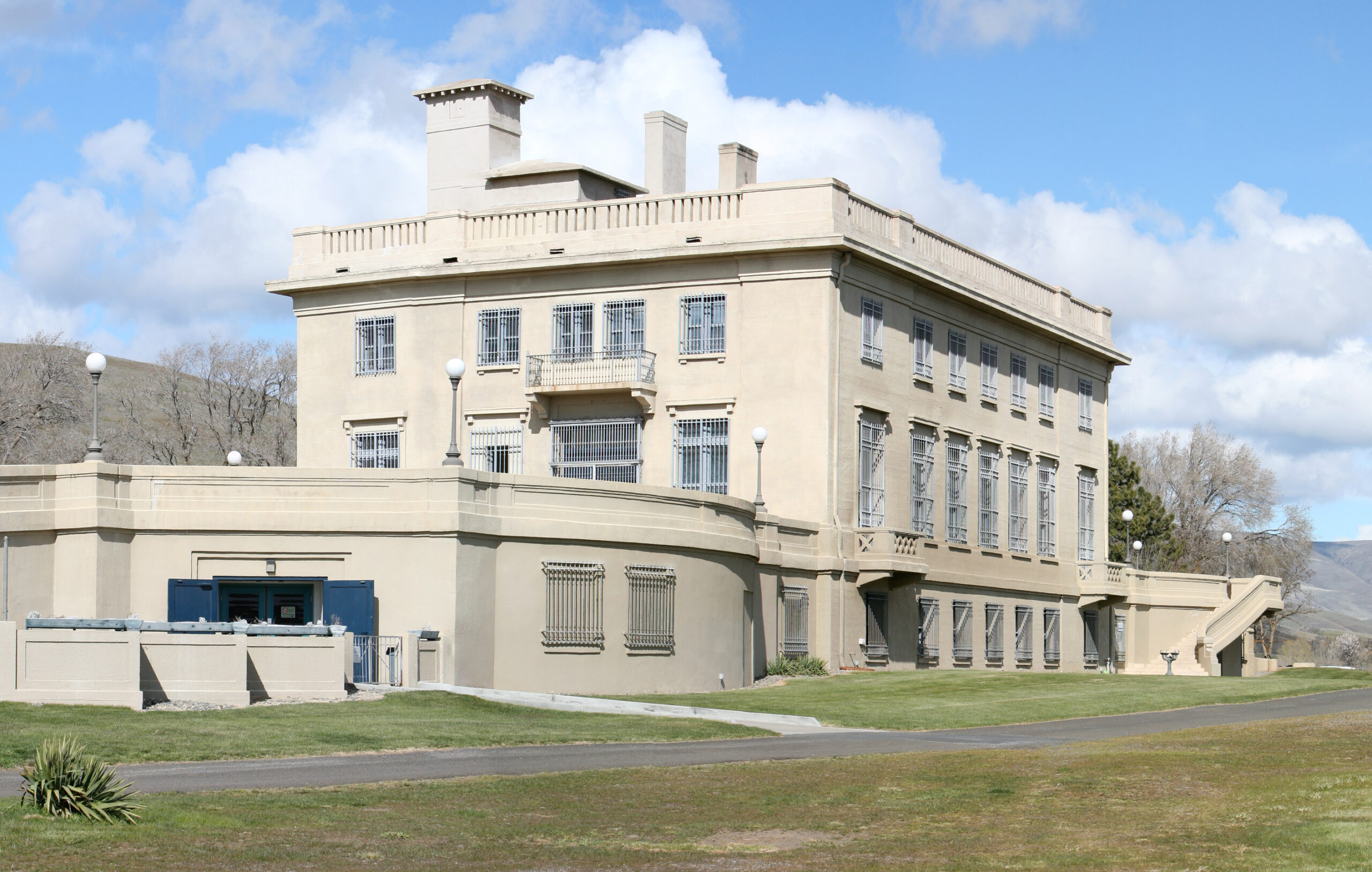
Maryhill Museum of Art, Maryhill Museum Dr, Goldendale, WA, USA
3 mi
View Listing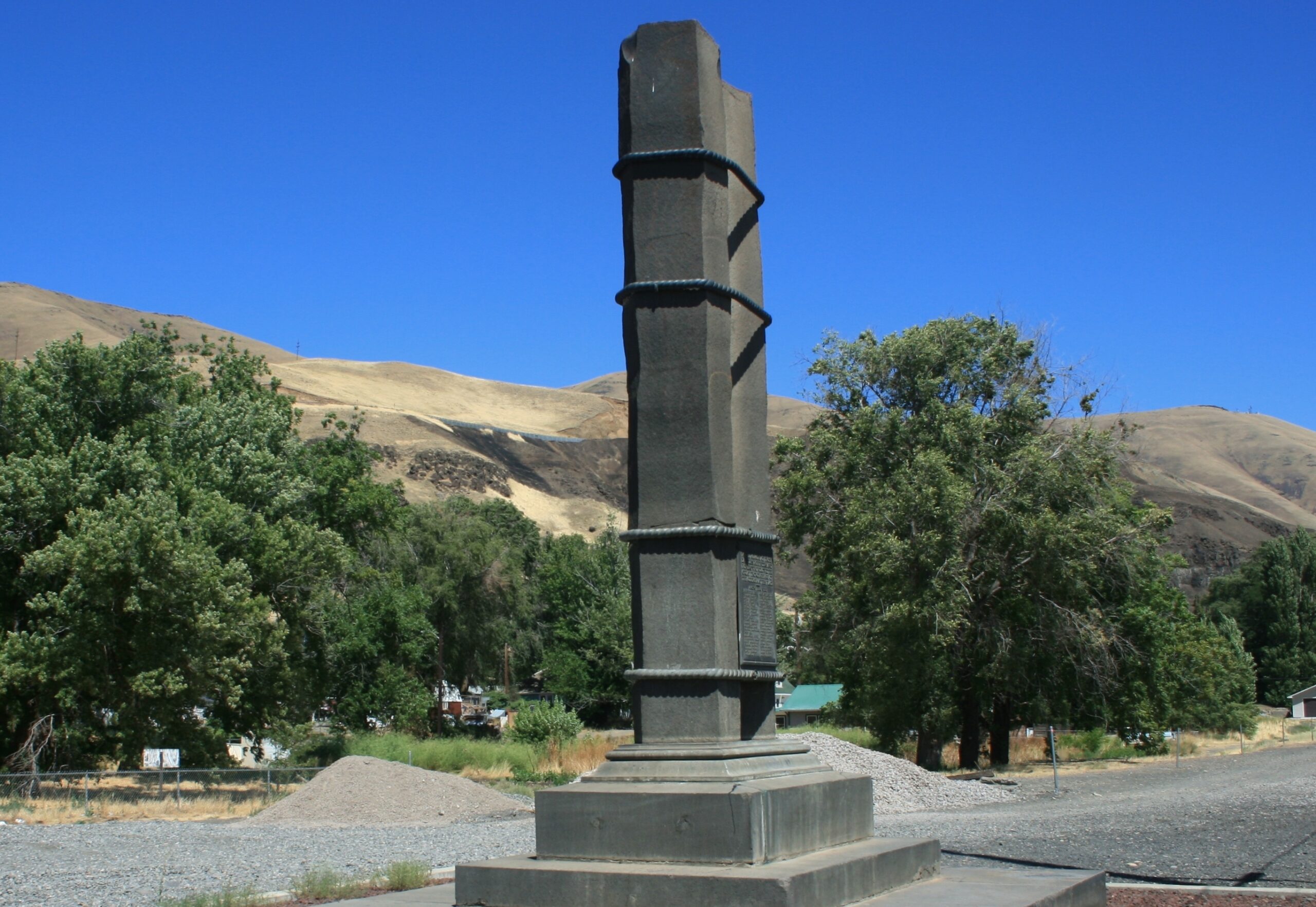
Great Northern President Ralph Budd unveiled this monument on July 20, 1925, and he took it upon himself to use the occasion to change the name of the surrounding town as well. Fallsbridge became Wishram, a native word meaning, “people who never moved,” referring to local pictographs. Nearby Celilo (Sel-LYE-low) Falls provided a sonic backdrop as the names of 43 “dauntless pathfinders and pioneers” who had come down the Columbia were revealed, with Lewis & Clark leading the list, followed by David Thompson. The monument evokes the hexagonal shape of the basalt columns that predominate in the Columbia Gorge.
Our bi-weekly newsletter provides news, history, and information for those interested in traveling along along the Lewis & Clark Trail.


