Great Falls, Montana
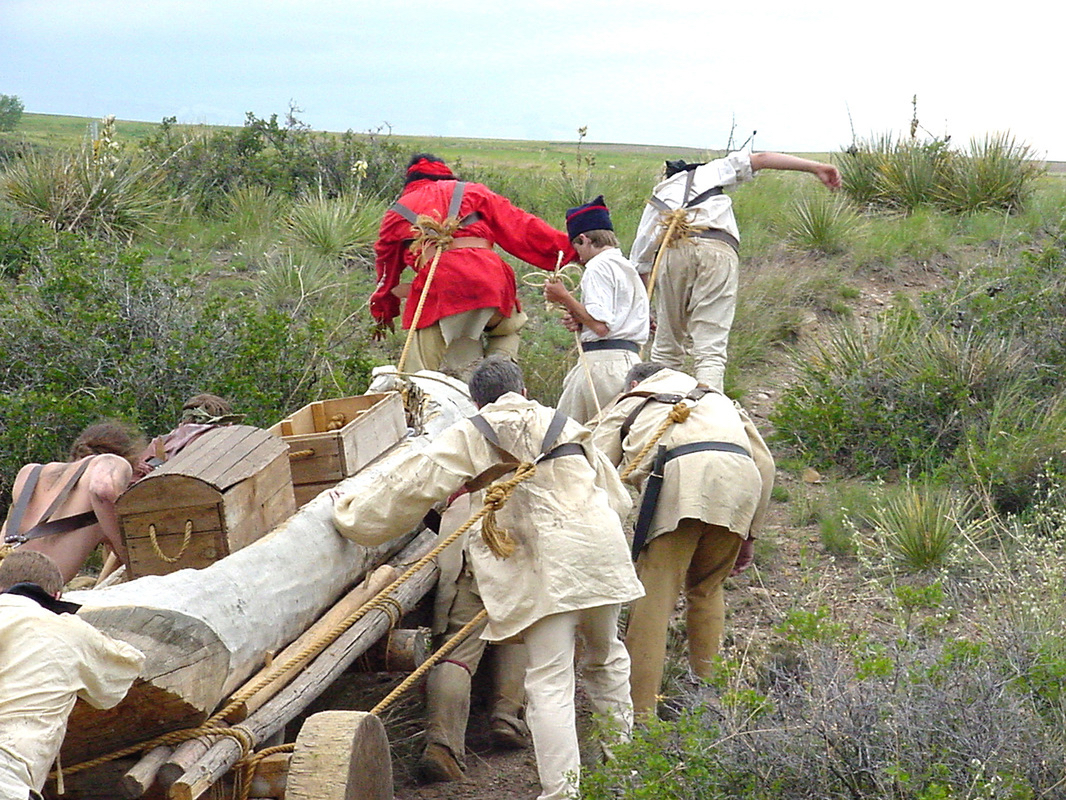

On June 13, 1805, Capt. Meriwether Lewis encountered the Great Falls of the Missouri and knew that the left branch at Decision Point was the true Missouri River. Further exploration revealed that a total of five waterfalls in the area impeded the progress of the Corps of Discovery. A portage of tremendous difficulty would be required to bypass these falls. With steep canyon walls and with coulees breaking up the adjacent plains, it was not a simple matter of hauling goods out of the boats and carrying them along a trail close to the river.
Capt. William Clark reconnoitered the landscape and staked out a route that would minimize the effort needed by remaining on mostly level ground and traveling diagonally toward the southwest, thereby cutting off the angle made by the river as it made its bend from a northward flow to one heading east-northeast. Although shorter and easier than it might have been otherwise, the portage still required a herculean effort by the men in hauling their goods and dugout canoes the 18.25 miles necessary to get beyond the last falls. They faced the abundant prickly pear cactus needles that pierced their thin moccasins. The indentations made by countless bison hooves that had been hardened into the soil over time caused their feet to ache. Tremendous thunderstorms that produced hailstones the size of eggs pelted the men and required them to take shelter any way they could. A flash flood nearly washed Clark, Sacagawea and her family into the river. Grizzly bears, or white bears as the men called them, prowled near the end point of the portage, prompting spots of land in the river there to be named “White Bear Islands” and causing a few men to have very close calls in avoiding their wrath. To top it off, the Corps drank up their last bit of whiskey as the portage was nearing its completion.
Despite the obstacles, the members of the Corps of Discovery completed their mission. Four round trips over thirty-one days upon leaving Decision Point were required to haul all the baggage and canoes. Sgt. Gass fashioned crude yokes and wheels out of the only large cottonwood tree for miles around, which combined with a sail ingeniously rigged up to harness the strong winds, enabled the men to literally sail across the land in their canoes when conditions were right. Capt. Lewis used hailstones to cool the punch he made to refresh the men. When the metal boat Lewis had designed failed for lack of proper sealant, the men fashioned two additional canoes out of trees they found a bit upriver. On July 15, 1805, the Corps of Discovery resumed their journey upstream by water in eight dugout canoes.
This Inspiration Trip will examine sites and features on the portage side of the river in Great Falls. Please consult the latter part of the Montana: Havre to Great Falls Trip for sites in the area on the opposite side of the river. We will travel primarily in the same direction as the river current, so we will see sights in the opposite order that the Corps of Discovery first encountered them while they were on their outward journey. We do this so you can better appreciate the obstacles the river presented to the Corps and then the extent of the portage they were required to make to get around them. Five falls originally were encountered and we cannot travel the exact portage route used to get around them since much of its presumed path is either on private property or within the security perimeter of Malmstrom Air Force Base. We also will see only two dams on this Trip, with one being inaccessible by vehicle and the two others being best seen from the opposite side of the river. This Great Falls Trip can be completed in a day with ample time for fully experiencing the museums we will visit. (Photo courtesy of Phil Scriver)
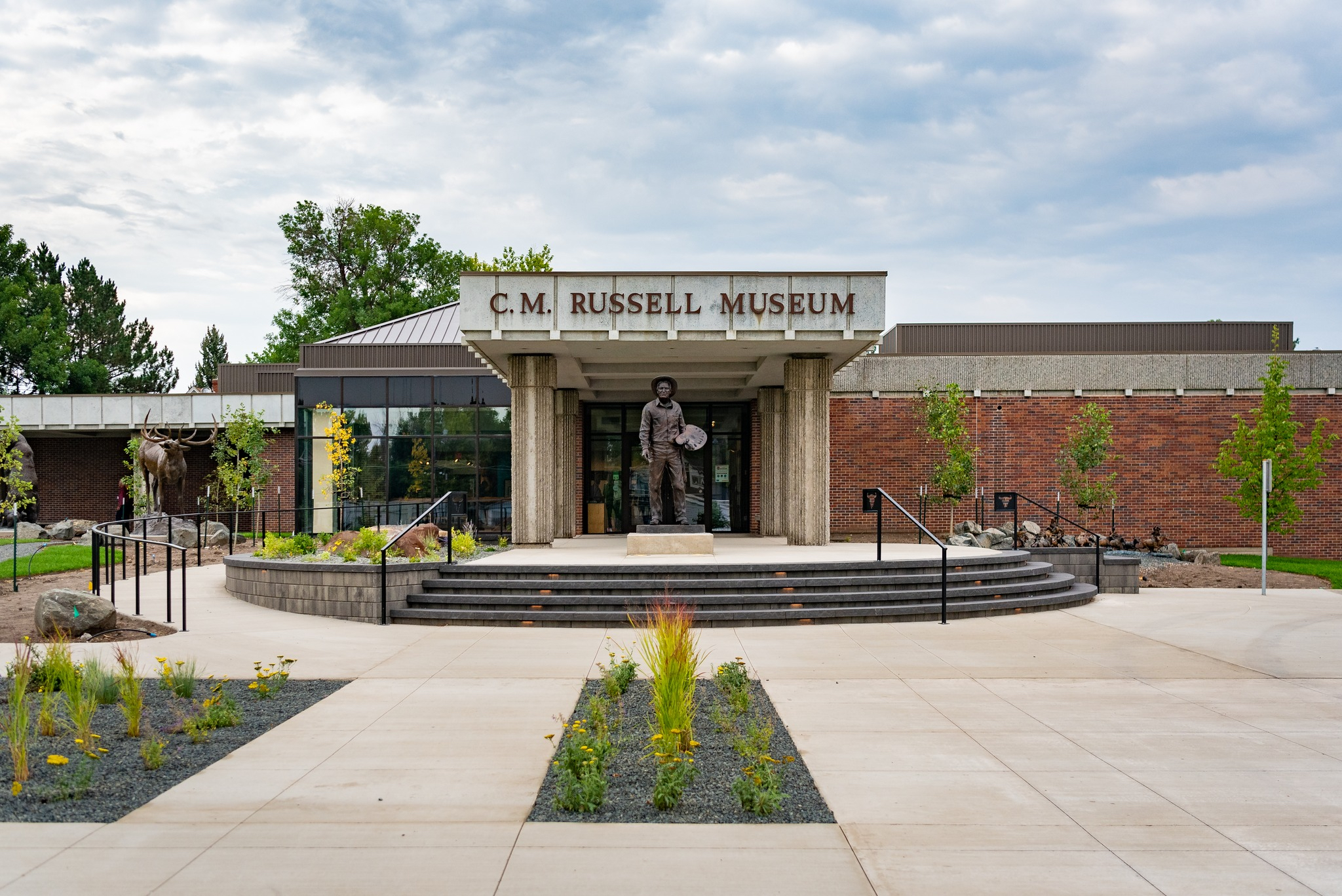
Begin your time in Great Falls with a visit to the C. M. Russell Museum at 400 13th St. N. Built next to his original house and studio, which can be seen by self-guided tours, the facility houses a large collection of Charles M. Russell's artworks as well as works by many other Western and native artists. Russell painted, sculpted, and created whimsical drawings on letters to his many friends, examples of which are on display in this magnificent museum. A large shop also provides an array of items by which to remember your visit.
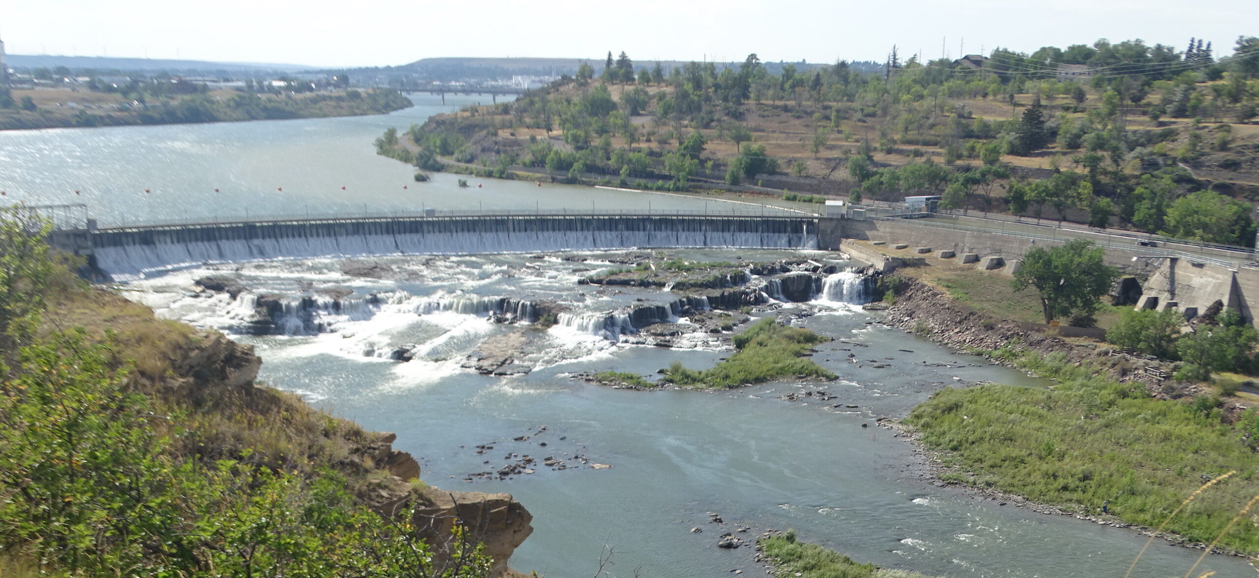
From the parking lot, turn west and take a left onto 15th St. Turn right onto River Dr. N. and in about a mile, turn left into the pullout for Black Eagle Falls and Dam at 5435 River Dr. N.
When the Expedition saw the eagle's nest atop this waterfall, they knew from information provided by their native hosts at Fort Mandan the previous winter that they had reached the final one. Nearest to Great Falls’ city limits, Black Eagle Falls are 26 feet high and 600 yards wide. Constructed in 1890, Black Eagle Dam above was the first to be built. It is 782 feet long and 34.5 feet high and houses three turbines that can generate up to 18 megawatts of power. An eagle's nest still stands on Black Eagle Memorial Island below the falls.
Continue on River Dr. and take the next left onto Giant Springs Road. A small turnout ahead on the left provides another view of the falls as well as a Lewis & Clark and Sacagawea metal sculpture down below. Artist Mike Woods unveiled these three figures in 2010. They can be approached on foot from nearby River's Edge Trail.
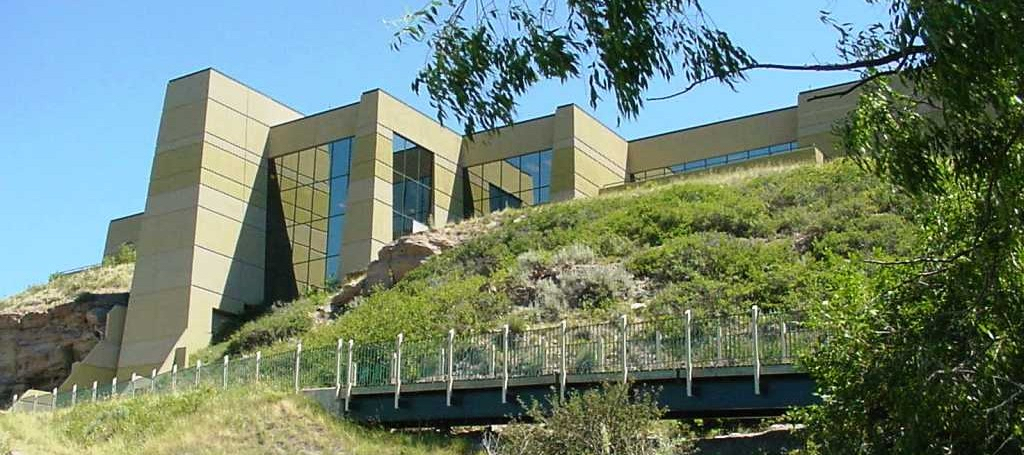
Continue in your vehicle down the road and turn left into the parking lot for the Lewis & Clark Interpretive Center. Run by the US Forest Service, the facility also houses the offices of the Lewis & Clark Trail Alliance, the national group that sponsors this website and app, and the Lewis & Clark Foundation, which supports the work of the Interpretive Center locally.
The Interpretive Center features a movie theater, a museum that covers the exploits of the Corps of Discovery throughout its journey, a small gift shop, and a life size recreation of the men pulling a canoe up a hill as part of the portage around the falls. Outside, viewpoints of the river and gorge and interpretive panels concerning plant life are available. A pathway also leads to the next Inspiration Trip stop if you care to stroll along the river a half-mile to it.
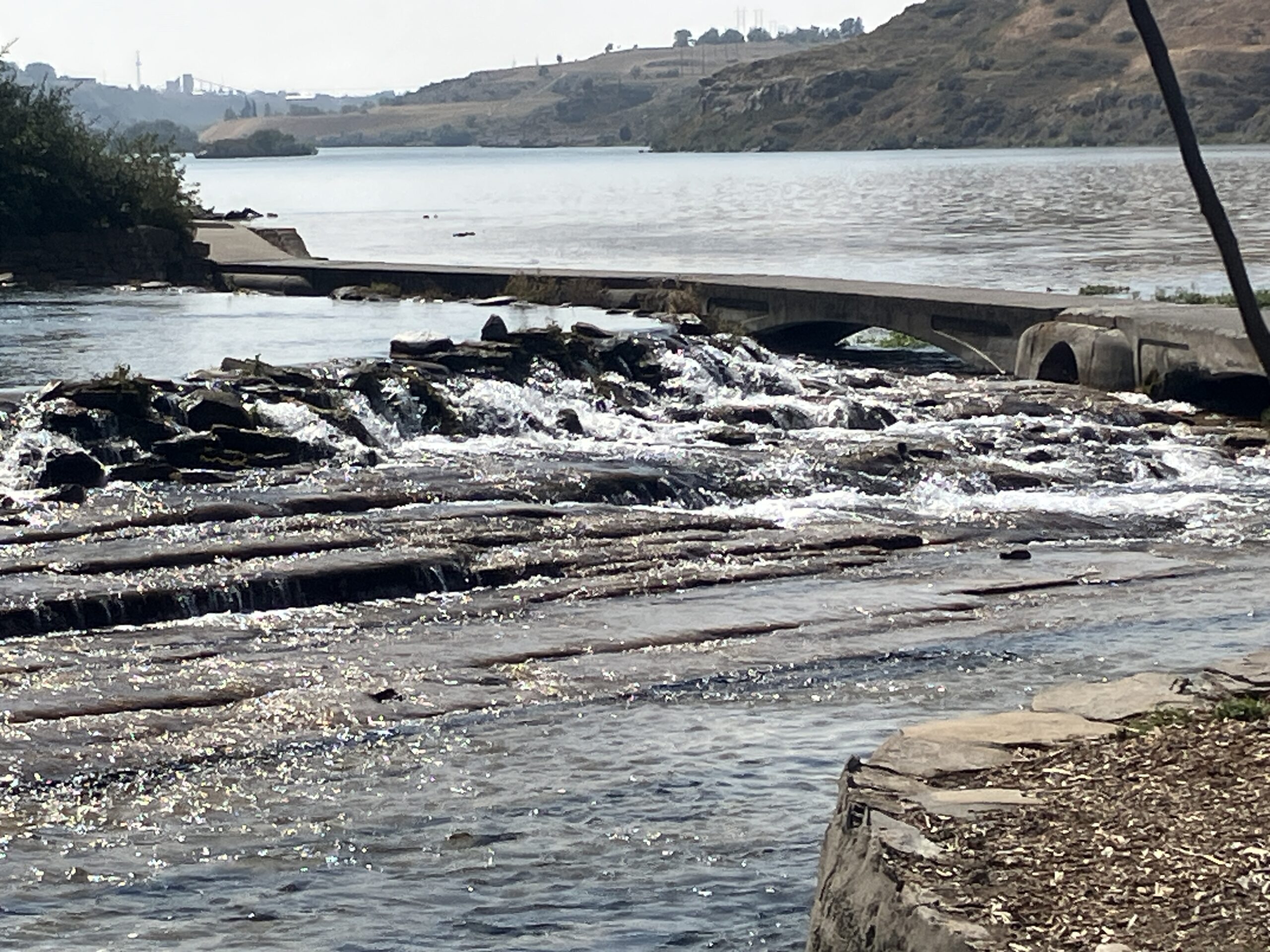
Turn left out of the Interpretive Center parking lot for the short drive to Giant Springs State Park. One of the largest freshwater springs in the US produces over 156 million gallons of water daily that is the source for one of the shortest rivers in North America, the Roe River. Interpretation and a fish hatchery are of interest as well. Be sure to amble on the walkway that allows for a close up view of both the spring and the Missouri and Roe Rivers.
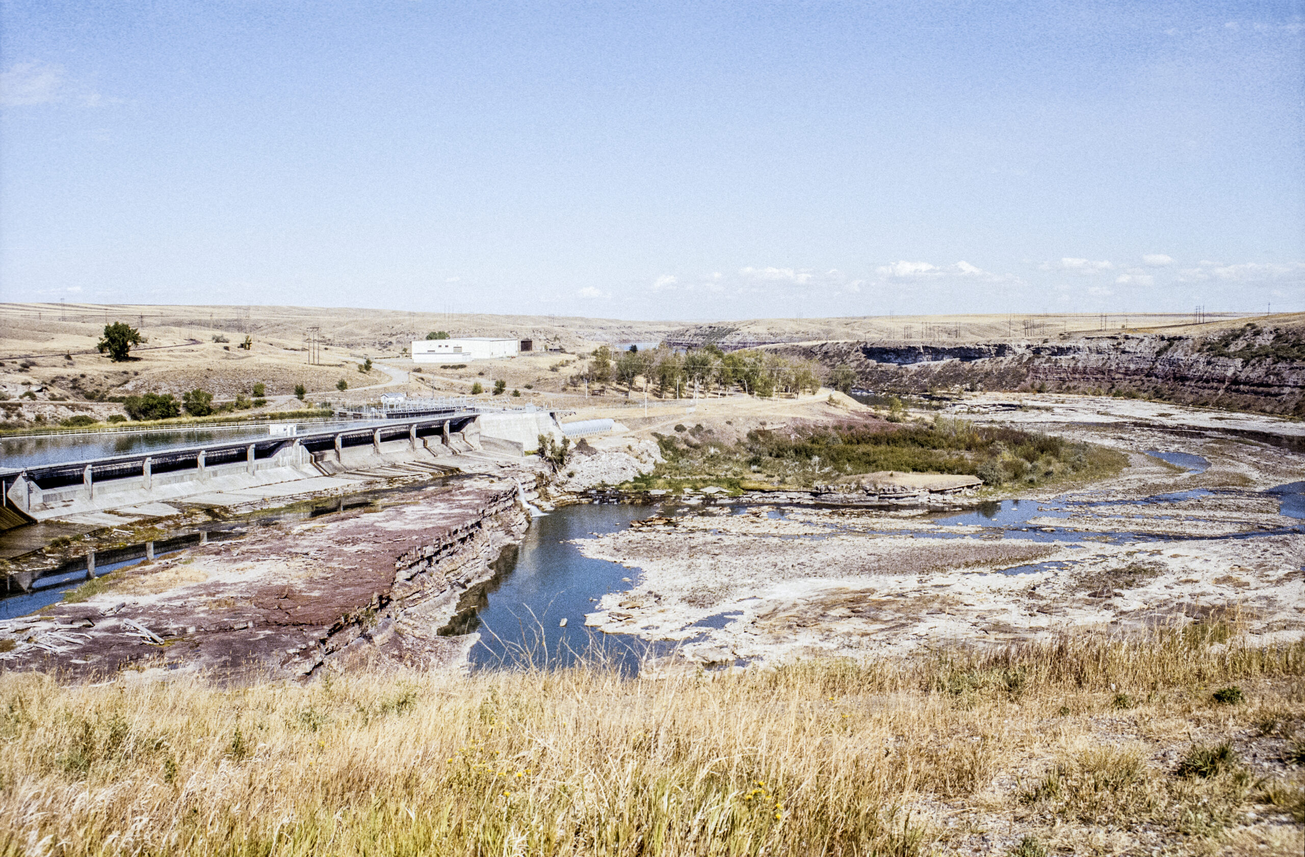
Turn left out of the parking lot to resume travel on Giant Springs Road. About a mile up ahead on the left at 6401 Giant Springs Road is the pullout for Rainbow Falls Scenic Overlook. On the way there you will have passed the inundated, six foot high Colter Falls, which is now submerged about a half mile upstream, below the water impounded behind Rainbow Dam.
Recorded by Captain Lewis as “Beautifull Cascade” in his journal, Rainbow Falls’ “cascade of about fifty feet perpendicular” was untouched when the dam was constructed in 1910. Rainbow Falls is the middle of the five falls in the Great Falls area.
Just downriver is Crooked Falls, which flows over an irregular shelf, 19 feet high and 300 yards across. Undammed and inaccessible by motor vehicles, Crooked Falls can be seen today just as the Expedition saw it in 1805 by hiking on River's Edge Trail downriver from the next parking area just ahead. It is the only visible falls in the Missouri/Mississippi River system that does not have a dam sitting on top of it.
A longer hike of about seven miles round trip on the same path leads to the middle and newest dam, Cochrane Dam, which is also inaccessible by motor vehicle. It was constructed in 1958 and is 59 feet high and 753 feet long. Its power station has two generators capable of producing 64 megawatts. Twice a year, pedestrians and bicyclists are allowed to cross along the top of the dam.
From Rainbow Falls Overlook, continue on Giant Springs Road, take a right onto 18th Ave. N., a left onto 52nd St. N, a left onto River Dr. N, and curve south to become 57th St. and pass Malmstrom AFB. Turn left onto 10th Ave. S. (MT 200-US 87). In 2 miles, turn left onto Highwood Rd. and stay with it as it turns east. Turn left onto Salem Rd. heading north. Stay on Salem for 3-4 miles and turn left into the parking lot for the Lower Portage Staging Area.
The Portage Route Chapter of the Lewis and Clark Trail Alliance owns and maintains this site. Interpretive signage informs the visitor of the initial stages of the portage made by the Corps of Discovery that took place in the vicinity.
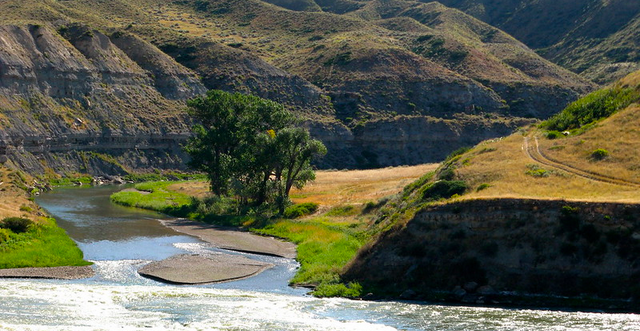
As you leave the lot, be sure to return any gates on site to the position in which you found them. Continuing on Salem Road a short distance to the bridge crossing Portage, today's Belt, Creek will give you a look at the beginning of the portage made by the Corps of Discovery out of the river and creek and onto the plains. The photo above was taken from the north bank and shows Belt Creek as it enters the Missouri.
The mouth of Belt Creek is just downriver from Sulphur Springs on the opposite side, from where Lewis drew water to aid in healing Sacagawea's abdominal complaint. Morony Dam is a little more than a river mile upstream and Ryan Dam and the Great Falls are approximately 4 river miles above Morony. The two easternmost dams may be viewed from the other side of the river at another time.

Reverse back on Salem Road, turn right onto Highwood Rd. and right onto US 87. Pass the entrance for Walmart to the pullout on the north side of US 87 between 51st and 50th Sts. to see the State of Montana Interpretive Sign concerning the Great Falls Portage. The sign shown in the photo has been replaced by a newer version.
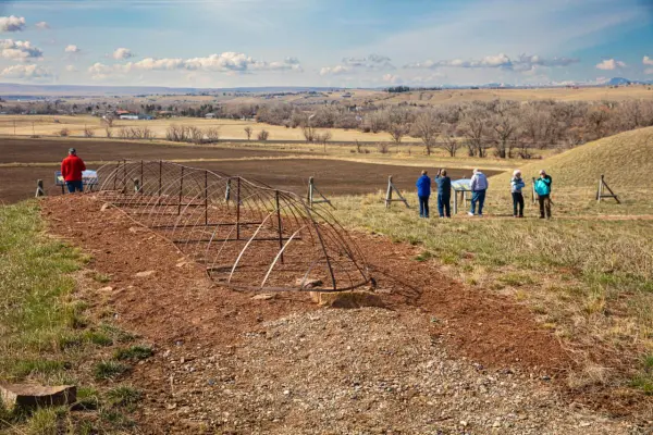
Continue on 10th Ave. (US 87), turn left onto 13th St. heading south, and right onto 40th Ave. Ahead on the left is the parking area for Upper Portage Overlook, which is owned and maintained by the Portage Route Chapter of the Montana Region of the Lewis & Clark Trail Alliance. You will need to open the gate and, as you leave, return it to the position in which you found it. Be aware that after the gate is unchained, it may move suddenly due to the wind or imbalance, so drive into the lot cautiously.
The portage route traveled generally from the northeast to the southwest, that is, from behind and to the left when you are facing south, away from the parking lot, and then in front and over to the right to the treeline by the river. White Bear Islands at the end of the historic portage are no longer separated from the banks.
Walk the trail loop around the site to read the various interpretive panels. See the replica of "The Experiment," the iron frame boat designed by Lewis and hauled for hundreds of miles by the men for use at the site below by the river, but which ultimately failed due to lack of the proper sealant. The frame was cached and almost certainly dug up on the return journey. Scientific searches of the area have turned up no trace of the boat. On the return trip, a detachment of men needing to transport a much smaller quantity of baggage and using horses and the already made wheels and folks, was able to complete the entire portaging process in four days.
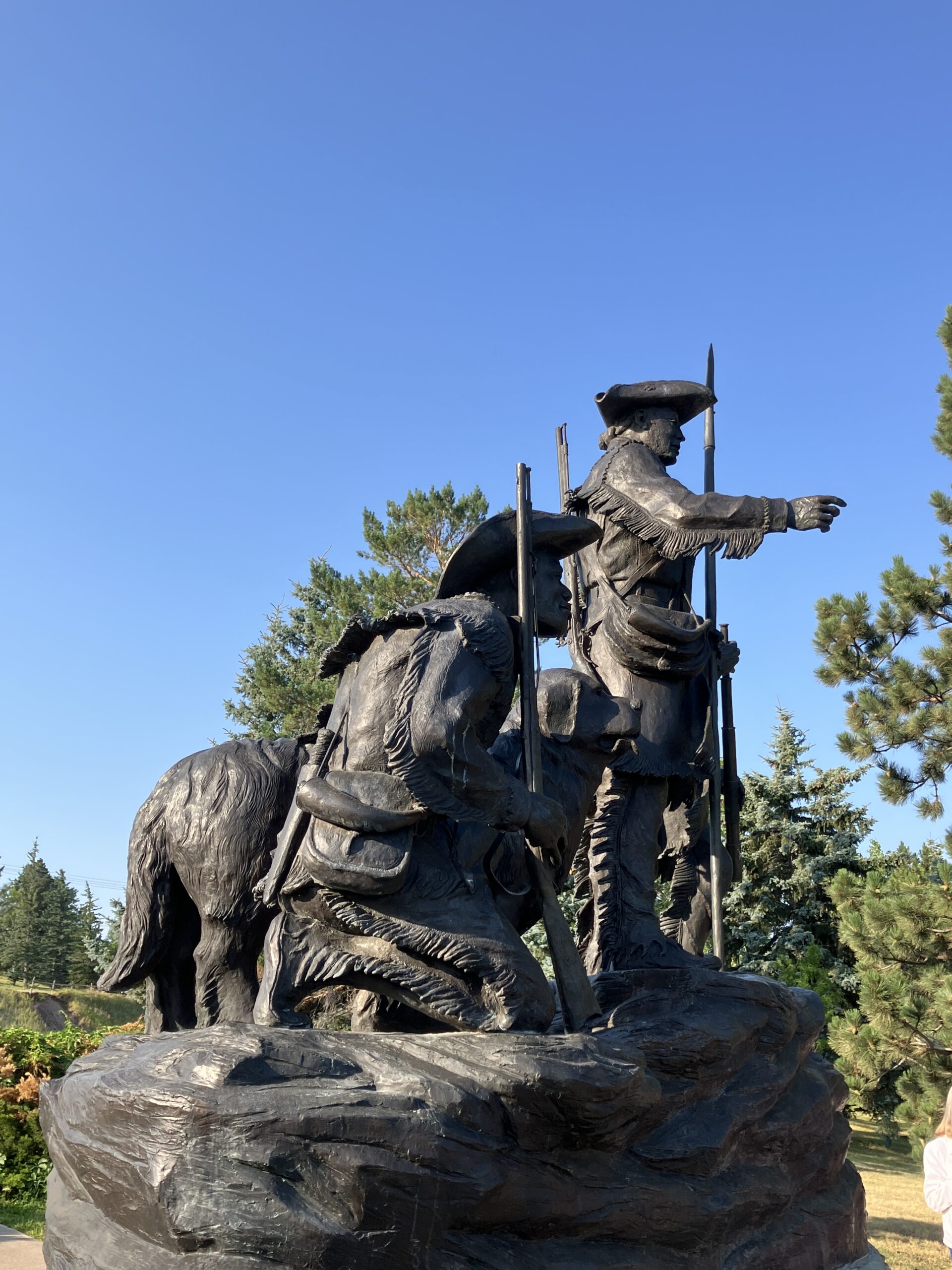
Continue on 40th St. and swing right onto Upper River Rd. Follow it for 2-3 miles, turn right onto Overlook Dr., and park in the lot ahead on the left.
A sculpture by Bob Scriver stands prominently there overlooking the river. "Explorers at the Portage," depicting Lewis, Clark, York, and the dog Seaman, was dedicated on July 4, 1989, as a Montana Centennial Project. In recent years, the sculpture was refurbished through the efforts of the Portage Route Chapter of the Montana Region of the Lewis & Clark Trail Alliance.
Located near the Great Falls Visitor Information Center, the sculpture is surrounded by tiles that list each member of the permanent party that reached the Pacific Ocean. Stop into the Visitor Center to get more information about other sights to see and things to do in Great Falls.