Along the Mississippi
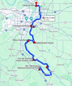 The Mississippi and lower Missouri region of the Lewis and Clark National Historic Trail offers a variety of influence and architecture. From early French influence in Ste. Genevieve and Cahokia, the recreation of the first winter Camp Dubois, the magnificent St. Louis Arch and surprising wine country along the Missouri River where German influence takes hold.
This itinerary can be completed as one trip or you can continue the series with “Around St. Louis” and then additional segments continuing upriver.
Read more in our Digital Travel Magazine on the Mississippi-Missouri Trail Segment.
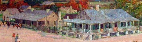
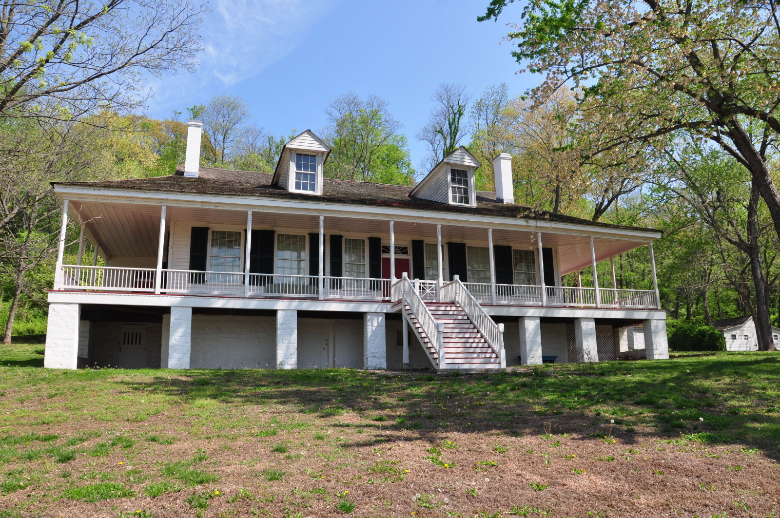
As Missouri’s oldest permanent European settlement, the village of Ste. Geneviève was settled by French Canadians around 1735 on the west bank of the Mississippi River about two miles south of its present location. In 1763, after the French and Indian War ended, France ceded all of its holdings west of the Mississippi River to Spain. Despite the transfer and new Spanish government in the region, Ste. Geneviève retained its distinctive French character and language.
Much of Historic Ste. Geneviève’s charm and ambiance are due to the remarkable preservation of the original colonial settlement. Its narrow streets and fenced gardens surround some of the most significant eighteenth-century architecture in the nation. These French Colonial-style buildings were constructed from massive, hand-hewn logs that were set vertically to form the walls of the home. Heavy timbers were mortised and pegged into sturdy trusses that supported the impressive double-hipped roof covering the house and its wide galleries or porches.
https://www.lewisandclark.travel/listing/dr-hertichs-house/
The small American military outpost of Fort Kaskaskia (1803–1807), Illinois, played a pivotal role in the early days of the Lewis and Clark Expedition. Fort Kaskaskia was one of a series of forts constructed by the U.S. Army in 1803 under orders from Secretary of War Henry Dearborn to protect the frontier. It was there on 29 November 1803, that Lewis and Clark stopped to recruit twelve soldiers . Lewis and Clark lingered at Fort Kaskaskia for about a week, conducting business or visiting influential citizens such as fur trader and merchant Pierre Menard in the nearby town of Kaskaskia.
Lewis departs on 3 December 1803, followed by Clark on 5 December 1803. With the Louisiana Purchase, Kaskaskia goes from being a border fort along the Mississippi to a surplus interior fort. Soldiers at Kaskaskia were needed to fill newly acquired fortifications and positions in the newly expanded American West.
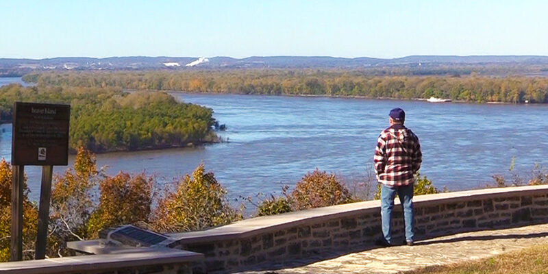
Today’s historic site consists of four major sections: the remains of Fort Kaskaskia, Garrison Hill Cemetery, the Mississippi River overlook and picnic area, and a large campground.
Fort Kaskaskia State Historic Site, Park Road, Ellis Grove, IL, USA
Pierre Menard Home State Historic Site, Kaskaskia Street, Ellis Grove, IL, USA
Pierre Menard Home State Historic Site, Kaskaskia Street, Ellis Grove, IL, USA
View Listing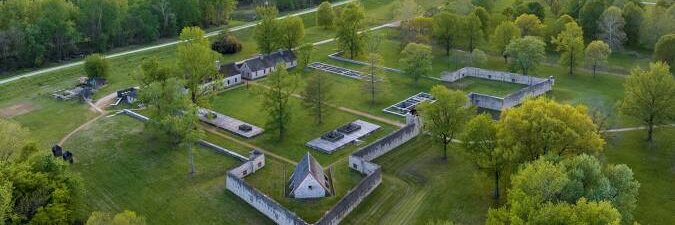
Built in 1753 by the French during their eighteenth-century colonization of the Illinois Country, the massive stone fort was preceded by t2o wooden forts, with the first fort erected in 1720. Fort de Chartres served as the French seat of government and its chief military installation in Upper Louisiana from 1753 until 1765 when it was occupied by the British.
In 1763, France ceded much of its territory in North America, including what is now Illinois, to Great Britain. British troops occupied the fort from 1765 until 1772, when encroachment by the Mississippi River caused a collapse of the south wall. Subsequently, the remaining walls and buildings fell into ruin.
Today, the site features an imaginative reconstruction of portions of the third Fort de Chartres. The fort gate, built in the 1920s, has been remodeled several times. Portions of the fort’s walls were reconstructed on original foundations in 1989. The site was declared a National Historic Landmark in 1960 and was added to the National Register of Historic Places in 1976.
Miles Cemetery and Bellefontaine House near Waterloo, IL provide two "secret" sites for your journey.
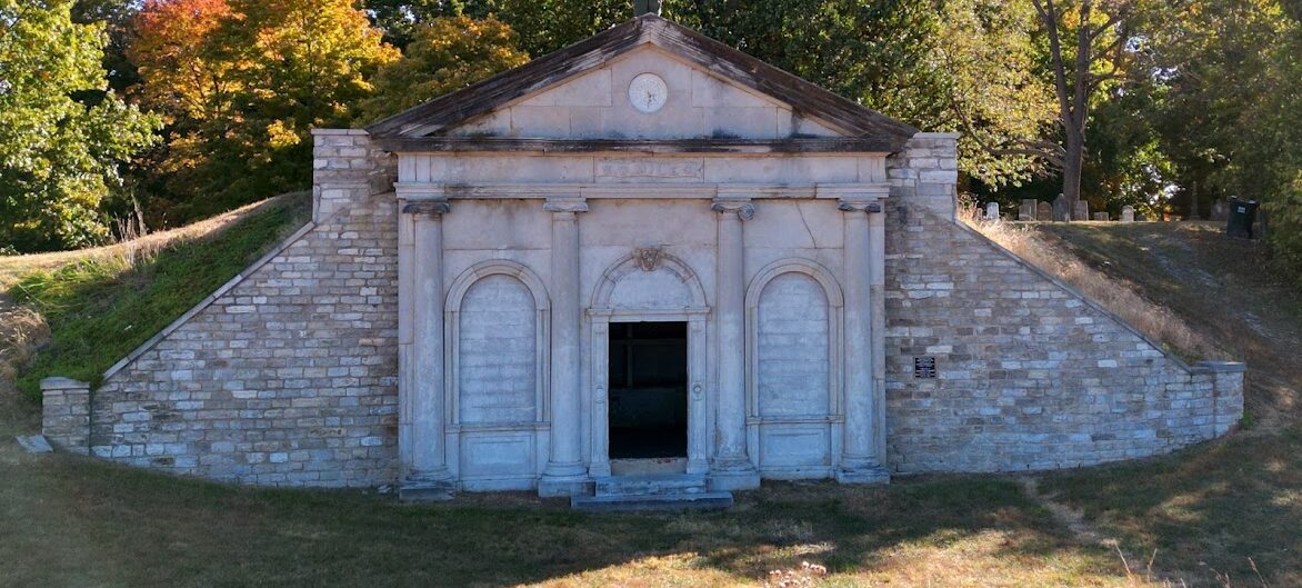
Nestled amongst the bluffs in rural Monroe County, Illinois lies a cemetery that is full of extravagance, mystery, and tragedy. Eagle Cliff-Miles Cemetery, often referred to simply as Miles Cemetery, is located off of present-day D Road and remains the final resting place for around at least 450 individuals. The cemeteries' mausoleum overlooks the American Bottoms and can be seen for miles and miles.
The Kaskaskia Cahokia Trail can be traced to American Indian people around 11,000 BC whose migrations created the trail for economic trade, government and social/religious purposes. Their use of the trail continued into historic periods, introducing the route to the first French explorers and colonists in the late 1600s. When the French established permanent settlements at Kaskaskia and Cahokia in 1699, they named these villages after the local Illini people.
Near Bellefontaine House you can see a remnant of the old trail on which Meriwether Lewis probably travelled while Clark was on the river with the Barge.
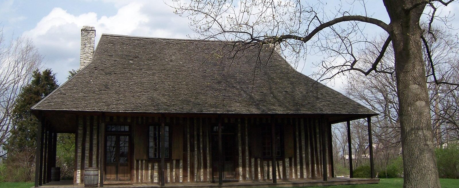
The Cahokia Courthouse was originally built as a French dwelling around 1740. In 1793 it became a courthouse, and for 20 years it served as a center of political activity in the Old Northwest Territory.
From December 1803 until the spring of 1804, Lewis and Clark used the courthouse as a headquarters. From there they collected information, met with territorial leaders, gathered supplies and corresponded with President Thomas Jefferson.
Just a few blocks away is the Holy Family Church. The log structure was built in 1799 and is the oldest church west of the Allegheny Mountains. The first Log Church was dedicated on May 14, 1699. The original structure burned in approximately 1740 and the structure standing today was built from the logs salvaged from the original church. It was dedicated on September 24, 1799.
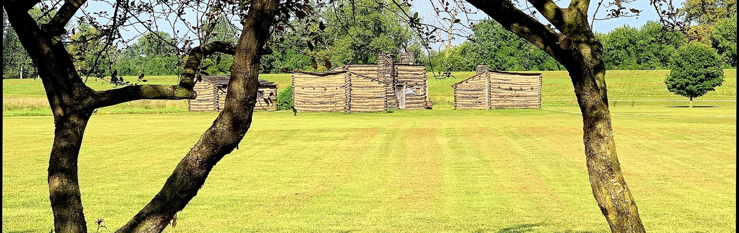
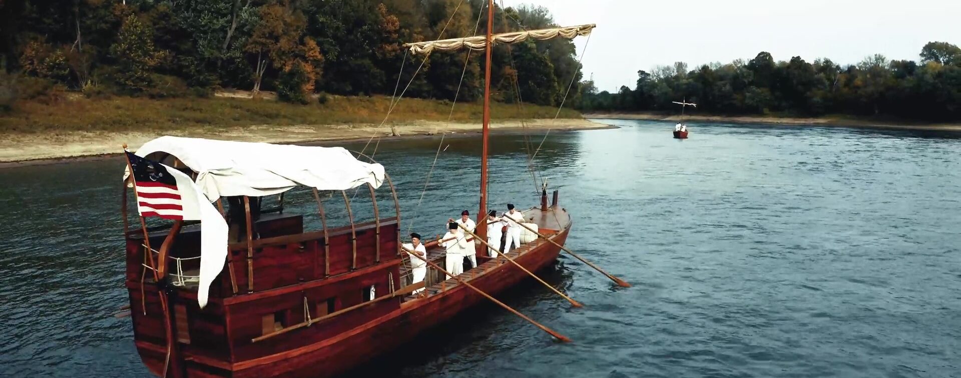
Clark chose the site, on the east side of the Mississippi River at its confluence with the Missouri, in part to fulfill treaty obligations. Conditions of the Louisiana Purchase required Lewis and Clark to remain within American territory until the land officially transferred from France to the United States on March 10, 1804. The location was also convenient to St. Louis and Cahokia Courthouse. Today, the exact location of the camp is unknown due to shifts in the Missouri and Mississippi Rivers.
Clark spent most of the winter at Camp Dubois supervising and training the recruits. His journals frequently mention French and Indigenous people stopping at Camp Dubois. Lewis spent much of the winter in St. Louis, meeting with fur traders and others who had experience on the Upper Missouri.
Our bi-weekly newsletter provides news, history, and information for those interested in traveling along along the Lewis & Clark Trail.
