St. Louis played a pivotal role in America’s westward expansion, a legacy embodied by the iconic Gateway Arch National Park. But there’s much more to explore beyond the Arch and a storied baseball tradition. Stand where the Missouri River meets the Mississippi, pay tribute at Bellefontaine Cemetery, the final resting place of William Clark and other notable figures, and take in breathtaking views from the top of the Arch. Visit Camp River Dubois, the official departure site of the Lewis and Clark Expedition, wander through Forest Park and the Missouri History Museum, and end your journey in historic St. Charles, home to the engaging Boathouse Museum.
Accompanying Trip Inspirations
Be sure to check out our array of additional resources available on our educational website Discover Lewis and Clark and Events along the Trail.
You may also like our L&C Travel Magazine!
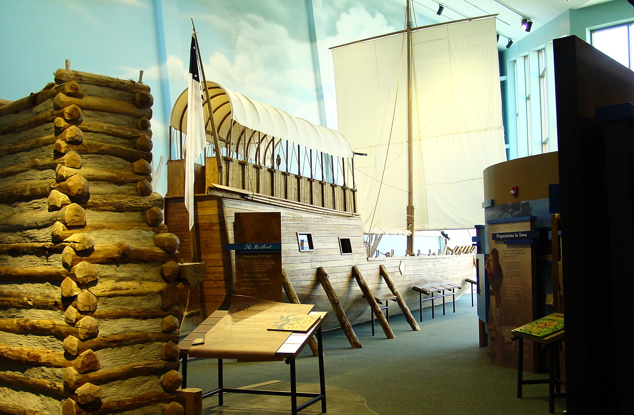
Step back in time and experience the journey of the Lewis and Clark Expedition at Camp River Dubois, the official point of departure for their historic adventure. Located near the confluence of the Mississippi and Missouri Rivers at Hartford, Illinois, this reconstructed winter encampment offers a fascinating glimpse into the challenges and preparations faced by the Corps of Discovery before setting out in 1804.
Wander through the interpretive center, where engaging exhibits and knowledgeable staff bring history to life. Explore the replica fort, see how the expedition members lived and trained, and imagine the anticipation of the journey ahead.
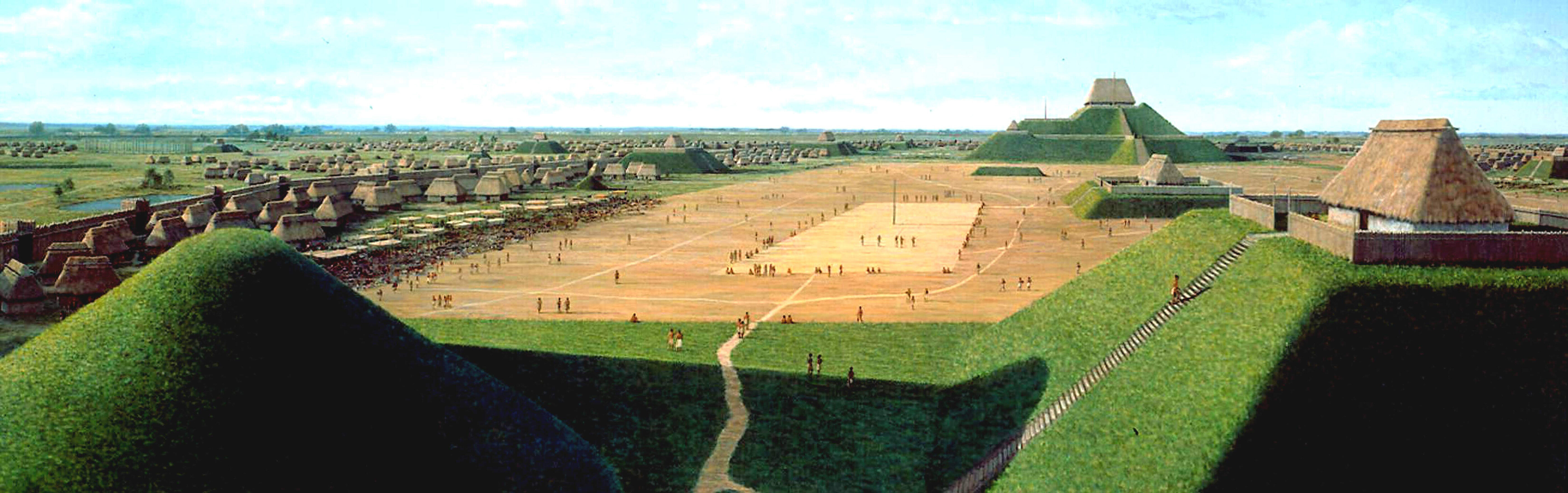
Cahokia Mounds State Historic Site, Collinsville, IL, USA
10 mi
View Listing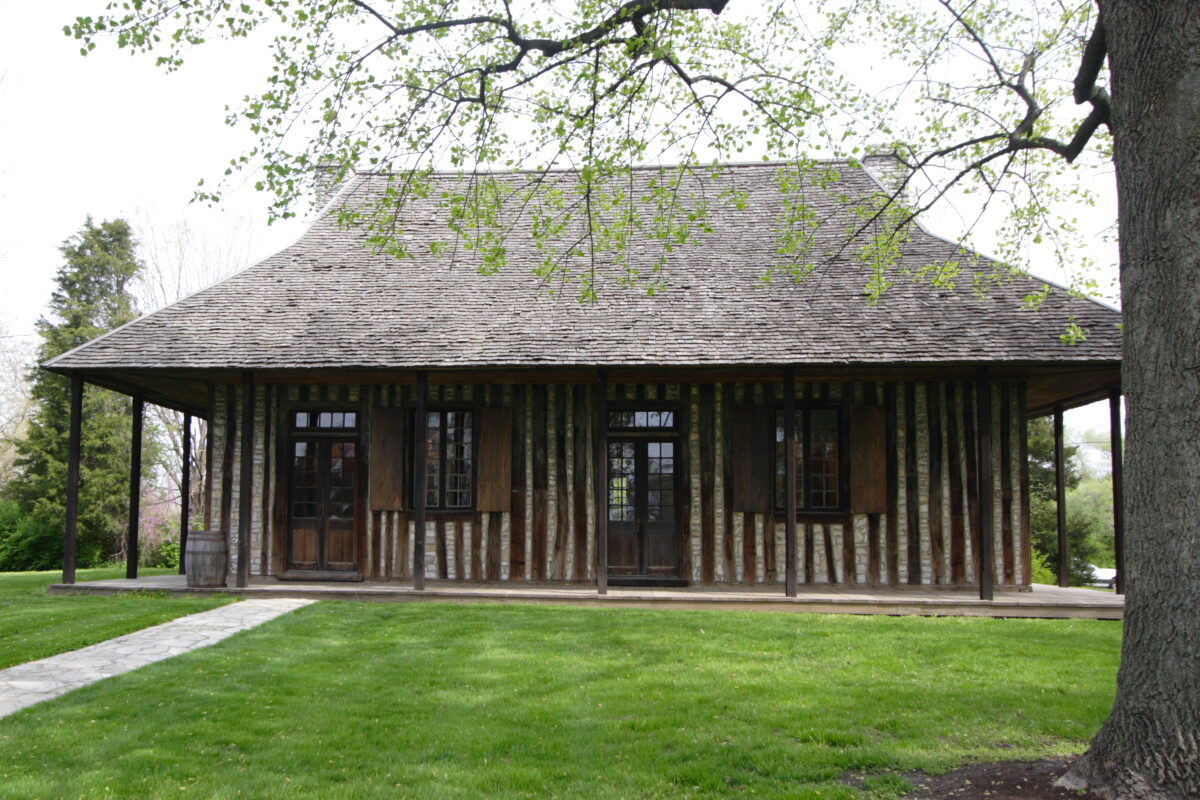
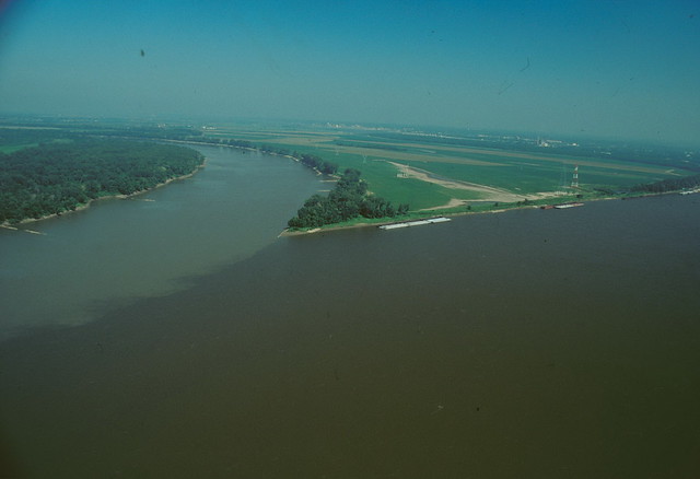
In 1721, French explorer Father Pierre Francois de Charlevoix wrote of the confluence of the Mississippi and Missouri rivers: “I believe this is the finest confluence in the world. The two rivers are much the same breadth, each about half a league; but the Missouri is by far the most rapid, and seems to enter the Mississippi like a conqueror, through which it carries its white waters to the opposite shore without mixing them, after wards, it gives its color to the Mississippi which it never loses again but carries quite down to the sea….”
Nearly 300 years later, visitors to Edward “Ted” and Pat Jones-Confluence Point State Park can still witness the two great rivers of North America as they join and become one. The Mississippi River, the vital highway down which the products of America’s factories and fields travel to the world market, merges with the Missouri River, the wild western river. In 1804, explorers Meriwether Lewis and William Clark hoped the Missouri River was the Northwest Passage leading to the Pacific Ocean. They did not find the Northwest Passage, but at the confluence of the two rivers, they began their epic journey to the Pacific Ocean.

The Mississippi River is a globally significant migratory flyway providing breeding, foraging and stopover habitat for over 300 species of birds. This includes 60% of migratory bird species in North America, and 40% of North American waterfowl.
The St. Louis District of the U.S. Army Corps of Engineers manages nearly 50,000 acres of floodplain forest on the Upper Mississippi River. Since 2012, the Audubon Center at Riverlands and the Rivers Project Office of the U.S. Army Corps of Engineers have conducted an avian monitoring program focused on these forests. These annual surveys occur over an 8-10 week period in spring and summer spanning 100 river miles. Surveys take place on 25 river islands and adjacent lands starting on Maple Island, located on the Riverlands Migratory Bird Sanctuary in West Alton, and ending north of Louisiana, Missouri.
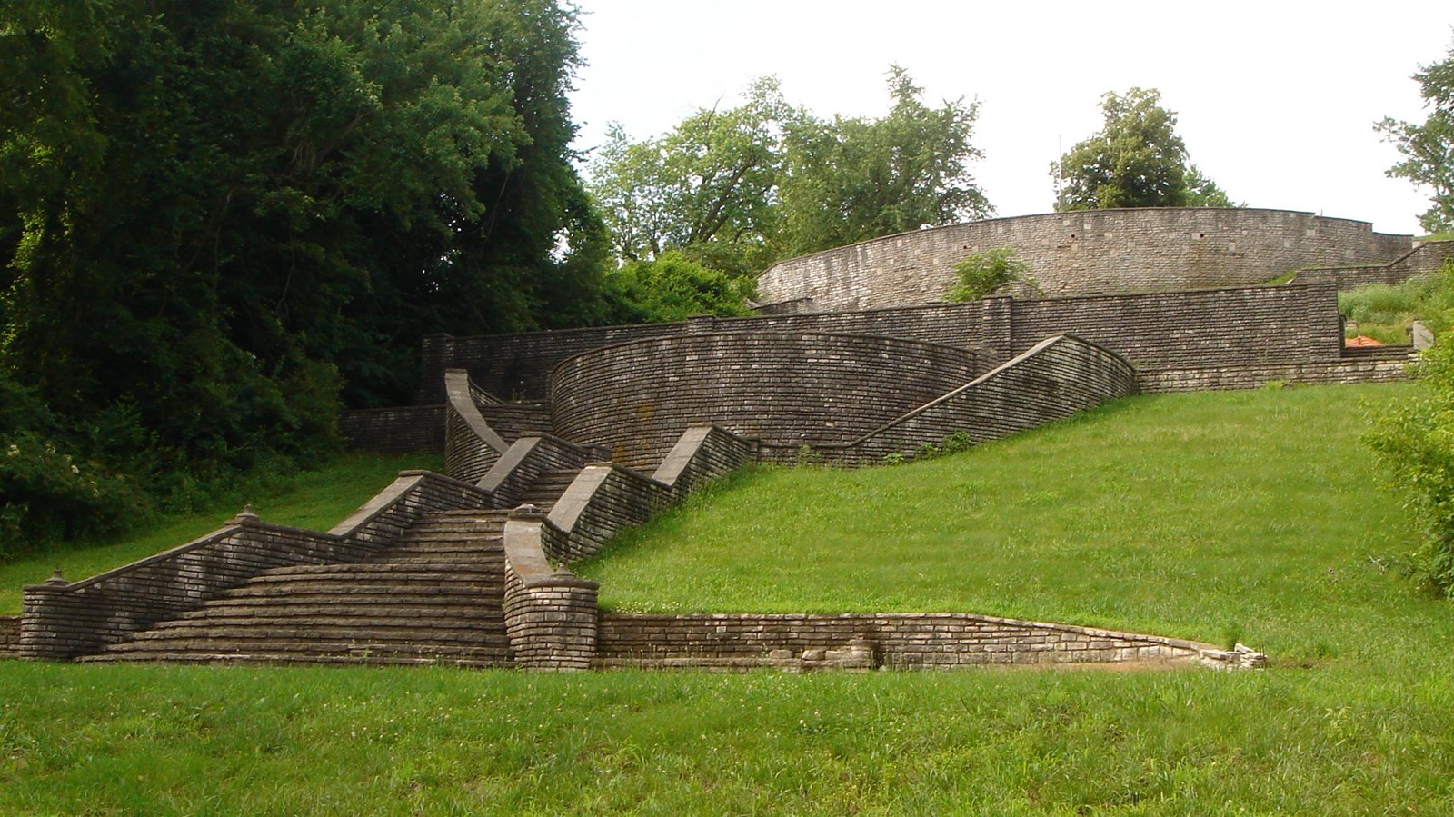
Fort Belle Fontaine is about 20 miles north of St. Louis, Missouri. Built in 1805 under the direction of Lt. Col. Jacob Kingsbury, the fort was the first U.S. military installation west of the Mississippi River. The trading fort was an important gathering place for officers and enlisted men; Native peoples; and French, Spanish and American settlers, trappers, and traders.
The original fort was built at river level and then moved to the bluff because of frequent flooding. The grounds below the bluff became a popular summer retreat during the late 1930s and in 1936 the Works Progress Administration (WPA) built a grand limestone staircase down from the bluff along with a number of other structures. Today, Fort Belle Fontaine Park is a 305-acre park of St. Louis County.
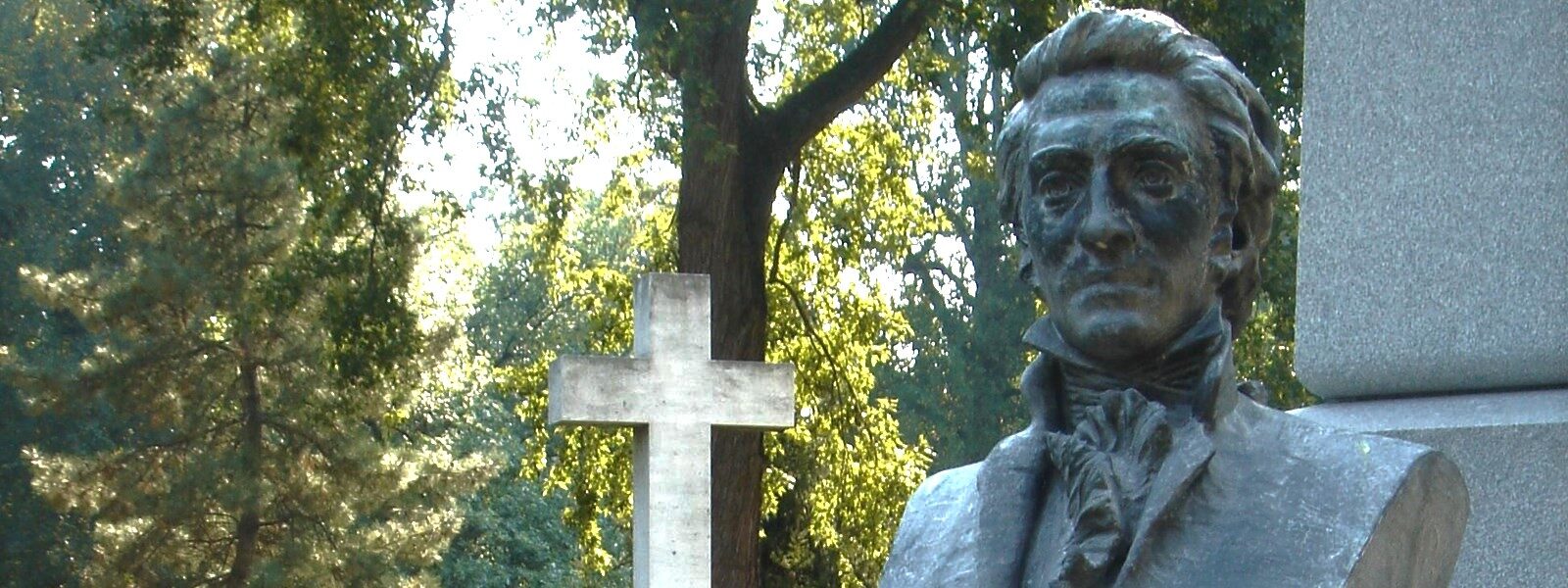
Atop a hill overlooking the Mississippi River in Bellefontaine Cemetery rises an impressive stone monument marking the gravesite of William Clark. A prominent citizen of St. Louis in the years following the expedition, he served there for about three decades as a U.S. Government official. On September 1, 1838, at the age of 69, he died at the home of his eldest son, Meriwether Lewis Clark. Burial, with military and Masonic honors, occurred 2 days later on the farm of the elder Clark’s nephew Col. John O’Fallon. Bellefontaine Cemetery later absorbed the gravesite.
Jefferson K. Clark, who died in 1900, then William Clark’s only surviving son, bequeathed money for the monument and his widow supervised its construction. Unveiled in 1904, it consists of a tall obelisk on a pedestal. At its base stands a bust of Clark inscribed with the following epitaph: “William Clark—Born in Virginia August 1, 1770—Entered Into Life Eternal September 1, 1838—Soldier, Explorer, Statesman, and Patriot—His Life Is Written in the History of His Country.”
The memorial is located in the northern part of the cemetery. The 333-1/2-acre burial ground also contains the graves of such noted personalities as Gens. B. L. E. Bonneville, Stephen W. Kearny, and Sterling Price; fur traders Manuel Lisa, William Sublette, and Robert Campbell; Senator Thomas H. Benton; physiologist Dr. William Beaumont; and engineer James B. Eads.
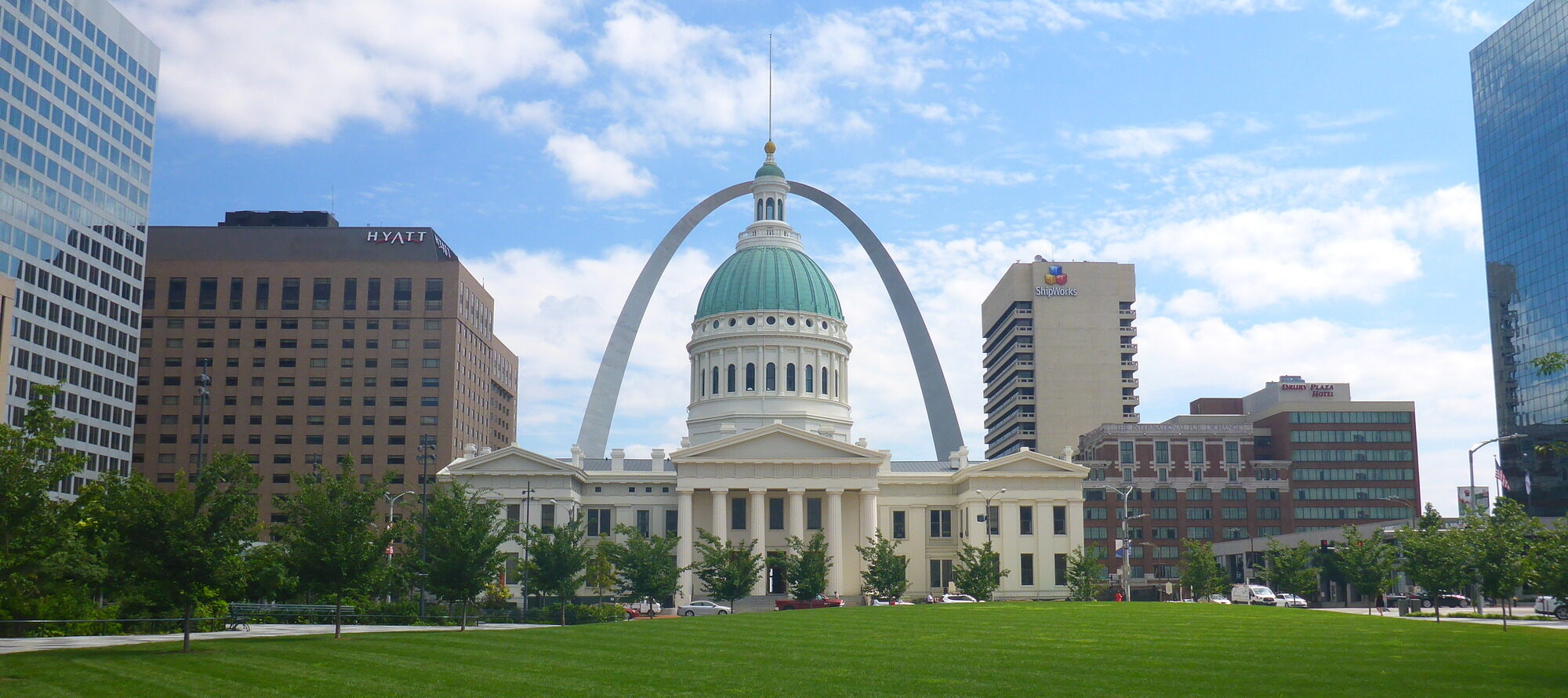
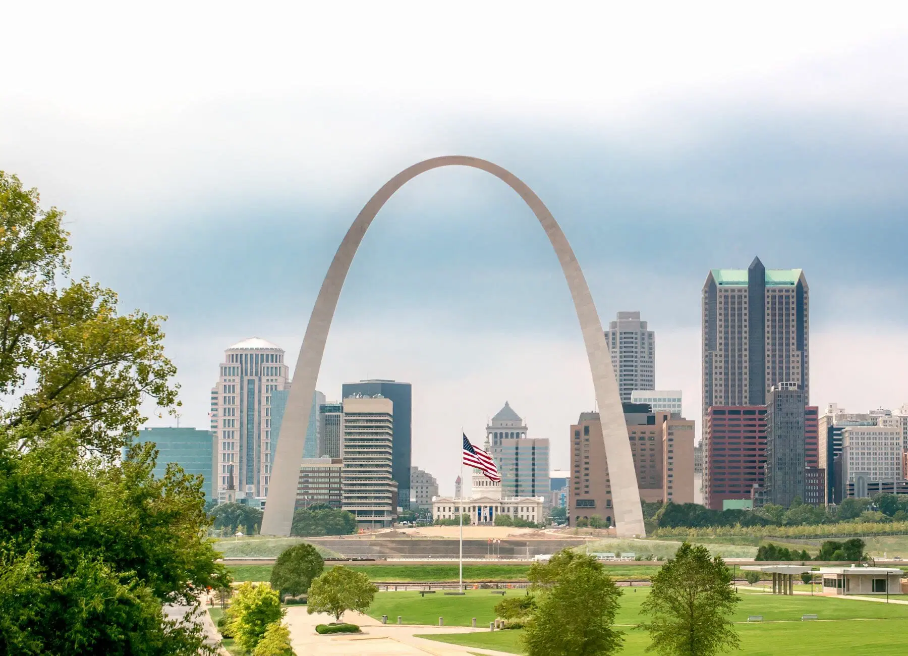
Gateway Arch National Park is part of the National Park Service, within the Department of the Interior. The 91 acre park is situated in downtown Saint Louis, Missouri at the edge of the Mississippi River. This park, established in 1935 as Jefferson National Expansion Memorial, had its name changed to Gateway Arch National Park in 2018. Each year, hundreds of thousands of visitors come to enjoy the unique experiences that only can be had at Gateway Arch National Park. We invite you to explore the park’s historic Old Courthouse, modern visitor center, and, of course, our soaring stainless-steel Arch in a impeccably manicured, tranquil park setting, right in the middle of downtown. Learn about some of the historic cases that took place at the Old Courthouse, including the first two Dred Scott trials. More about Dred Scott at the National Park Service.
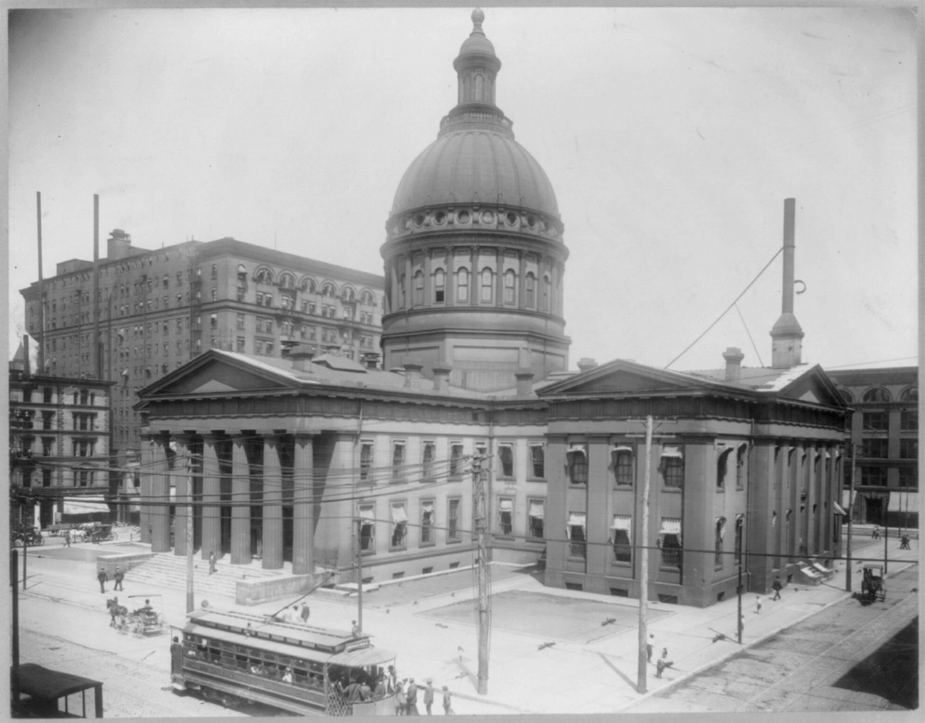
Old Courthouse, North 4th Street, St. Louis, MO, USA
0 mi
View Listing
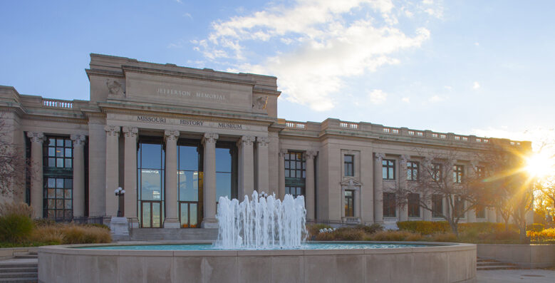
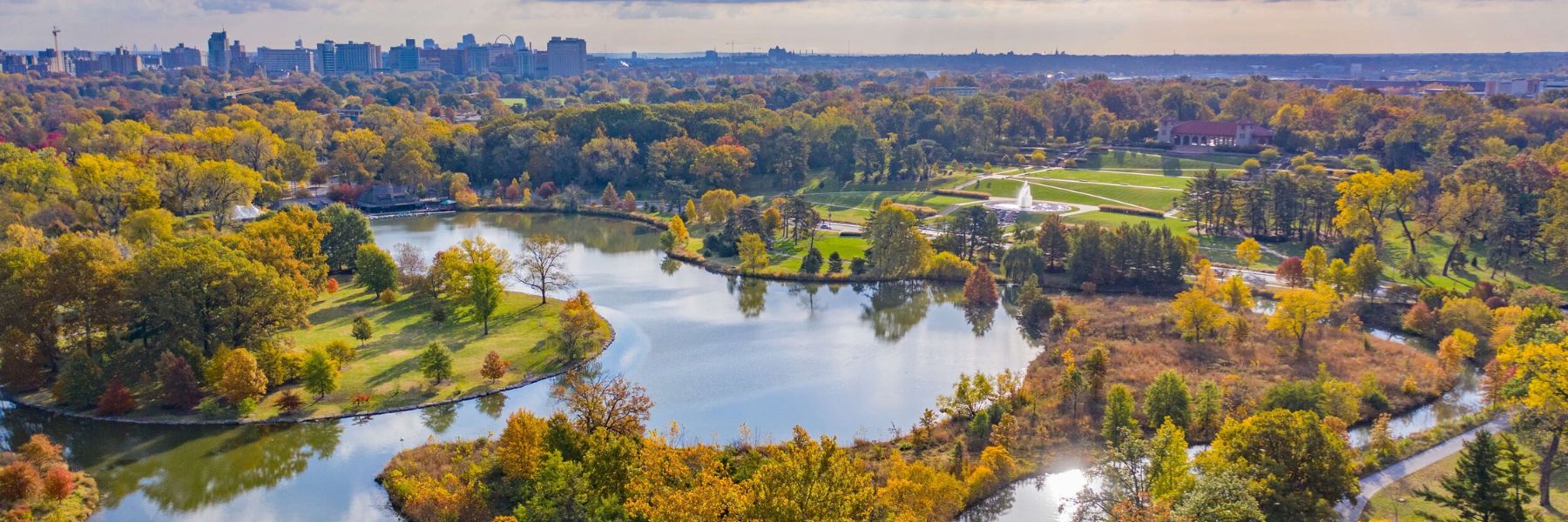
Originally built as the first national monument to Thomas Jefferson, the Missouri History Museum looks at the history of St. Louis from its founding in 1764 up to the present day. The Museum is located in beautiful Forest Park, on the site of the main entrance to The Louisiana Purchase Exposition, popularly known as the 1904 World’s Fair. The Jefferson Memorial Building section of the Museum was built entirely with proceeds from the Fair, and opened to the public on April 30, 1913. Suspended above visitors in the Museum’s Grand Hall is “The Spirit of St. Louis,” sister plane to Lindbergh’s, which was featured in the 1957 film of the same name starring Jimmy Stewart.
Visitors can discover the city’s baseball history from the Browns to the Cardinals, learn about life on the Mississippi River, marvel at the magnitude of the 1904 World’s Fair, and much more. The History Clubhouse is a special gallery with hands-on activities for children. General admission to the Museum is free. The Museum also features a rotating schedule of free special exhibitions throughout the year.

The Barracks were initially founded in 1826, only a few miles south of St. Louis, as the major military outpost for American expansion west of the Mississippi River. During this period, the Barracks often served as a mediary between white settlers and Native American tribes. When the Civil War broke out in 1861, the outpost’s prime tactical location along the banks of the Mississippi made it a central hub for Union troops, including Generals Ulysses S. Grant and William T. Sherman.
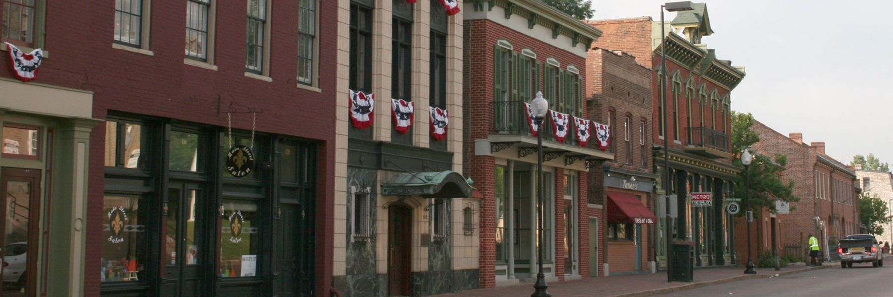
Approximately 30 minutes from downtown St. Louis, the historic town of Saint Charles is nestled on the banks of the Missouri River. The growing community was founded as Les Petites Côtes (The Little Hills) by French Canadian fur trader Louis Blanchette in 1769, and it served as the state’s first capital.
Today, visitors enjoy casual strolls along Main Street, where more than 100 shops, restaurants and cafés decorate the beautifully preserved historic district. The Frenchtown area, known for its antique shops, boasts 58 historic French Colonial and German buildings that are worth a stop, too. While you’re in Saint Charles, visit the Lewis & Clark Boat House and Museum to learn more about the famous explorers
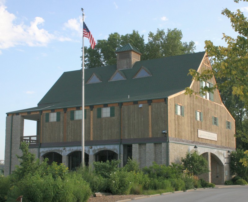
Lewis & Clark Boat House and Museum, South Riverside Drive, Saint Charles, MO, USA
0 mi
View Listing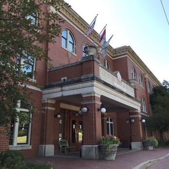
1190 S Main St, Saint Charles, MO 63301, USA
0 mi
View ListingOur bi-weekly newsletter provides news, history, and information for those interested in traveling along along the Lewis & Clark Trail.


