 Leaving Columbia, head west and take exit 121 off the interstate to embark on one of William Least Heat Moon’s “Blue Highways.” You’ll find yourself on old US 40, heading toward Fayette and into the heart of Booneslick Country, named for the salt lick operated by Daniel Boone’s sons, Nathan and Daniel Morgan. This area is steeped in history, as Lewis and Clark noted the “saline” when they passed through here in early June 1804.
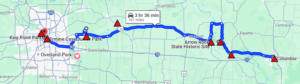
On this leg of our journey, we’ll visit several historic sites, beginning with Old Franklin, the starting point of the Santa Fe Trail. We’ll also explore the Booneslick, visit the time-capsule village of Arrow Rock, and stop by historic Lexington. From there, we’ll visit Fort Osage, established by William Clark in 1808, before making our way into modern Kansas City. Once there, we’ll climb the hill to Case Park, where you can look out over the confluence of the Kansas (Kaw or Kanza) River and the Missouri River. This is the spot where Lewis and Clark paused for three days, during which Lewis determined that the Missouri River’s water was heavier—carrying more sediment—while Clark remarked that the taste of the Kansas River’s water was “very disagreeable” to him.
Kaw Point is also notable as the site where John Collins and Hugh Hall broke into the whiskey supply while on guard duty. John Collins was charged with “getting drunk on his post this morning out of whiskey put under his charge as a sentinal and for suffering Hugh Hall to draw whiskey out of the said barrel intended for the party.” Both were tried by a court composed of five members of the expedition, found guilty, and sentenced to one hundred lashes for Collins and fifty lashes for Hall.
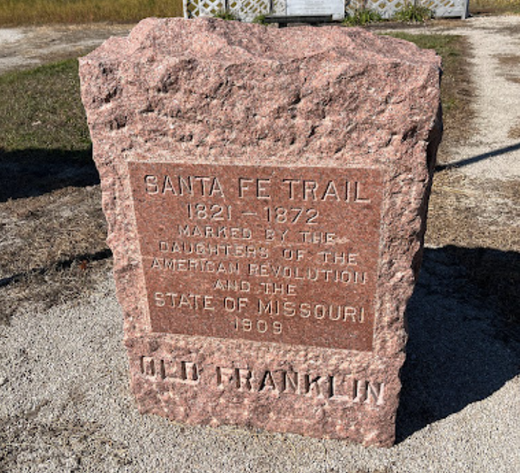
What was the second largest population center in Missouri in 1820 now has only historic markers and the route of the KATY Trail. The original town of Franklin, founded in 1816 was the seat of Howard County. It was about two miles southwest of present day New Franklin. The town was named for Benjamin Franklin.
Franklin had more than 225 buildings. In the fall of 1823, other counties were formed out of Howard's original boundaries and in 1825, the county seat was moved to Fayette. The first newspaper west of St. Louis, "The Missouri Intelligencer," was printed here in 1819 and the seat of the U.S. Land office opened in 1818. The Boonslick Trail brought settlers to this westernmost settlement and in 1821, William Becknell opened up the Santa Fe Trail, a trade route, from Franklin to the southwest.
Before the devastating Missouri river floods of 1826 and 1828, the town's population was estimated from 1,500 to 1,700. The town was relocated to higher ground in 1828 and renamed New Franklin. Franklin was the early boyhood home of western scout, Kit Carson, four governors, two Supreme Court Justices, Missouri's first Senator and artist George Caleb Bingham.
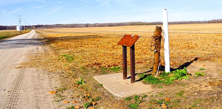
Stop at the roadside markers to read about the Corps of Discovery and the Santa Fe Trail before continuing on toward Booneslick State Historical Park.
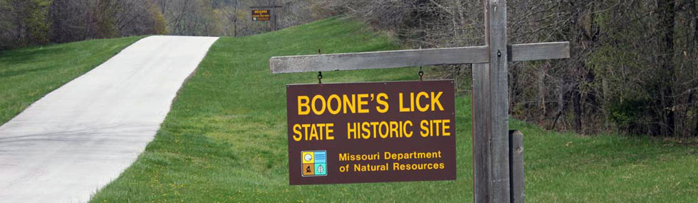
In 1804, explorers Lewis and Clark reported the presence of many saltwater springs in the area that now comprises Howard, Cooper and Saline counties. The largest of these salt springs was the Boone's Lick. In pioneer times, salt was indispensable for preserving meat and tanning hides. The countryside around these salt springs was considered ideal for settlement and by 1810 had acquired the name "Boone's Lick Country."
In 1805, the Boone brothers formed a partnership with James and Jesse Morrison to produce salt. Salt production was a labor-intensive project. Brine water was poured into iron kettles and heated to boiling on a stone furnace. As the water evaporated, salt crystallized in the bottom of the kettle. Approximately 250 to 300 gallons of brine water produced a bushel of salt.
Several noted Missourians were associated with the Boone's Lick saltworks. William Becknell, a manager at the works, led the first successful trading expedition to Santa Fe in 1821 and took the first wagons the following year. The Cooper family, the first white settlers in the Boone's Lick Country, helped manage the works and brought back the first mules, jacks and jennets from Santa Fe, helping lay the foundation of Missouri's renowned mule-breeding industry.
Boone's Lick State Historic Site, Missouri 187, Franklin, MO, USA
500 Co Rd 330, Franklin, MO 65250, USA
From the earliest days, the Arrow Rock bluffs were a well-known landmark on the Missouri River. Visible for many miles, they first appeared on a French map in 1732, noted as "pierre á fleche" -- the "rock of arrows." The origin of this name was first explained in 1819; “Arrow Rock is so-called from its having been formerly resorted to by neighboring Native Americans, for the stone used to point their arrows.”
As the "Boone's Lick Country" began to be more settled and more people moved into what is now Saline County, a ferry was established by 1815. The ferry linked the Arrow Rock community with the boom town of Franklin and Howard County on the north bank of the river.
In the 1820s, the earliest travelers on what would become the Santa Fe Trail crossed the river on the Arrow Rock ferry. In 1829, a town was formally platted on this site under the name of New Philadelphia, but this grandiose designation did not last long, and in 1833, it was changed to Arrow Rock to coincide with the landmark bluff.
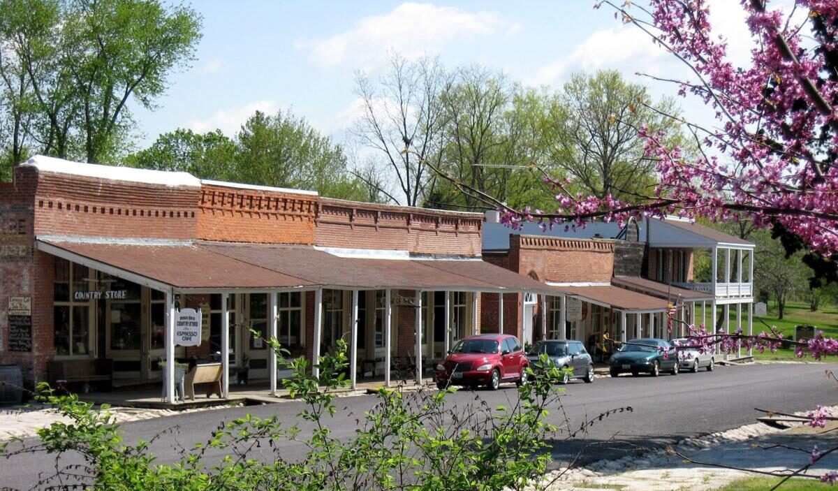
Today there are many events and attractions to experience in Arrow Rock. In addition to the quaint village with its historic structures, the Arrow Rock landing offers interpretation of where the original river channel provided a ferry landing and the Missouri State Park offers an impressive visitor center which contains the trunk of Alexander Willard, one of the members of the Corps of Discovery.
Arrow Rock State Historic Site, Visitor Center Drive, Arrow Rock, MO, USA
Arrow Rock, MO, USA
Arrow Rock, MO, USA
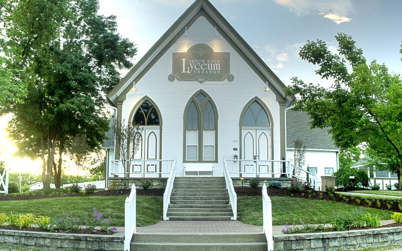
Lyceum Theatre, High Street, Arrow Rock, MO, USA
As you continue your journey west from Arrow Rock to Fort Osage, you'll closely follow the historic path of the Santa Fe Trail by staying on the blue highways. Begin by taking MO 41 north to Marshall, then connect with US 65 north to Waverly, and finally, merge onto US 24. This scenic drive will lead you through the rolling hills on the southern side of the river.
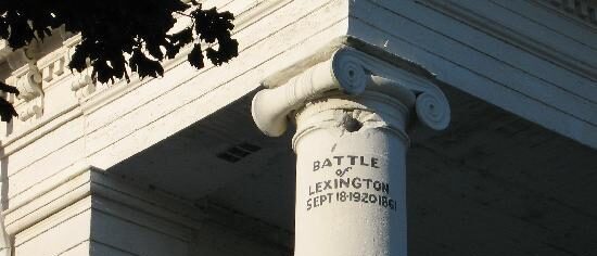
Make sure to stop in Lexington, a town steeped in history. Lexington was once home to Russell, Majors, and Waddell, the freight company behind the Pony Express and a vast freight network. While there, don't miss the cannonball embedded in a courthouse column, a remnant of the largest Civil War battle fought west of the Mississippi. Also, visit the Madonna of the Trail statue, one of 12 identical monuments erected by the Daughters of the American Revolution in each state along the Old National Road. This particular statue was dedicated by Harry Truman in 1928.
For an even more authentic blue highway experience, take MO 224, the old US 24 route, along the river from Lexington westward toward Fort Osage.
Lexington, Missouri, USA
Lafayette County Courthouse, Main Street, Lexington, MO, USA
Madonna of the Trail, Commerce Street, Lexington, MO, USA
Battle of Lexington State Historic Site, Delaware Street, Lexington, MO, USA
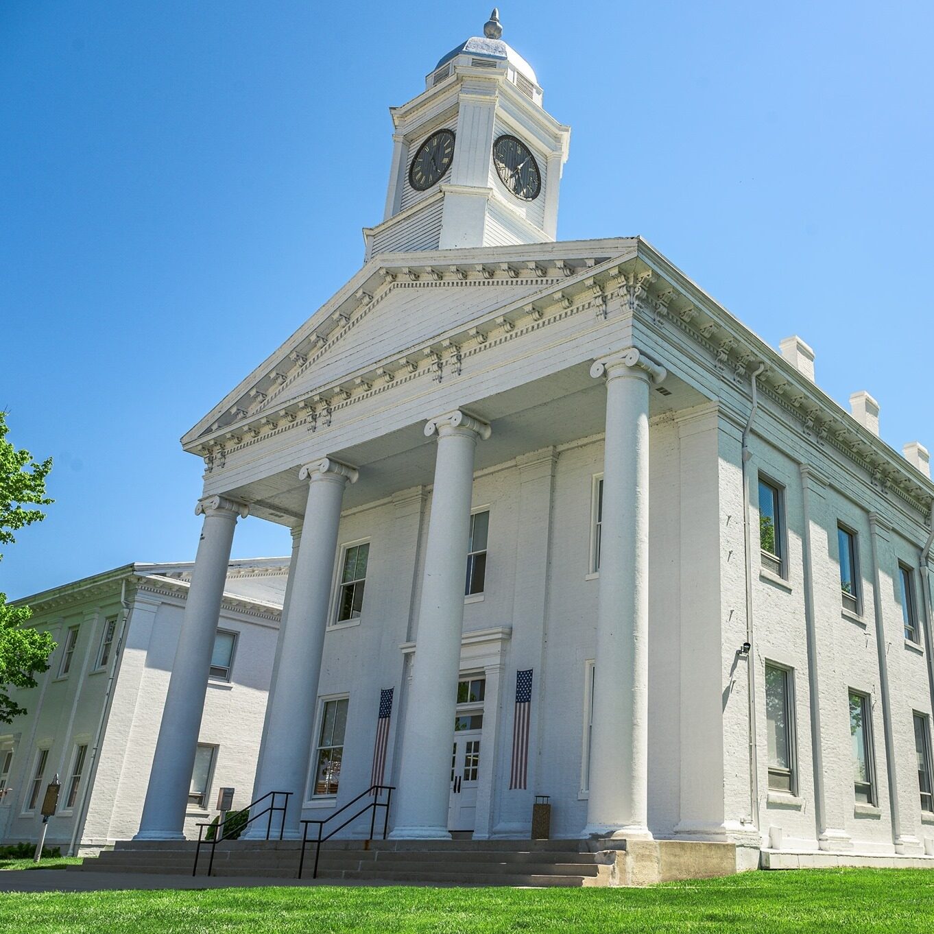
Lafayette County Courthouse, Main Street, Lexington, MO, USA
View ListingMadonna of the Trail, Commerce Street, Lexington, MO, USA
View Listing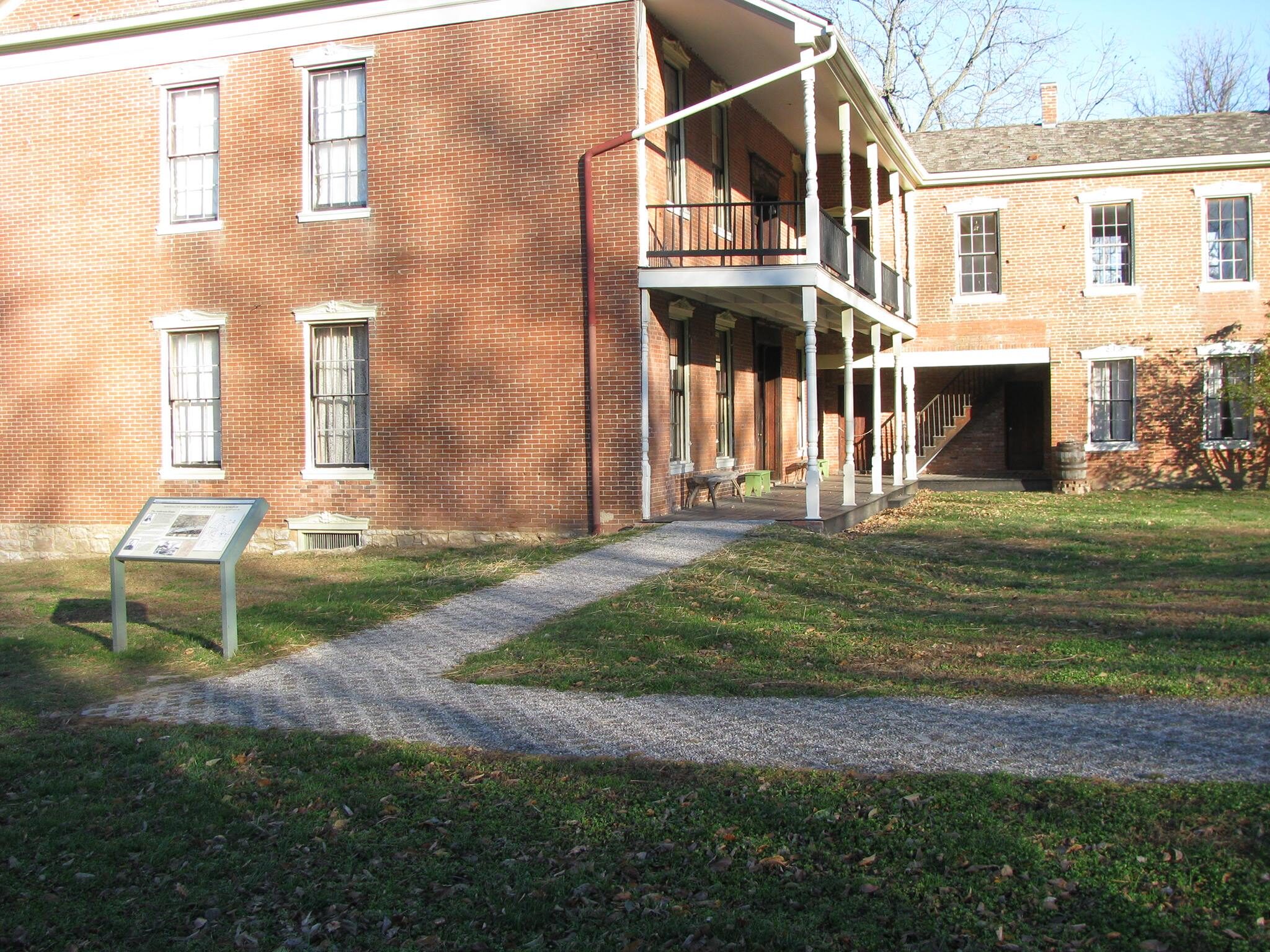
Battle of Lexington State Historic Site, Delaware Street, Lexington, MO, USA
View Listing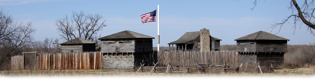
Built under the direction of General William Clark, joint commander of the famous Lewis and Clark expedition, Fort Osage was established in 1808 as a military outpost in the newly acquired Louisiana Territory. The Fort’s purpose was to provide a military presence in the territory in order to assure Spain, France and Great Britain that the United States meant to protect its territory by military strength and to establish healthy relations with the Native American population in the territory. Fort Osage has been partially reconstructed, and it is currently a park owned and operated by Jackson County Parks + Rec.
The Fort is brimming with fascinating history, information, and artifacts. While exploring the grounds and buildings, be sure to check out two particularly intriguing items. First, learn about Sacagawea's visit to the Fort on April 25, 1811, as she traveled up the river after spending time in St. Louis with Charbonneau. In the Education Center's exhibit hall, don't miss the Bronze Relief Plaque created by sculptor Sabra Tull Meyer. Additionally, you can view a preserved 16-foot dugout canoe, discovered during the Blue River channelization project in 1992. This remarkable canoe, dating back to the late 1600s to early 1700s, is now on display.
Fort Osage National Historic Landmark, Osage Street, Sibley, MO, USA
Harry S. Truman Presidential Library & Museum, West US Highway 24, Independence, MO, USA
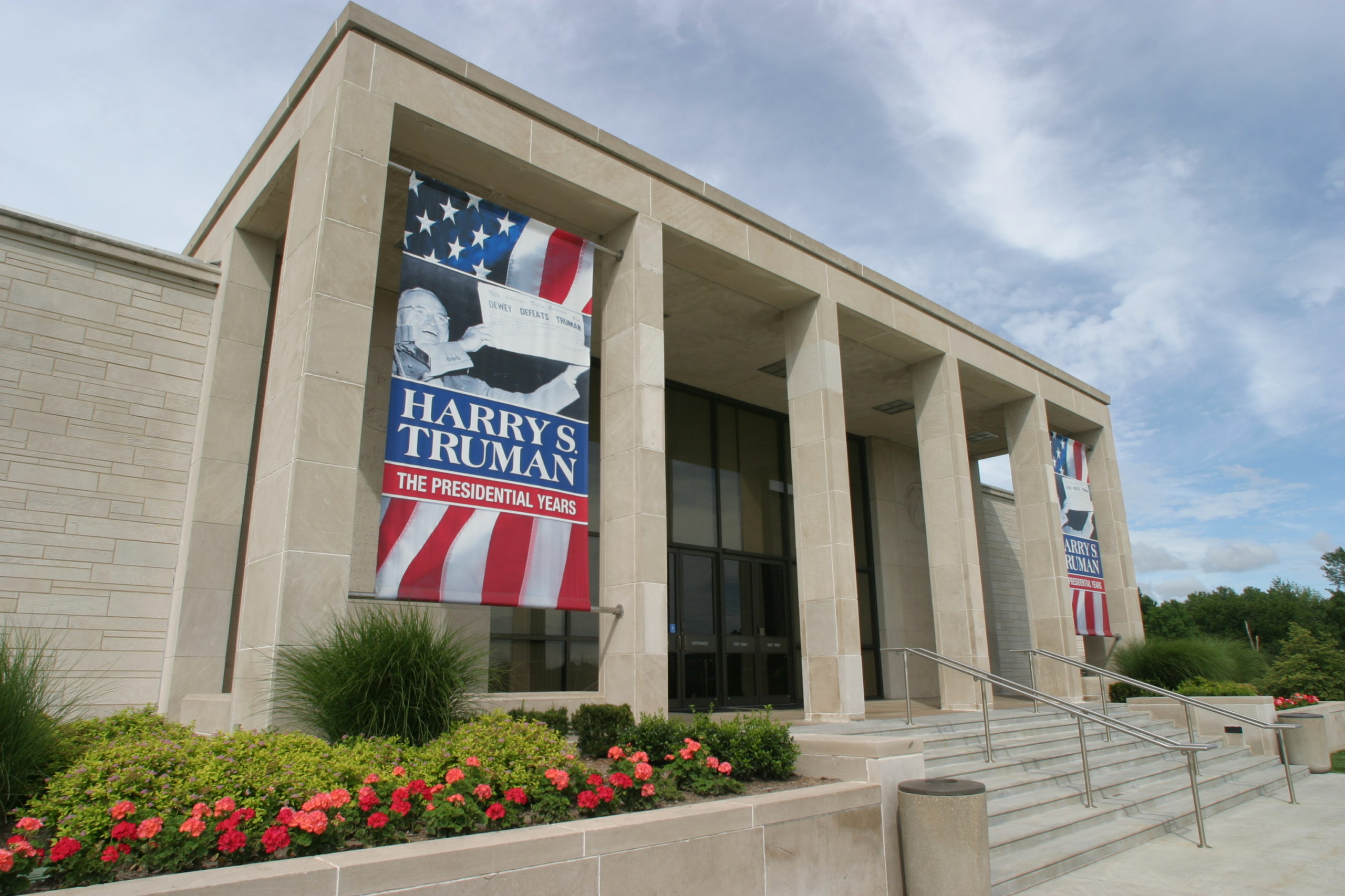
Harry S. Truman Presidential Library & Museum, West US Highway 24, Independence, MO, USA
View Listing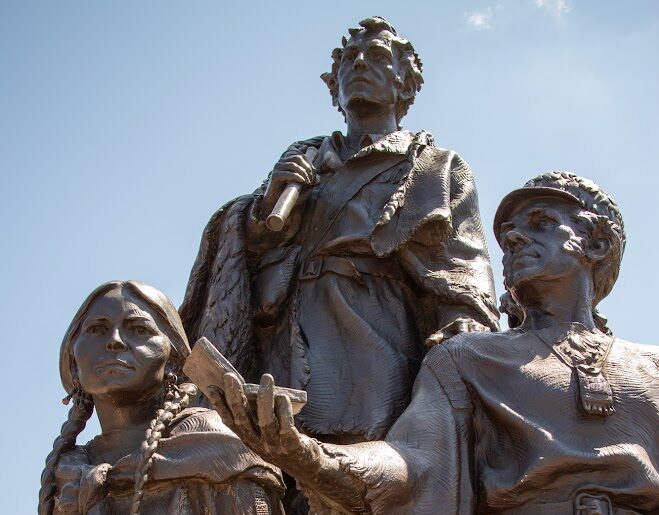
Leaving Fort Osage, head west on US 24 and you will be able to pass through Independence, MO on your way into Kansas City. Stop at sites including the Truman Library and Home, the historic square where the Oregon Trail jumped off and the 1859 jail where outlaw Frank James lived for six months.
When Lewis and Clark stopped on a bluff overlooking the Missouri and Kansas Rivers, they made a note that the site provided a “commanding situation for a fort.” Today on the bluff at the western edge of downtown Kansas City, Missouri, you’ll find Case Park where this statue stands to honor the Corps’ visit in mid-September 1806. Created by sculpture Eugene Daub, “Corps of Discovery” features the two Captains, York, Sacagawea holding Jean Baptiste, and Seaman. Created of bronze and granite, it stands 21 feet tall and about 18 feet wide. It was dedicated in April 2000.
George B. Case donated land for a park to the city in 1944 on the condition that it be called Ermine Case, Jr. Park in honor of his father. Ermine Case, Jr. was born in 1841 in Columbus, Ohio and moved to Kansas City in the 1860s. He was a lawyer and real estate developer who died in 1886.
Case Park, Jefferson Street, Kansas City, MO, USA
14 W 10th St, Kansas City, MO 64105, USA
Union Station, 30 W Pershing Rd, Kansas City, MO 64108, USA
3218 Gladstone Blvd, Kansas City, MO 64123, USA
14 W 10th St, Kansas City, MO 64105, USA
View Listing
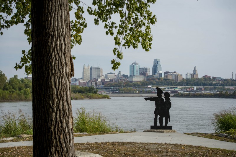
The Lewis and Clark Expedition arrived at Kaw Point, the confluence of the Kansas and Missouri rivers, on June 26, 1804. The expedition camped at Kaw Point for three days to rest, repair their boats, explore the surrounding countryside, and for the first time during their journey, engage martial law.
Today, Kaw Point is located in the center of metropolitan Kansas City with a great view of downtown, but the Point itself remains in a natural state with beautiful wooded trails, wildflowers, and wildlife. Located along the river, the park has access to highways, the Lewis and Clark Heritage Trail, and two great rivers. This accessible park has an infrastructure to support a large number of visitors, and has an outdoor amphitheater equipped with electricity for performing arts and special events.
Visit Kaw Point Park to see the beautiful scenery and learn more about the Lewis and Clark Expedition. The park is open from 7am to 10pm daily.
Kaw Point Park, Fairfax Trafficway, Kansas City, KS, USA
3205 Main St, Kansas City, MO 64111, USA
LaMar's Donuts and Coffee, Main Street, Kansas City, MO, USA