
After leaving the Falls of the Ohio and floating the Ohio River downstream to the confluence with the Mississippi, the Lewis & Clark Expedition rounded the bend and began heading for the first time against the powerful fluvial currents they would be facing until they reached the Continental Divide. Although the captains brought along York and had already engaged the Nine Young Men from Kentucky as part of their command, they realized they would need more men to propel their barge and some fifteen tons of supplies for hundreds of miles up the Missouri River.
In this stretch of their journey, expedition members gained valuable experience as rivermen, brought aboard additional soldiers and supplies, gathered intelligence about what they would find in traveling up the Missouri, and searched for a suitable spot to establish and build a camp for the impending winter. Follow the route of the Expedition as they journey up the Mississippi from Cairo, Illinois to their first winter at Camp Dubois.
We also have a parallel trip along the western (Missouri) side of the river.
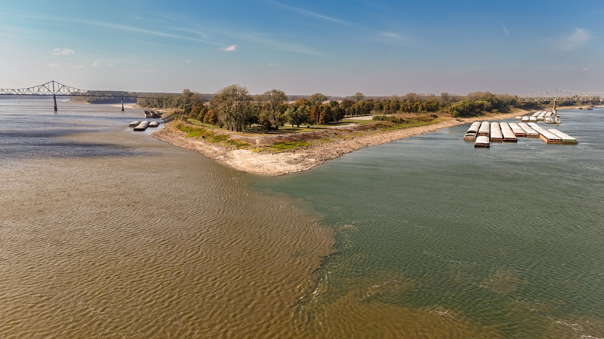
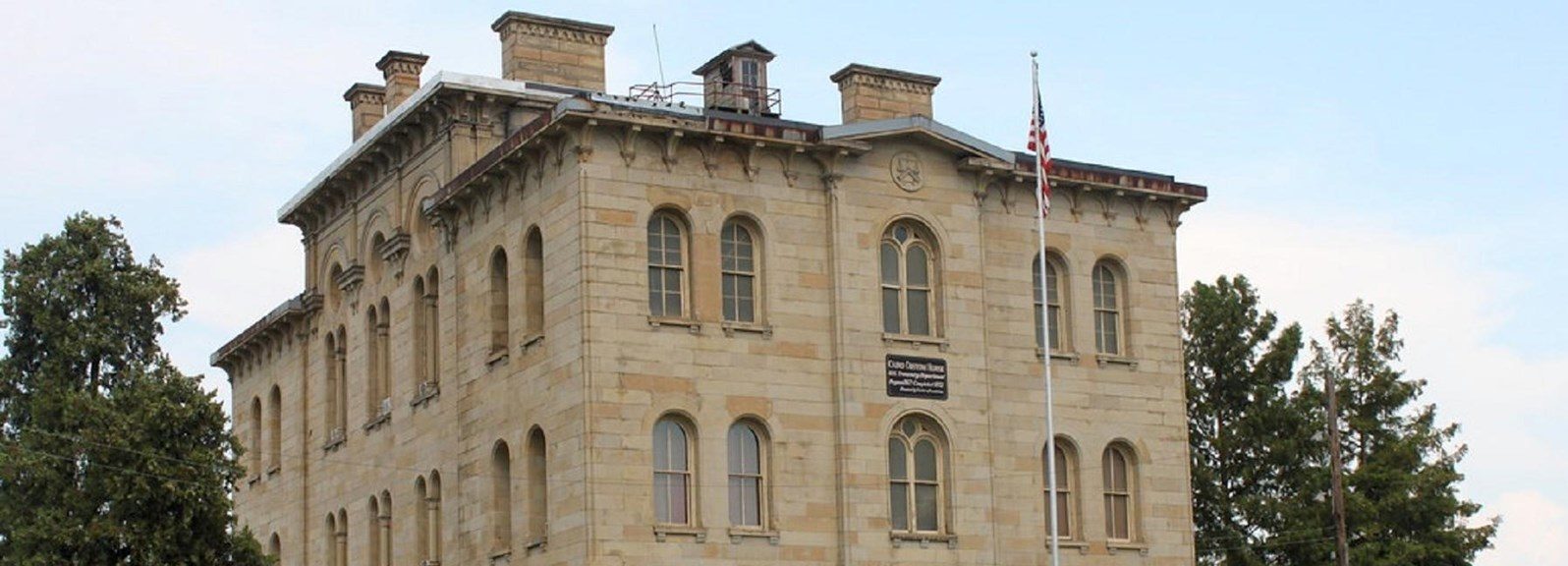
Start your journey at the confluence of the two great rivers at Fort Defiance, just south of Cairo (KAY-roh), IL. Cairo was virtually destroyed during the 2011 floods and the population stands at a little over 1,000 people today. Still it is notable for its surviving historic structures including the Cairo Custom House (not currently open).
Check our Events page for even more things to do while on this journey and read more about this section of the Expedition in our Digital Travel Magazine library.
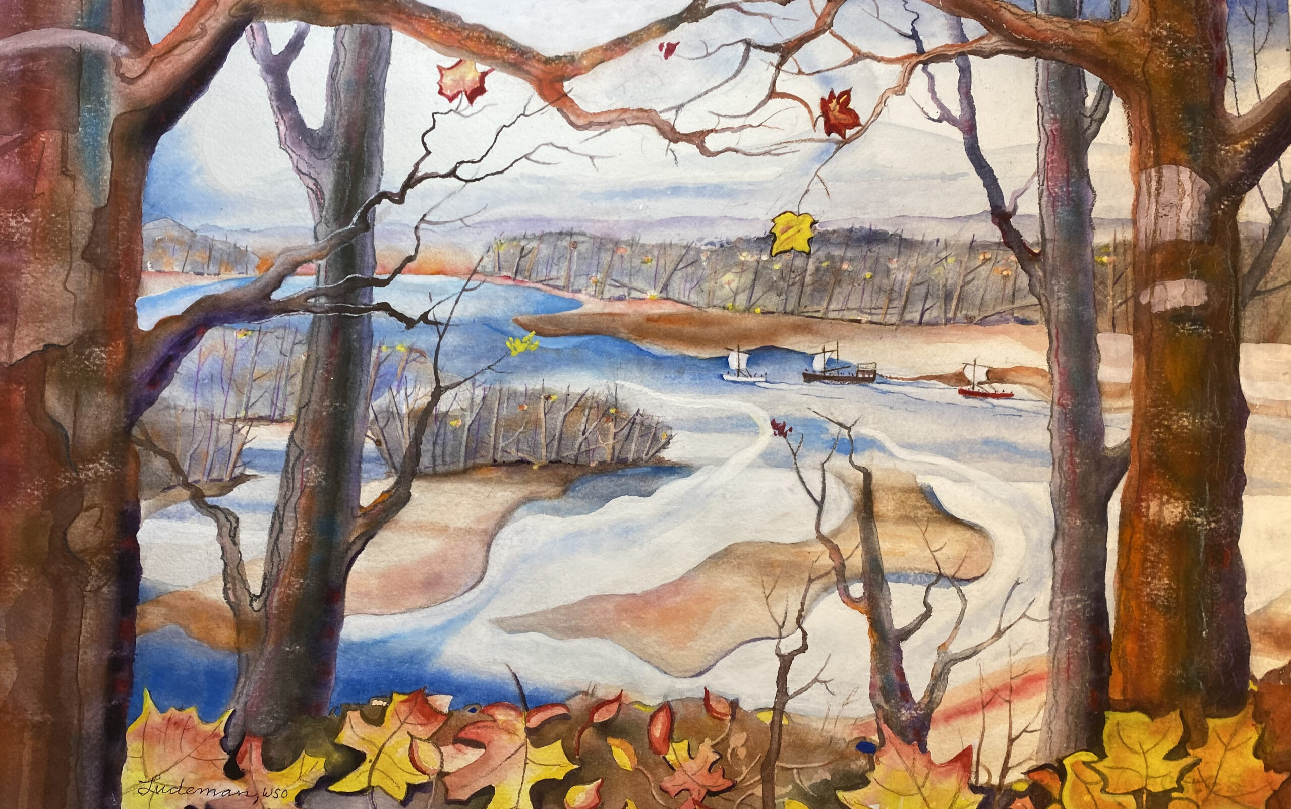
Artwork courtesy of Steve Ludeman.
You may also like our L&C Travel Magazine!
The expedition camped near here, arriving on November 14, 1803 and departing November 20.
While at ‘The Point’ the captains trained recent recruits, surveyed and took celestial observations for the first time, and explored the opposite shores of both rivers. Today, you can drive across the Ohio and Mississippi via bridges on U.S. Highway 51 and 62, respectively. Besides Lewis and Clark interpretation, Fort Defiance State Park has picnic facilities and a concrete observation building. It’s also the southernmost point and lowest elevation in Illinois.
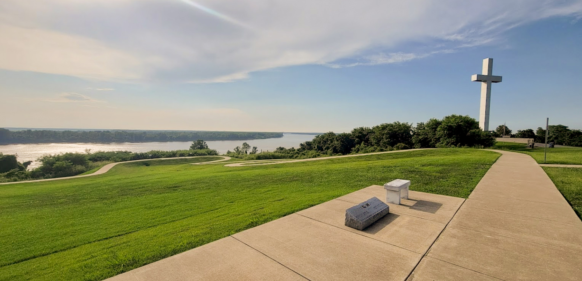
Venture beyond Cairo, IL, and explore the rich history waiting just south along the Lewis and Clark National Historic Trail. Cross the Ohio River on U.S. 51 into Wickliffe, Kentucky, where a short drive leads to Fort Jefferson Hill Park. Here, visitors can take in a breathtaking view of the river confluence while uncovering the story of Fort Jefferson, a 1789 settlement founded by George Rogers Clark, brother of William Clark. Though abandoned a year later, the site saw a visit from eight members of the Lewis and Clark Expedition in 1803. Today, the park features interpretive exhibits, a walking path, a visitor center, and a striking 95-foot cross. Nearby, continue your journey to Wickliffe Mounds State Historic Site, where ancient Native American history comes to life before heading back across the Ohio to follow the expedition’s route northward.
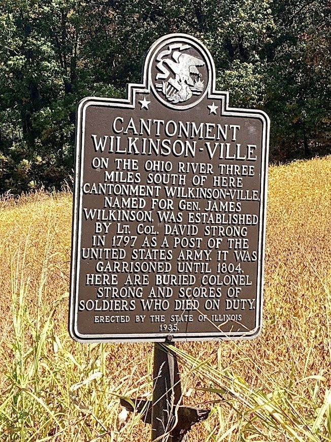
A bonus side trip for those interested is to make the 22 mile (one way) journey back in Illinois to the Cantonment Wilkinsonville Historical Marker on IL 37 near New Grand Chain, IL.
Cairo Custom House Museum, Washington Avenue, Cairo, IL, USA
2 mi
View Listing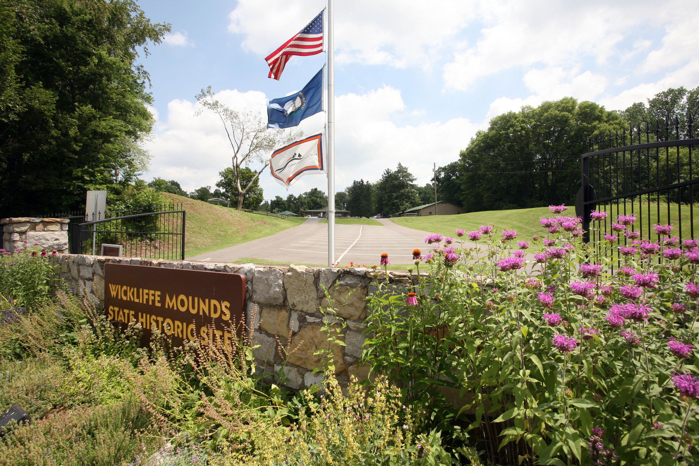
Wickliffe Mounds State Historic Site, Green Street, Wickliffe, KY, USA
3 mi
View Listing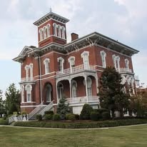
Fort Jefferson Hill Park and Memorial Cross, Wickliffe, KY, USA
3 mi
View Listing
110 S Church Rd, Grand Chain, IL 62941, USA
20 mi
View Listing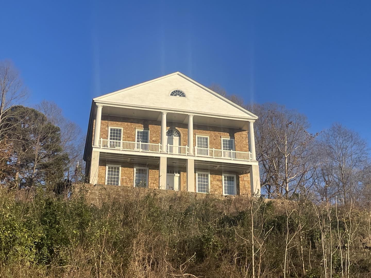
Leaving Wickliffe, cross the Ohio River Bridge into Illinois. Go north on Illinois Route 3, which follows the natural curves of the river and offers broad views of the Mississippi River Valley.
Your next destination is Thebes, Illinois, a small town rich in history. As you arrive, make your way to the Thebes Courthouse, a striking Greek Revival-style building built in 1848. This historic courthouse, sitting high on a bluff, once hosted a young Abraham Lincoln and provides a breathtaking vantage point of the river below.
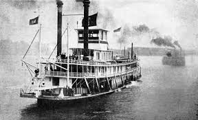
On Riverview Dr. by the river levee, don’t miss the Lewis and Clark historical marker. Meriwether Lewis and William Clark and the rest of the men camped near Thebes, Illinois in November 1803. Close by, find the Steamboats on the Mississippi marker, which commemorates Thebes’ role as a bustling river port during the steamboat era. Imagine the mighty paddlewheelers that once navigated these waters, bringing commerce and travelers to this historic stretch of the Mississippi.
Resume traveling north on IL 3. If the traveler is looking for a city in which to relax, eat or stay, turn left onto IL 146 west and cross the river into Cape Girardeau, MO. See the companion Against the Current Missouri Trip.
Otherwise, continue north on IL 3 approximately ten miles farther. About two blocks before IL 146 turns east, on the left is a turnout with another bicentennial marker.


Shawnee Hills Wine Trail, Hickory Ridge Road, Pomona, IL, USA
14 mi
View Listing
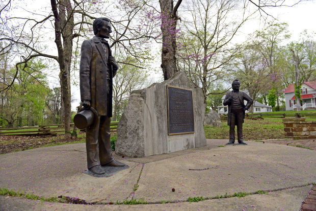
If the traveler desires to experience different types of history, turn right onto IL 146 east to Jonesboro. A historical marker along the way describes the Trail of Tears and the Lincoln-Douglas Debates, one of which took place in the center of town. There are also several other debate commemorations in town.
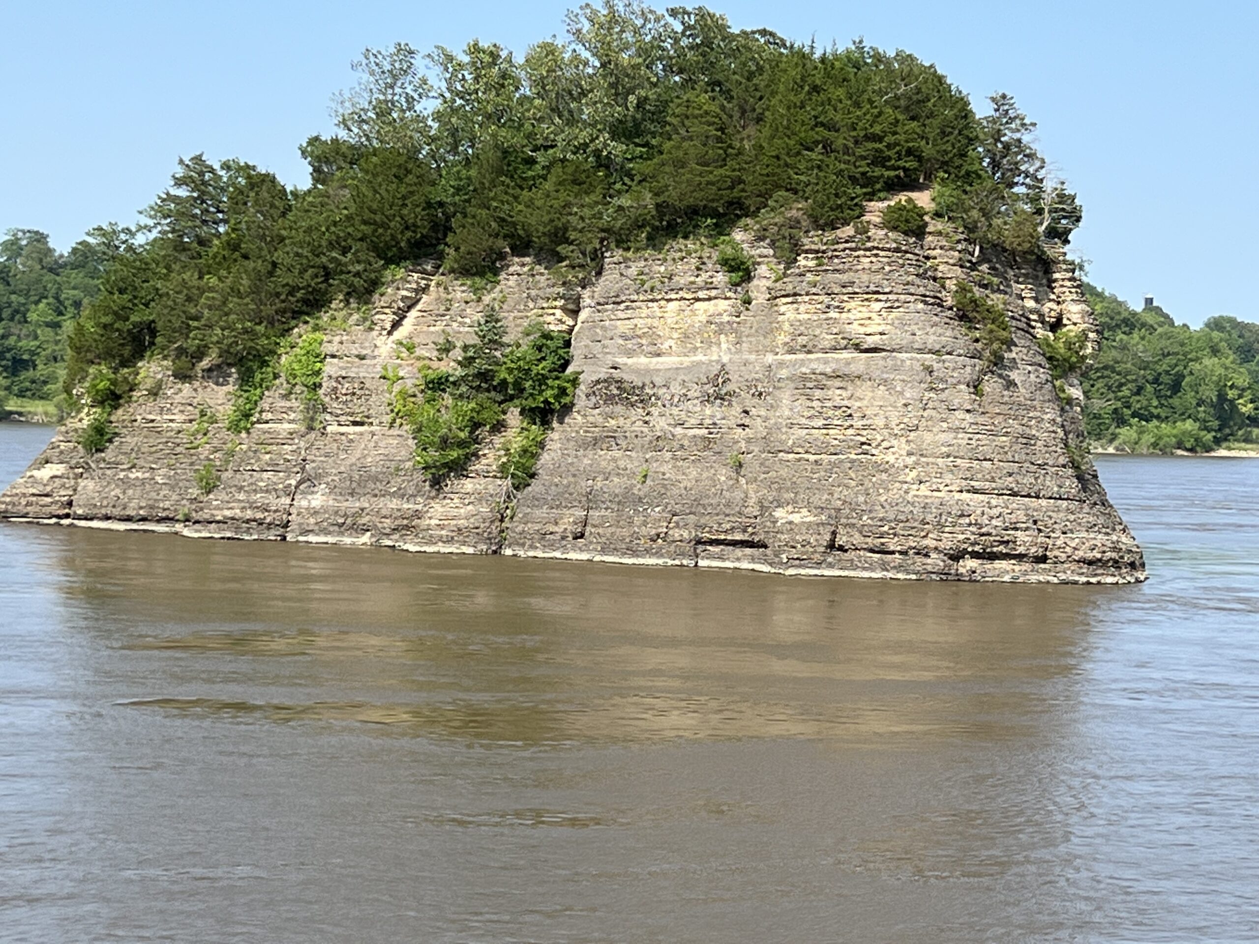
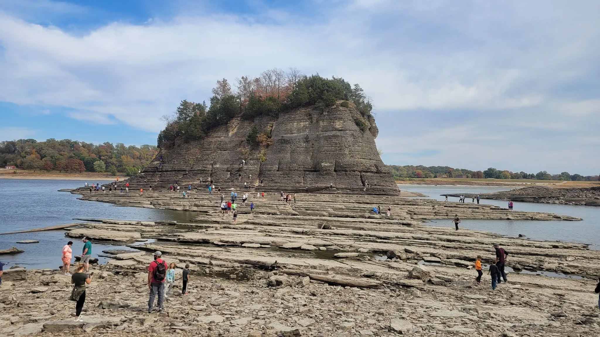
To continue with the Lewis & Clark theme, resume IL 3 north and turn left onto Grand Tower Rd. into the town of that name. Curve right onto Front St. and then stay left when the road forks ahead. On the left is another marker and a terrific view of Tower Rock across the river in Missouri. The limestone rock was visited by the Corps and mentioned in the journals. Another Lewis & Clark historical marker may be seen by staying to the left again onto Park Road ahead.

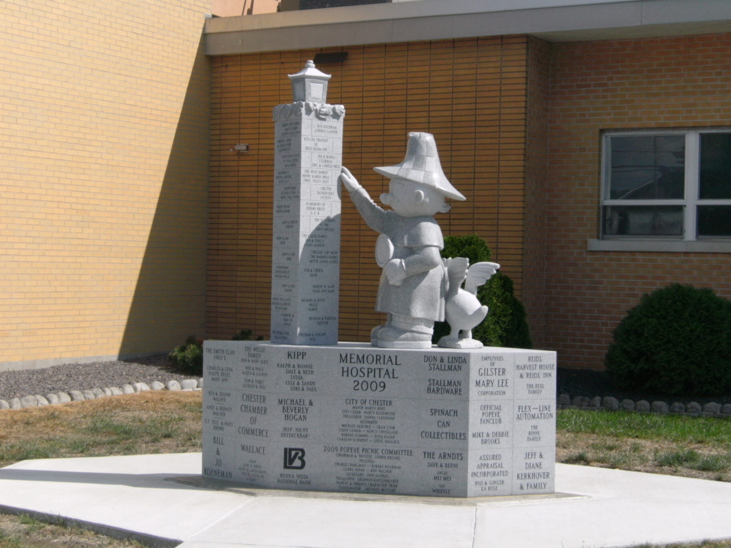
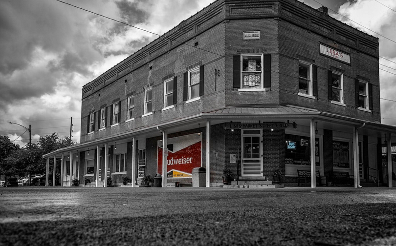
From Grand Tower, resume IL 3 north all the way to the town of Chester. Get oriented at the Bridge Welcome Center on Bridge Bypass Rd. Obtain information about the trail of whimsical Popeye character sculptures all around town. Relax and take in the magnificent view of the Mississippi below and the bridge crossing to the west side of the river. Then explore what the town of Chester has to offer.
Randolph County IL Courthouse, West Taylor Street, Chester, Illinois, USA
0 mi
View Listing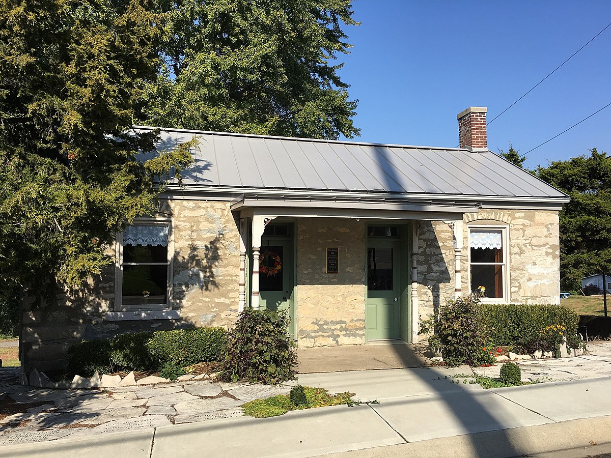
Frederick Weistar House Historic Site, Chestnut Street, Chester, IL, USA
0 mi
View Listing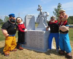
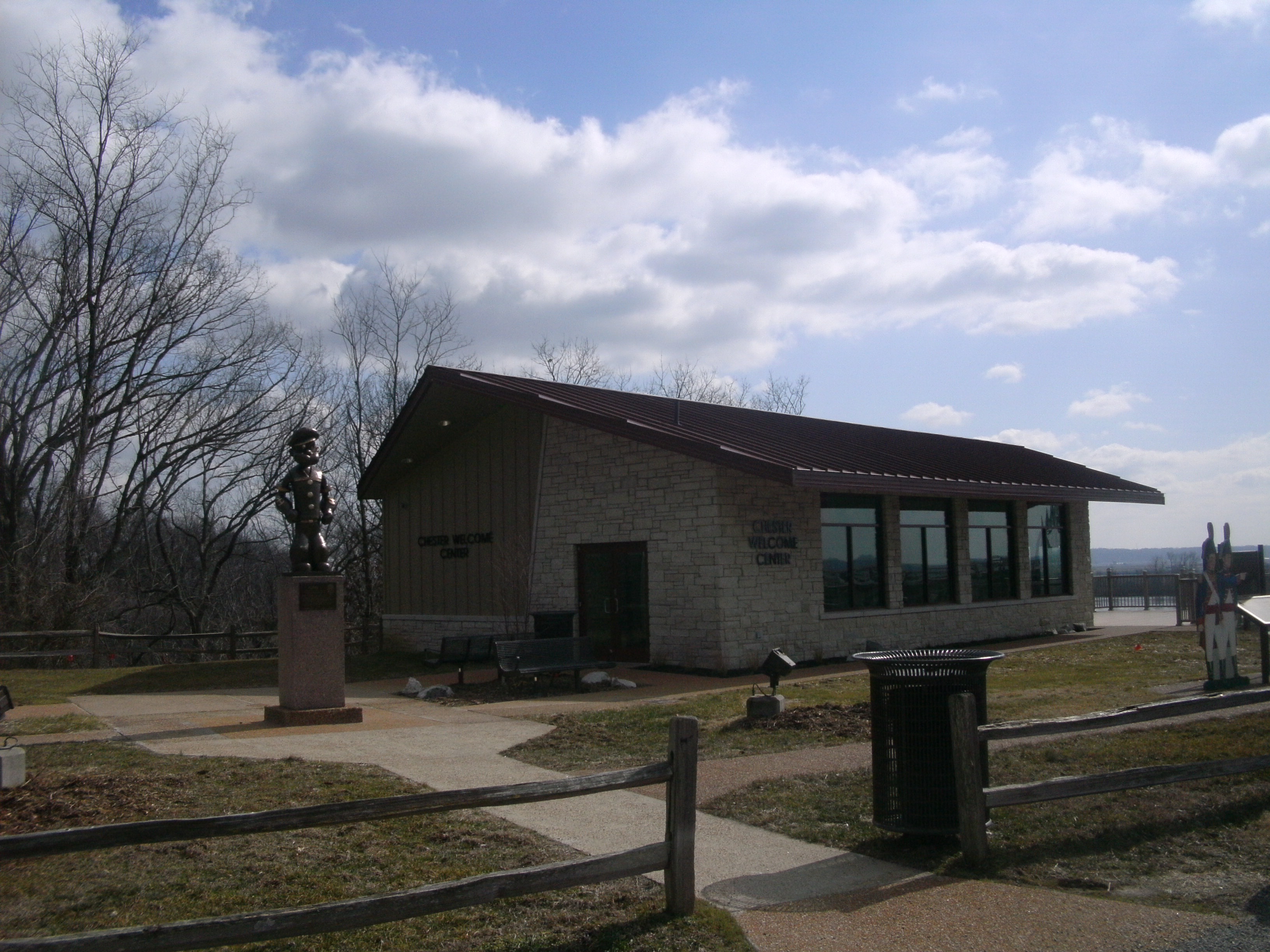
Chester Welcome Center, Bridge Bypass Road, Chester, IL, USA
0 mi
View Listing
Chester Welcome Center, 10 Bridge Bypass Rd, Chester, IL 62233, USA
0 mi
View Listing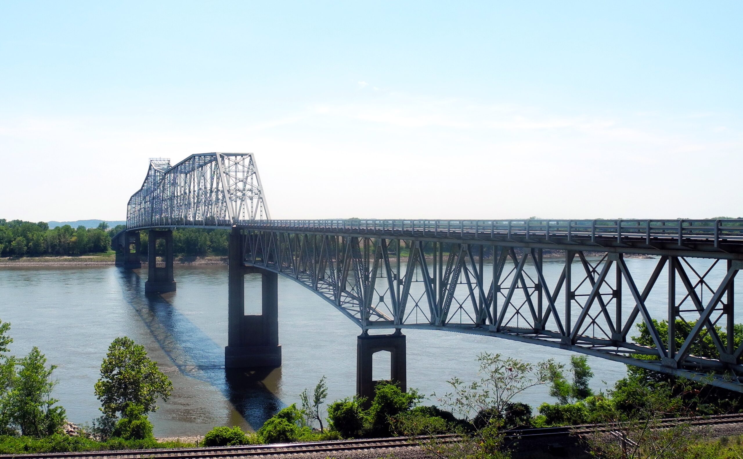
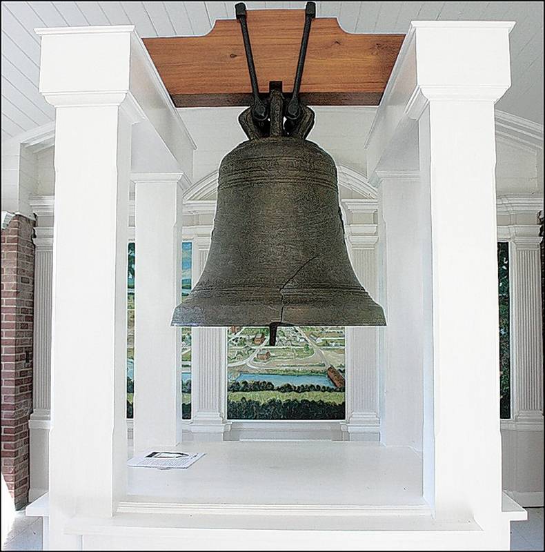
Kaskaskia Bell State Historic Site (Liberty Bell of the West), 1st Street, Chester, IL, USA
5 mi
View Listing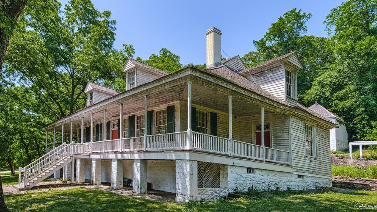
Two very worthwhile sites, the historic towns of Kaskaskia and Ste. Genevieve, are accessible by crossing the river at Chester and turning north. Details are found in the companion Against the Current: Missouri Side Trip.
This Trip will stay on the east side of the river and continue north on IL 3. As you drive along the bluffs on your right, notice the agricultural fields extending from your left down to the river. This low-lying land up and down river was historically referred to as the “American Bottoms” and was for years the most productive cropland in the world due to the frequent flooding that renewed the soil with nutrients. Channelization and flood control upriver have lessened the naturally beneficial impact of flooding, but the land still produces bumper crops.
Take Randolph St. from just east of the bridge visitor center down to Kaskaskia Rd. below the bridge. Turn right to head upriver. Pass the Menard Correctional facility on the right.
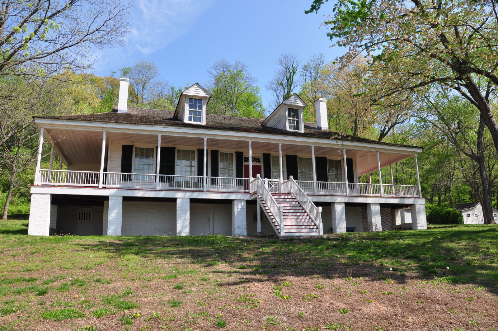
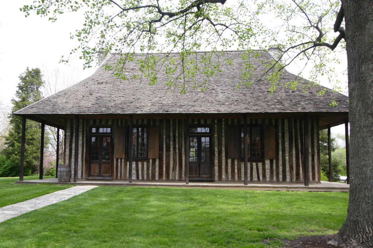
Just past Shawneetown Trail Rd. on the right is the Pierre Menard Home State Historic Site. It stands from the time Lewis & Clark passed by and its owner, a prominent businessman and fur trader, was known to them. Some Lewis and Clark interpretation is available in the museum inside, but even if you happen to find it inaccessible, a quick stroll around the house and grounds will give you a good idea of how a gentleman of that era would have lived.
Pierre Menard Home State Historic Site, Kaskaskia Street, Ellis Grove, IL, USA
0 mi
View Listing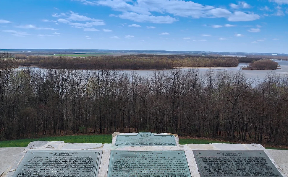
In the fall of 1803, Meriwether Lewis and William Clark traveled up the Mississippi River, gathering supplies, recruits, and information for their expedition. On November 29, Lewis arrived at Fort Kaskaskia, where he sought skilled recruits, including hunters, carpenters, and blacksmiths.
For millennia, Indigenous communities of the Illinois Confederation had lived, hunted, and farmed in this region. French settlers established a trading post at Kaskaskia in 1703, near an existing Illiniwek village, and later built an earthworks fort atop the hill. In 1763, the French officially ceded the land to the British, whose presence was very small and only occasional, and many French-speaking residents remained.
By the time Lewis arrived in 1803, the civilian population of Fort Kaskaskia was still largely French-speaking, though the U.S. military controlled the fort up the hill. Nearby, many Shawnee, Delaware, and other Indigenous groups continued to live in the area. Lewis recruited ten men from Kaskaskia to join the Corps of Discovery: John Boley, John Collins, John Dame, Patrick Gass, John Ordway, Ebenezer Tuttle, Peter Weiser, Isaac White, Alexander Hamilton Willard, and Richard Windsor. Clark left by boat on December 3, 1803.
Today, the Fort Kaskaskia State Historic Site preserves the remains of this significant landmark. Built by the French around 1759 to protect the town of Kaskaskia, the fort was small, consisting of a three-room barrack and a kitchen, and was never fully completed. It was occupied periodically by French and U.S. troops until 1807 and later provided shelter for settlers during conflicts tied to the War of 1812.
The historic site now includes four key areas: the remnants of Fort Kaskaskia, Garrison Hill Cemetery, a Mississippi River overlook with a picnic area, and a large campground. The fort’s long earthen walls still form a rough square with bastions at the corners. Established in 1891, Garrison Hill Cemetery houses the relocated graves of early settlers threatened by Kaskaskia’s flooding and features a large monument dedicated in 1892.
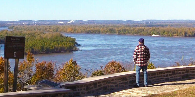
From the bluff, visitors can enjoy sweeping views of the Mississippi River and Kaskaskia Island, with interpretive panels telling the story of Kaskaskia’s rich history—including its near destruction and separation from the rest of Illinois by the river’s changing course in the late 19th century.
Fort de Chartres State Historic Site, State Route 155, Prairie du Rocher, IL, USA
16 mi
View Listing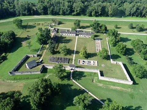
Reverse to Shawneetown Rd., turn left, and left again to resume IL 3 north. On the northern outskirts of Ellis Grove, turn left onto Roots Rd. After crossing over the Kaskaskia River, the road curves right and becomes Bluff Rd. About 4 miles ahead on the right is Modoc Rock Shelter National Historic Site with signage that explains its significance.
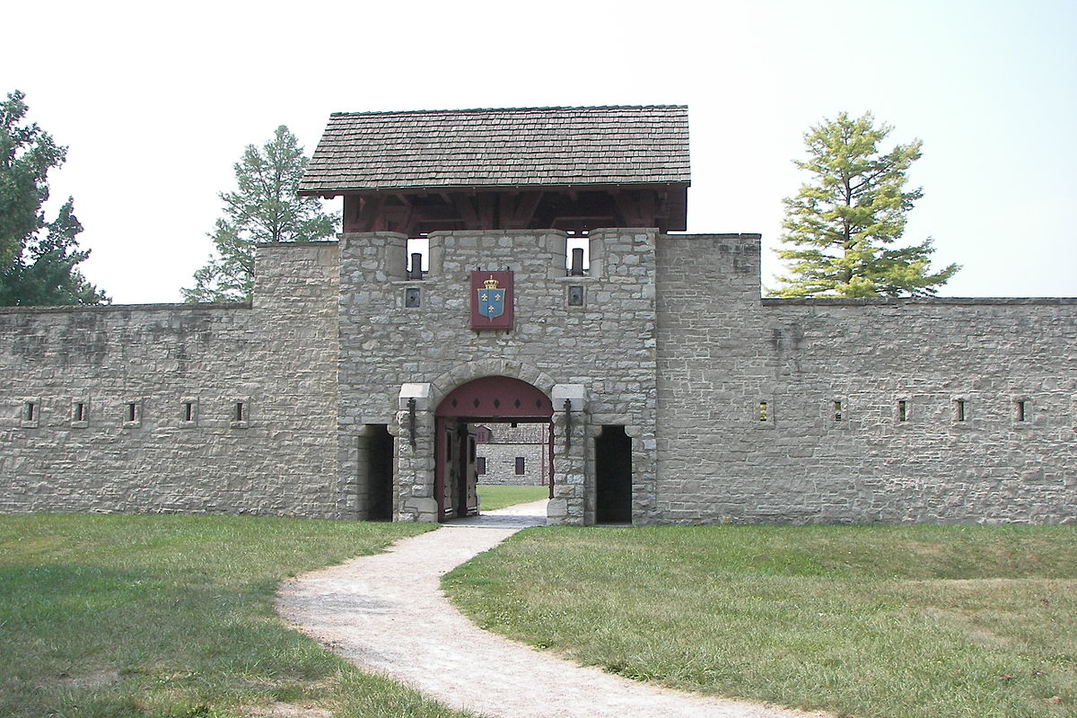
In 2 miles, on the far end of the town of Prairie du Rocher, turn left onto Henry St. (IL 155). A few miles ahead on the left is a partial recreation of the French Fort de Chartres. The small museum contains relics of the pre-Revolutionary War era and describes French influence in the area.
Continue travel in the same direction and in 2 miles, turn right onto Kaskaskia Rd., and then left onto Bluff Rd. In about 7 miles, turn right onto Maeystown Rd. and stay on it as it becomes Mill St. Take a few moments to enjoy the quaint village of Maeystown. Continue on Mill Rd. and it resumes as Maeystown Rd. or County Rd. 7 farther north.
The road becomes Lakeview Dr. as it enters the town of Waterloo. Turn right onto Library St., left to stay on it, cross IL 3, and turn right onto Cathy Ln. The parking lot for the Monroe County History Museum is ahead.
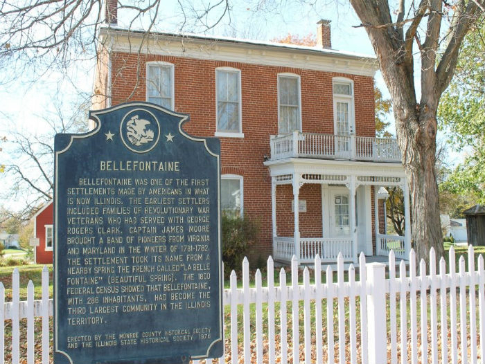
To the left of the parking lot in a shady area is a spring where Meriwether Lewis is thought to have stopped to refresh himself as he made his way by land up to the site of Camp River Dubois. Atop the hill is Bellefontaine House and the path that leads along the edge of the ridge from the house to the southwest above and behind the modern museum is where the original road ran. Lewis almost certainly traveled along this route in 1803.
724 Elaine Drive, Waterloo, Monroe County, Illinois, USA
0 mi
View Listing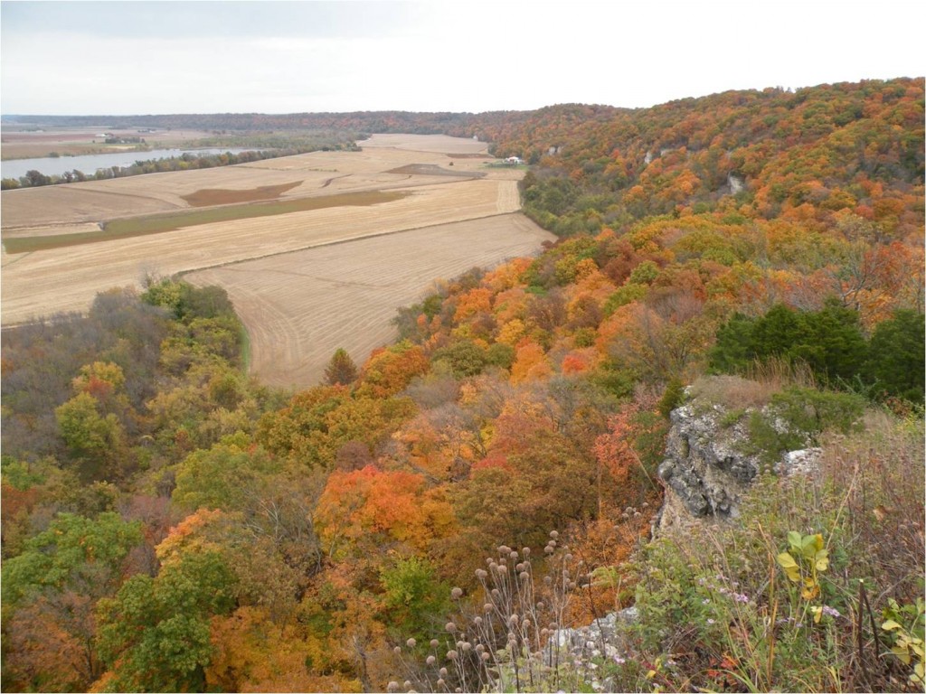
Salt Lick Point and Water Reserve Trailhead, South Meyer Avenue, Valmeyer, IL, USA
7 mi
View Listing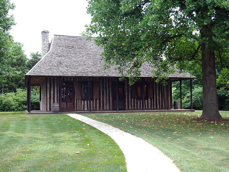
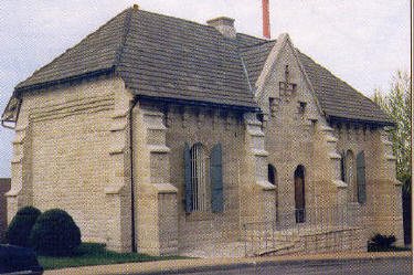
Continue north on Library St., turn left onto Park St., and right onto IL 3 north. Go through the town of Columbia and merge onto I-255 north. In 3 miles, exit back onto IL 3 north (Great River Rd.). In 2 miles, turn left onto 2nd St. Turn right onto Elm St. and up a block on the right is the Old Cahokia Courthouse. Built circa 1740, it is the oldest building in the state.
Meriwether Lewis arrived by land at the courthouse on December 7, 1803, one day ahead of the rest of the party, which was on the water. This building also served as the westernmost post office in the United States at the time and was in close proximity to the Spanish town of St. Louis, just across the river. Postal service here enabled Lewis to correspond with President Jefferson and others back east.
The renowned Indian leader Pontiac was murdered in Cahokia in 1769, a fact attested to by a historical marker on the edge of the courthouse parking lot.
Be sure to visit the nearby Jarrot House, residence of Nicholas Jarrot. Holy Family Church, and a cluster of Lewis & Clark interpretation 3 blocks east on 1st St. Another eight miles to the northeast stands Monks Mound, the largest and tallest Indian Mound north of Mexico City, as part of the Cahokia Mounds State Historic Site, a UNESCO World Heritage site. For a radical change of pace, 4 miles east of there is the World’s Largest Catsup Bottle in Collinsville, IL.
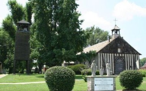
Holy Family Log Church, Church Street, Cahokia Heights, IL, USA
0 mi
View Listing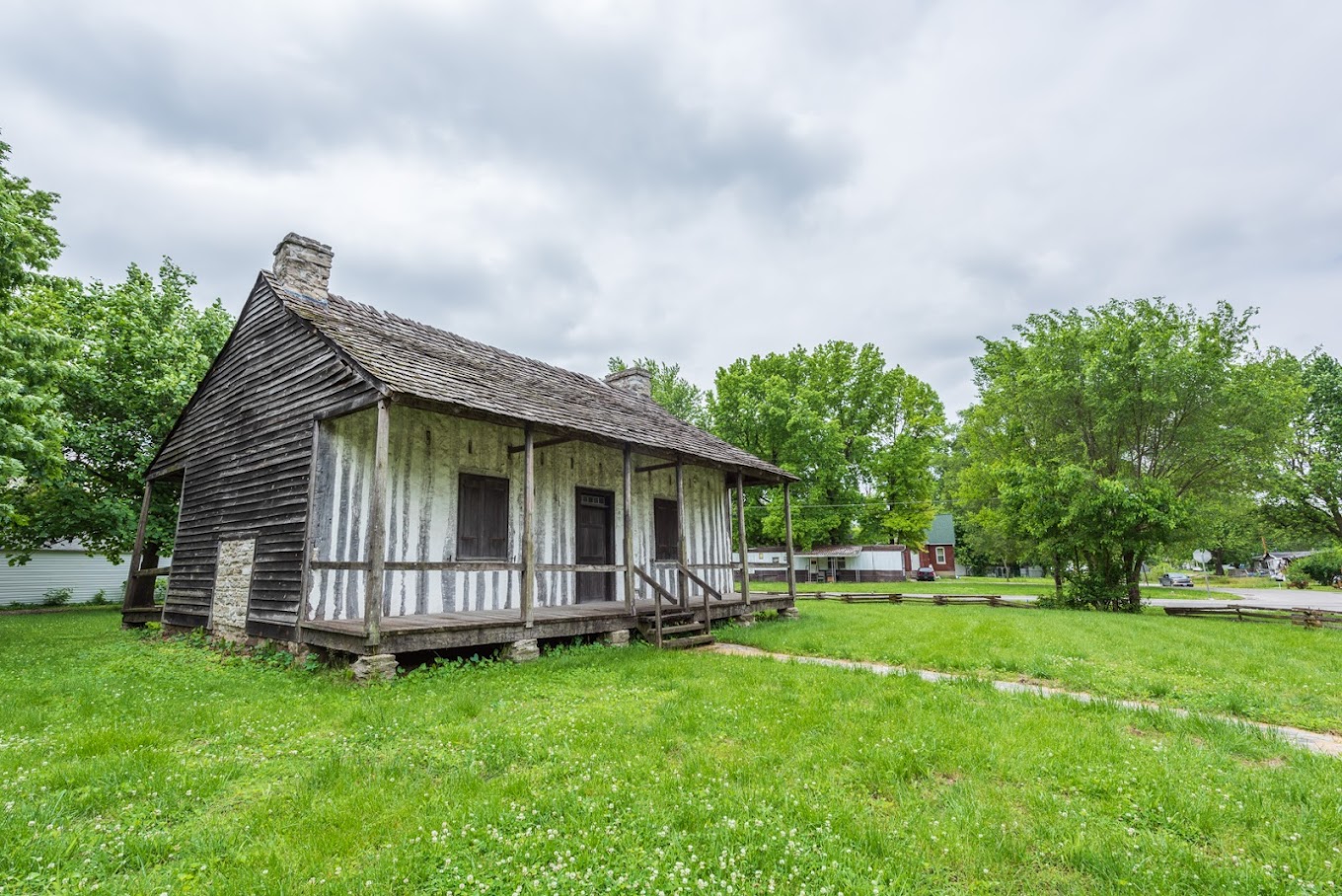
Martin-Boismenue House State Historic Site, 1st Street, East Carondelet, IL, USA
2 mi
View Listing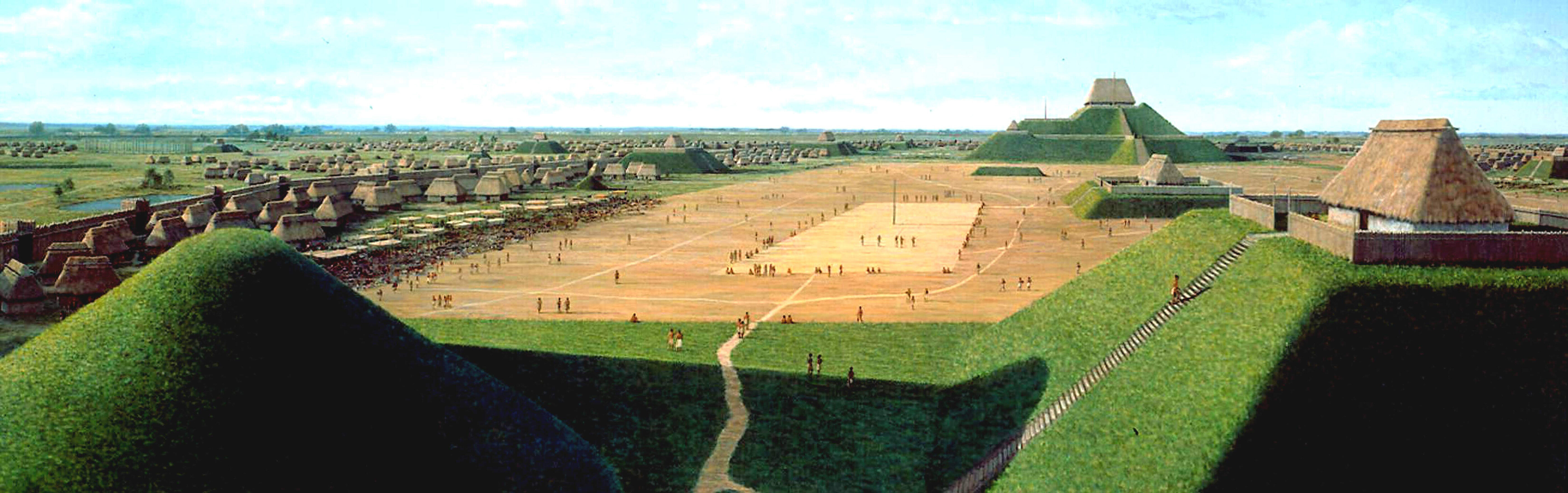
Cahokia Mounds State Historic Site, Collinsville, IL, USA
9 mi
View Listing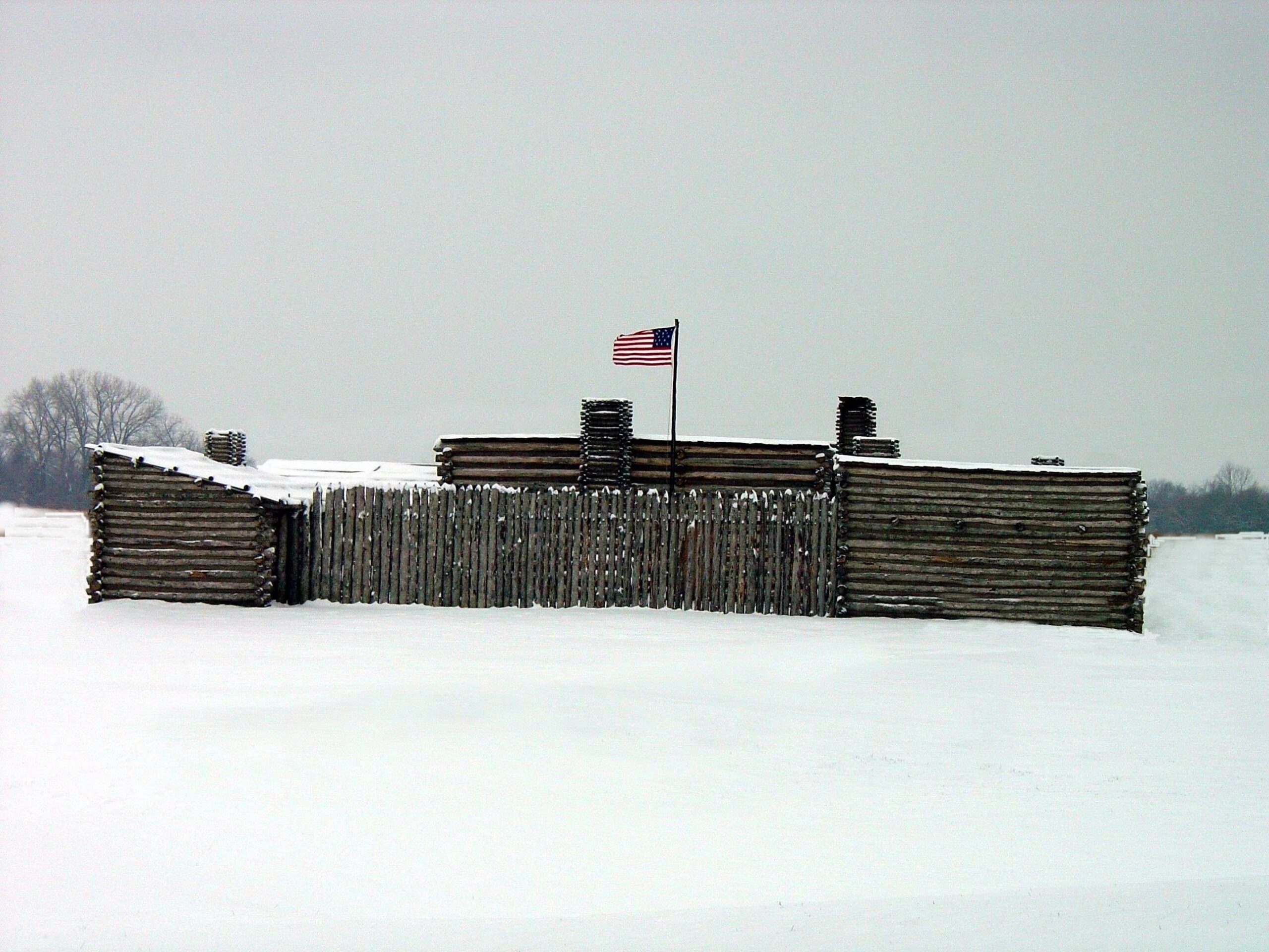
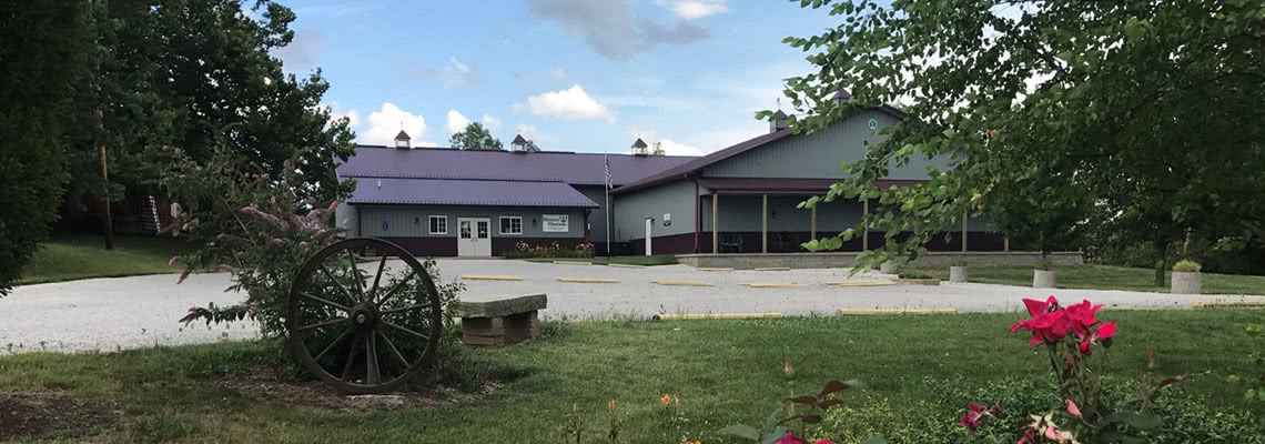
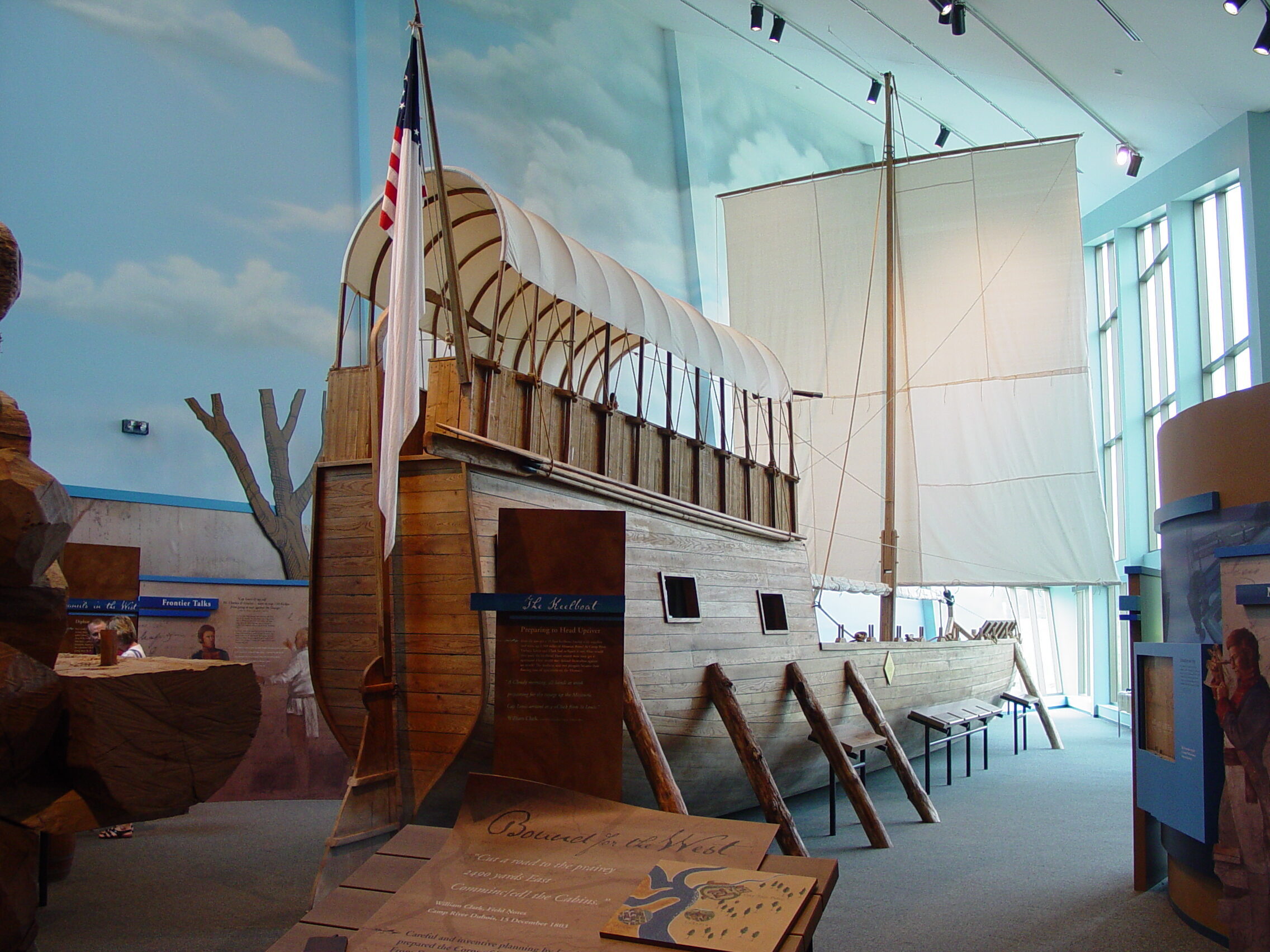
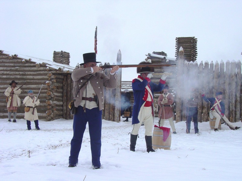
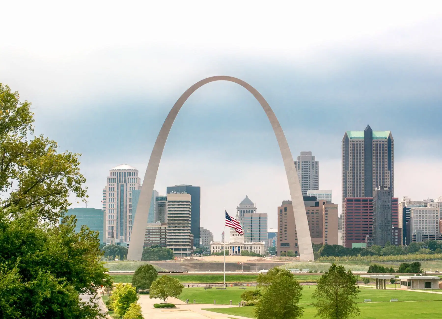
Of course, St. Louis lies across the river. But one final stop on the east side will complete your journey near the mouth of the Missouri River. Resume IL 3 north for about 18 miles to visit Camp River Dubois State Historic Site, which commemorates the first winter home of the Corps of Discovery. A fine museum and film will inform the traveler all about the extensive preparation engaged in by the men of the Corps of Discovery before they journeyed up the Missouri. A recreated fort stands outside, but it is dilapidated and in need of extensive repair.
It was from leaving this camp that Capt. William Clark penned on May 14, 1804, we “proceeded on under a jentle brease up the Missourie.” The Corps left the edge of the United States and sailed into a rendezvous with destiny.
Be sure to check out the Inspiration Trip centered on St. Louis as you make your way across the river into Missouri and continue your own journey of discovery.
Lewis and Clark (Camp River Dubois) State Historic Site, Lewis and Clark Trail, Hartford, IL, USA
0 mi
View Listing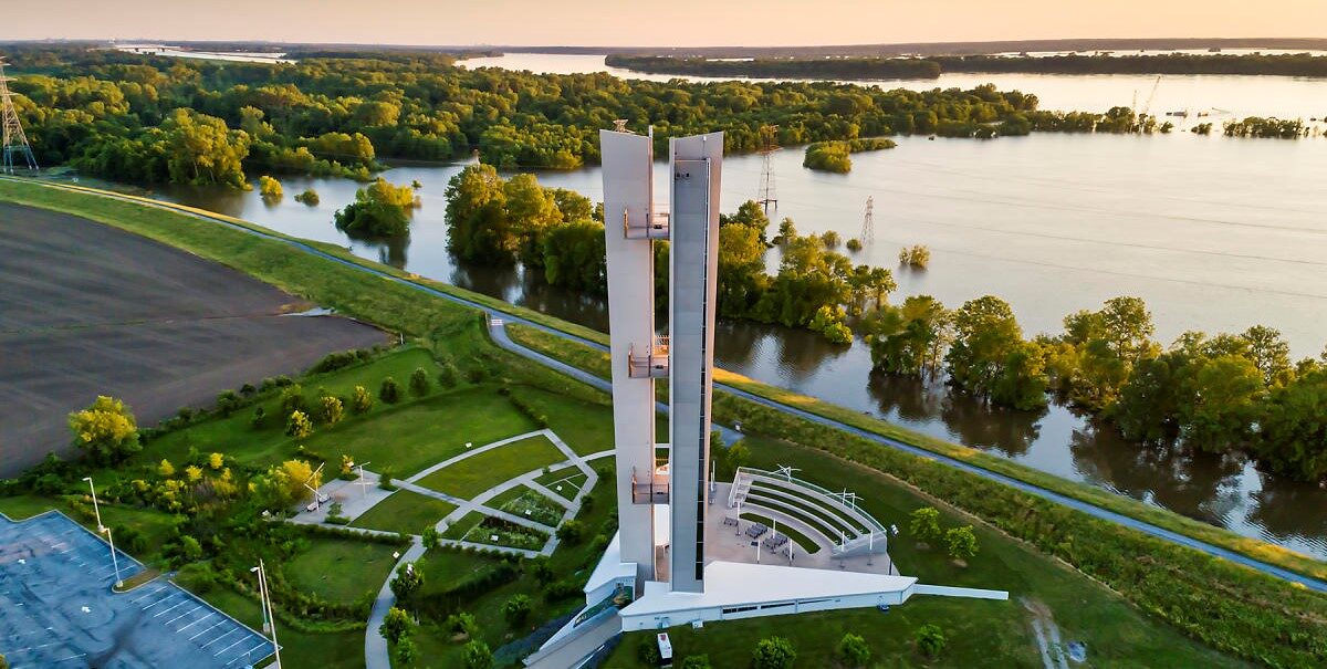
Lewis & Clark Confluence Tower, Confluence Tower Drive, Hartford, IL, USA
1 mi
View Listing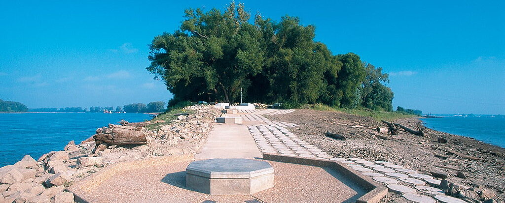
Edward "Ted" and Pat Jones-Confluence Point State Park, Riverlands Way, West Alton, MO, USA
1 mi
View Listing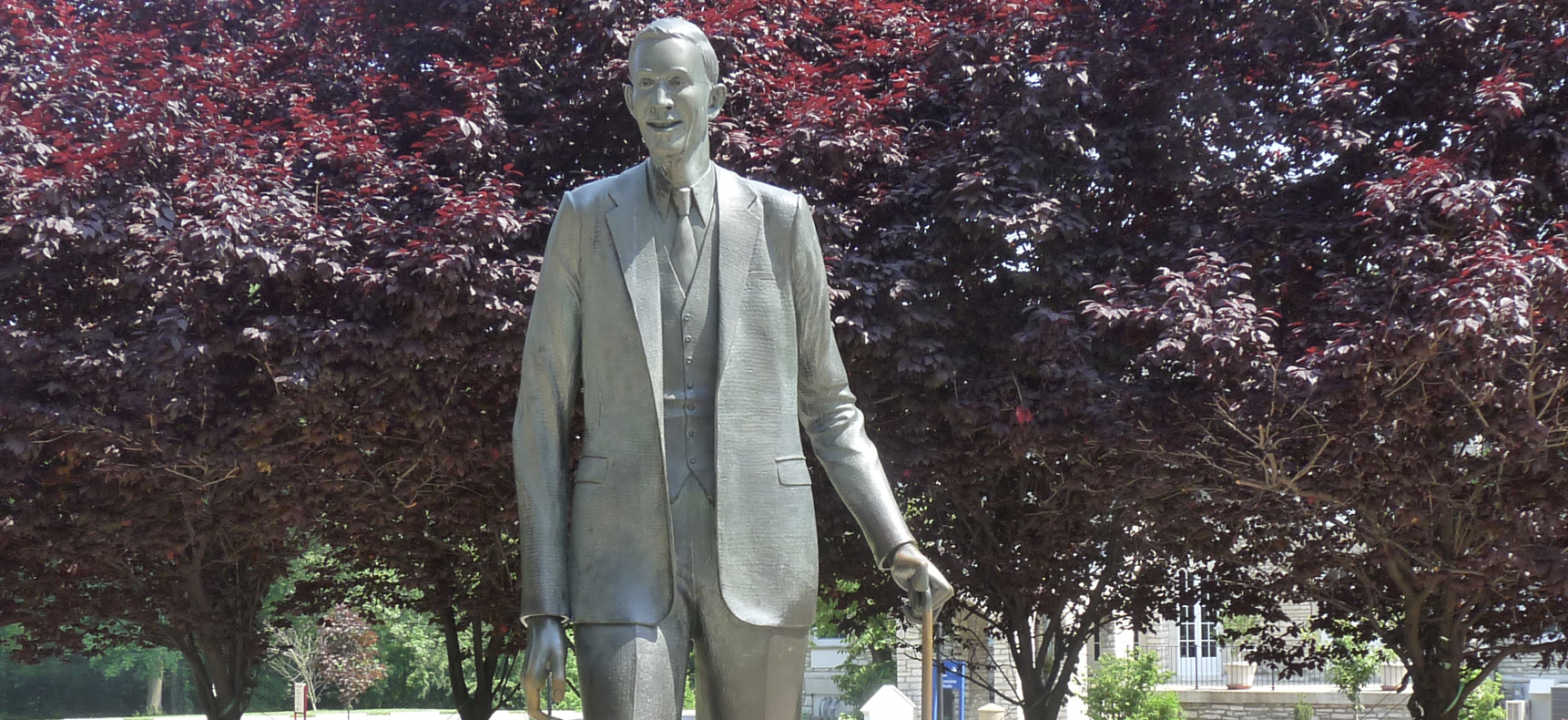
Robert Wadlow Statue, College Avenue, Alton, IL, USA
7 mi
View Listing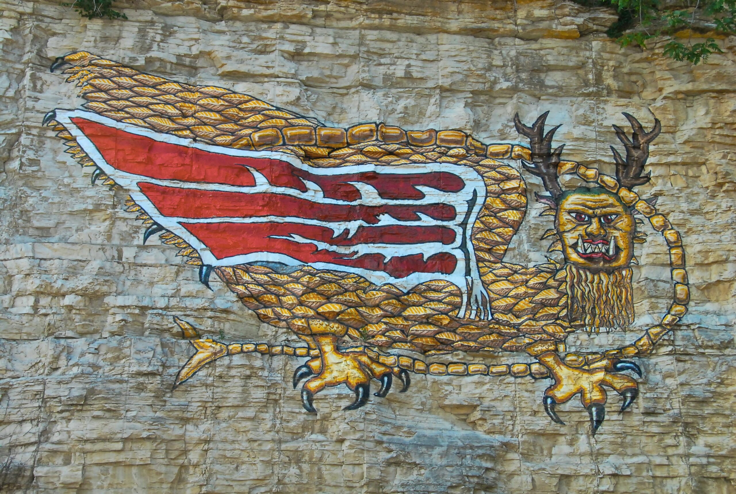
Our bi-weekly newsletter provides news, history, and information for those interested in traveling along along the Lewis & Clark Trail.


