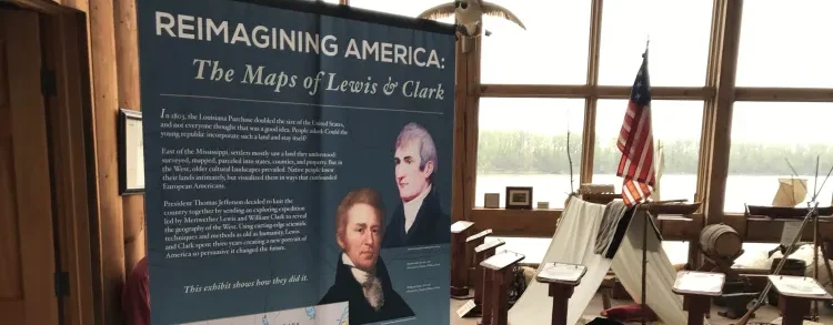
Reimagining America – The Maps of Lewis and Clark
- Location: Knife River Indian Villages National Historic Site, County Road 37, Stanton, ND, USA (View on Google Maps)
- Start Date: August 29, 2024
- End Date: October 21, 2024
- Start Time: 9:00 am
The exhibit explains how the Lewis and Clark Expedition’s findings transformed Euro-American understandings of North America in the early 1800s. It also investigates methods used by the explorers to gather and process that information, including preexisting maps, navigational scientific equipment considered cutting edge for its time, and intelligence gained from Native Americans whom the explorers interacted with. “Reimagining America” was created by the Lewis and Clark Trail Heritage Foundation to increase awareness of the story of the nation’s geographic understanding of itself and the different cultural viewpoints and strategies that enabled Lewis and Clark to map and share their data.