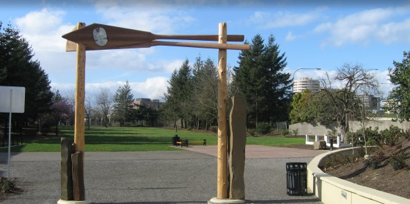
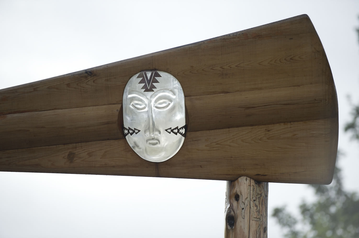
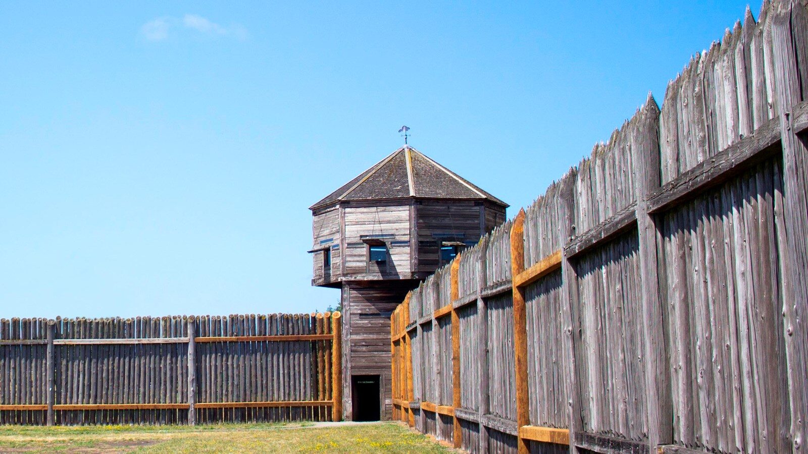
Page Feedback

Confluence Land Bridge in Vancouver

Confluence Land Bridge in Vancouver

Information

360.693-0123
lat: 45.621144 long: -122.6702891

The land bridge is a real link connecting back to the Klickitat Trail, Lewis and Clark, and the development of the Northwest. It completes a circle that’s been broken. -Johnpaul Jones

Site Features

European and Native American cultures once converged at this Columbia River site, where the Hudson’s Bay Company stood as the first European trading post in the Pacific Northwest. Lewis and Clark camped here, and Fort Vancouver was built here 20 years later. Today, the site features a 40-foot wide earth-covered pedestrian bridge that arcs over State Route 14, reconnecting historic Fort Vancouver with the Columbia River, which helped extend the fort’s influence from Mexico to Alaska and across the Pacific Ocean.

Learn about the site’s indigenous plants as you walk along the Land Bridge, which leads you up to a grand view of the river and the surrounding mountains. From the south, walk under the Land Bridge’s Welcome Gate, designed by Native American artist Lillian Pitt. Two cedar canoe panels, each adorned with a cast-glass sculpture of a Chinook woman’s face, evoke the site’s role as a historic tribal crossroads as well as a point of contact between European and Native people.

1–Welcome Gate

The Welcome Gate by artist Lillian Pitt greets visitors, representing the way Chinook people would welcome someone arriving by canoe. Two cedar logs are topped with crossed canoe paddles, set with the cast-glass face of a Chinook woman.
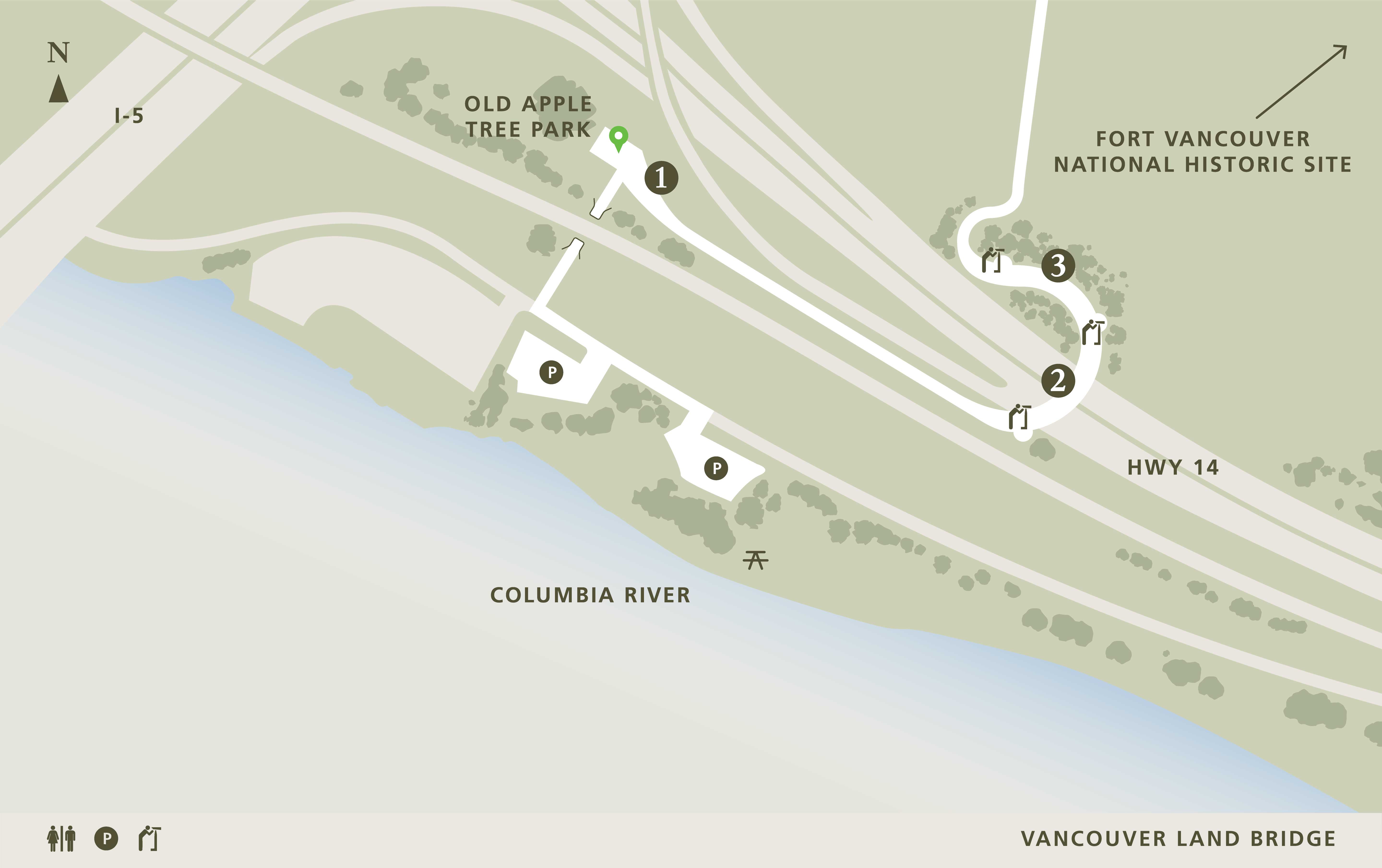
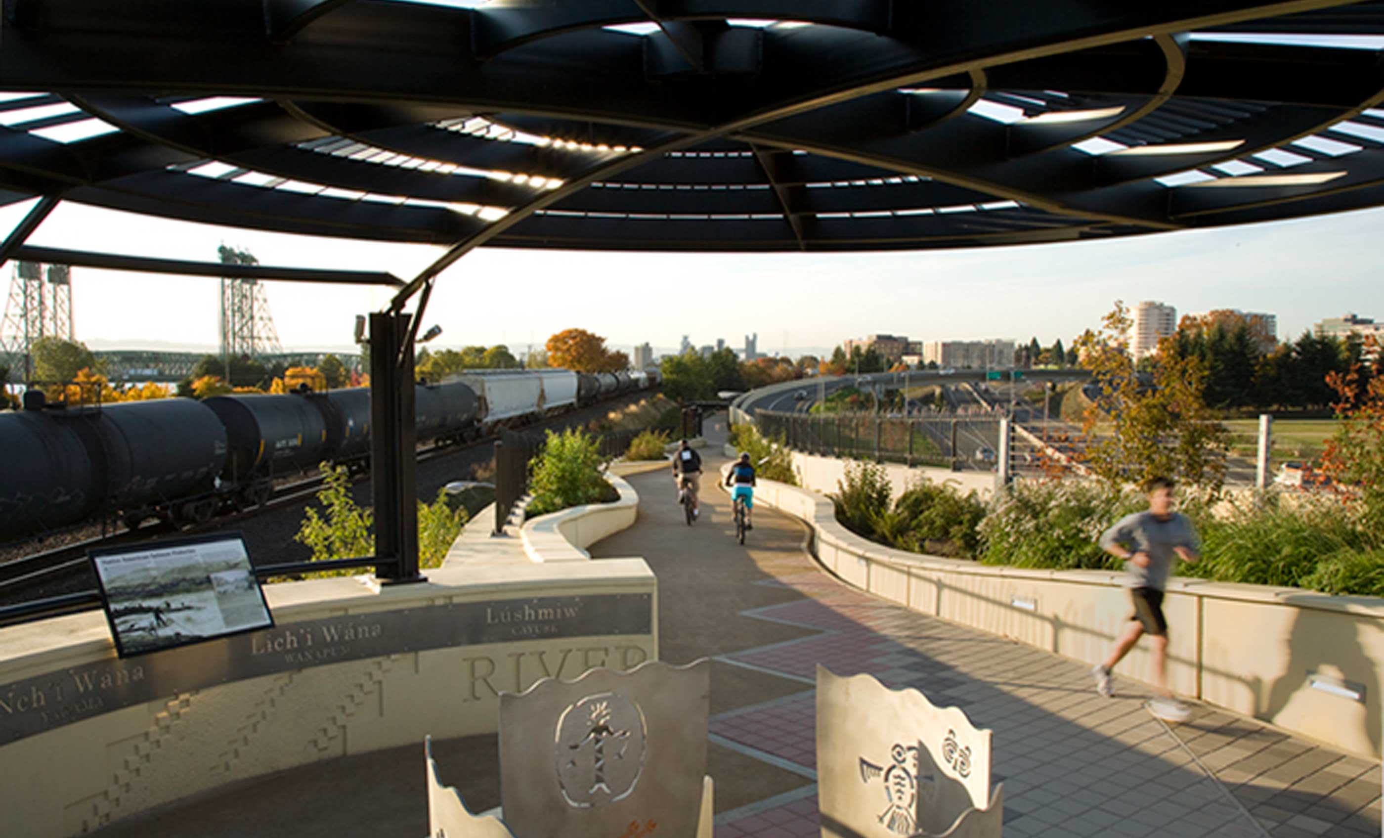
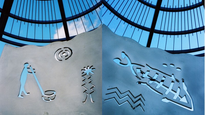
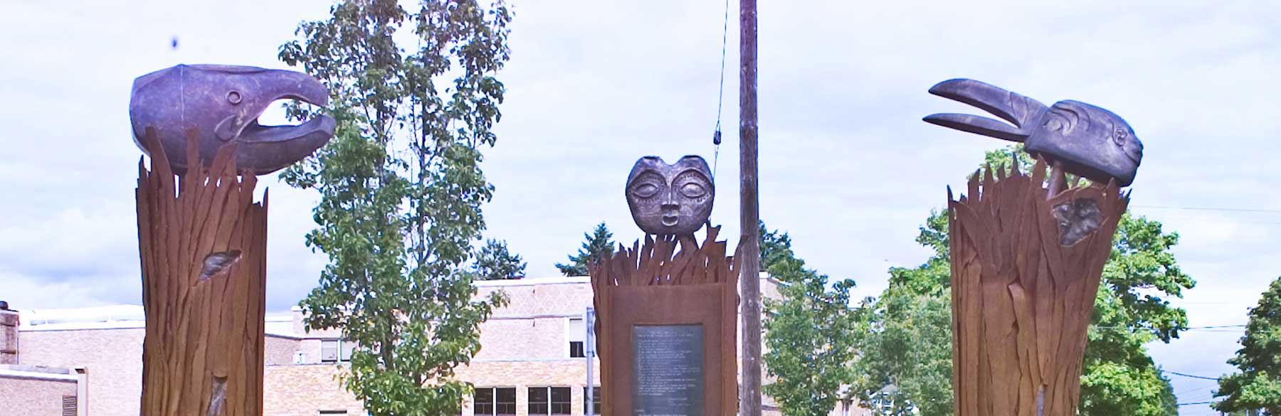
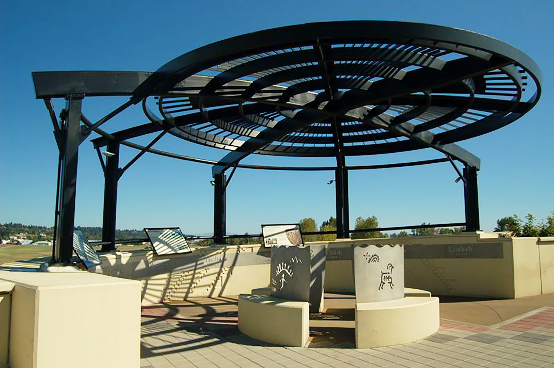
2–Overlooks

Three overlooks on the bridge mark the River, Prairie and Village. Spirit Baskets by Lillian Pitt, feature figures inspired by Columbia River petroglyphs. The words for River, Land, and People appear in nine native languages on stainless steel panels.

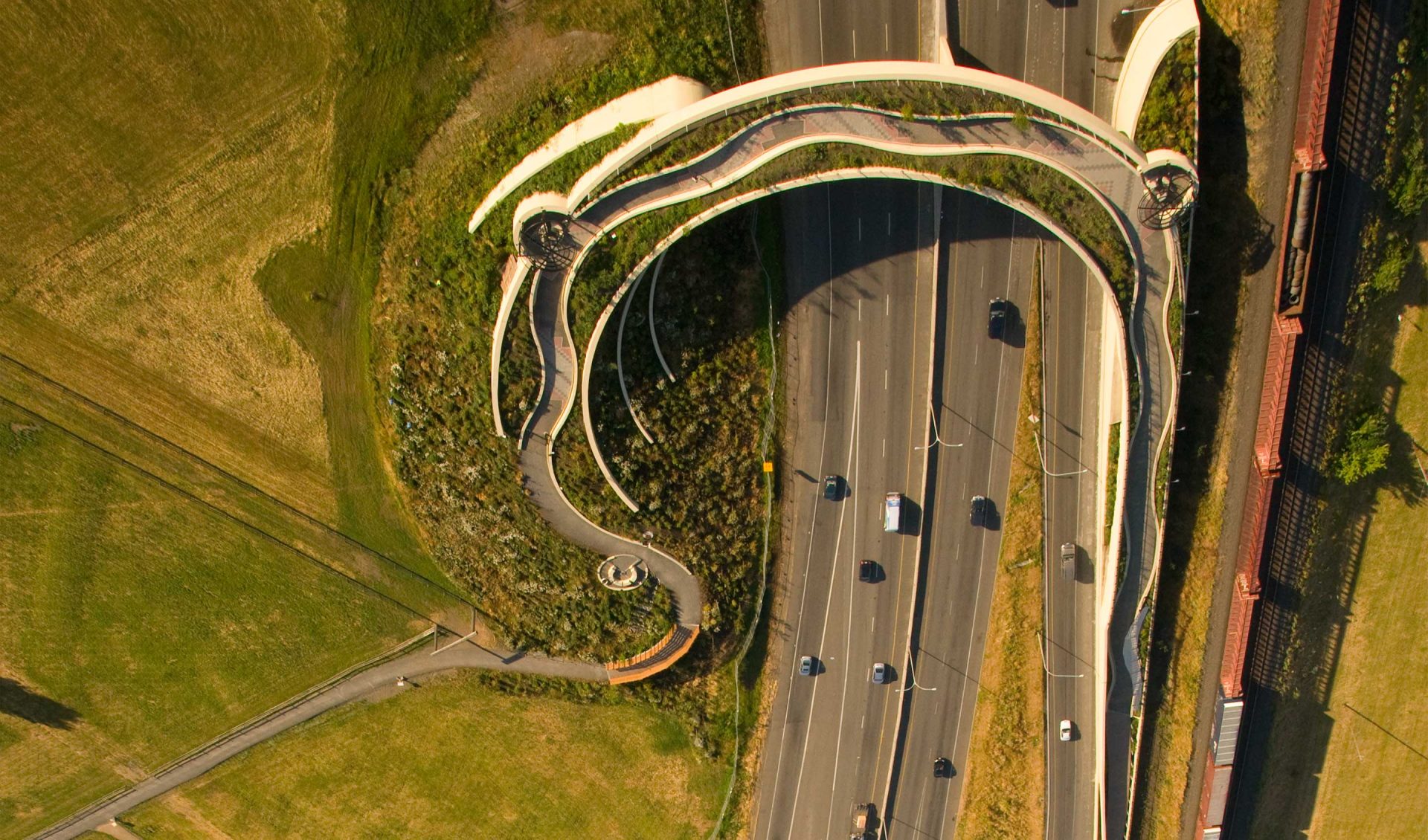
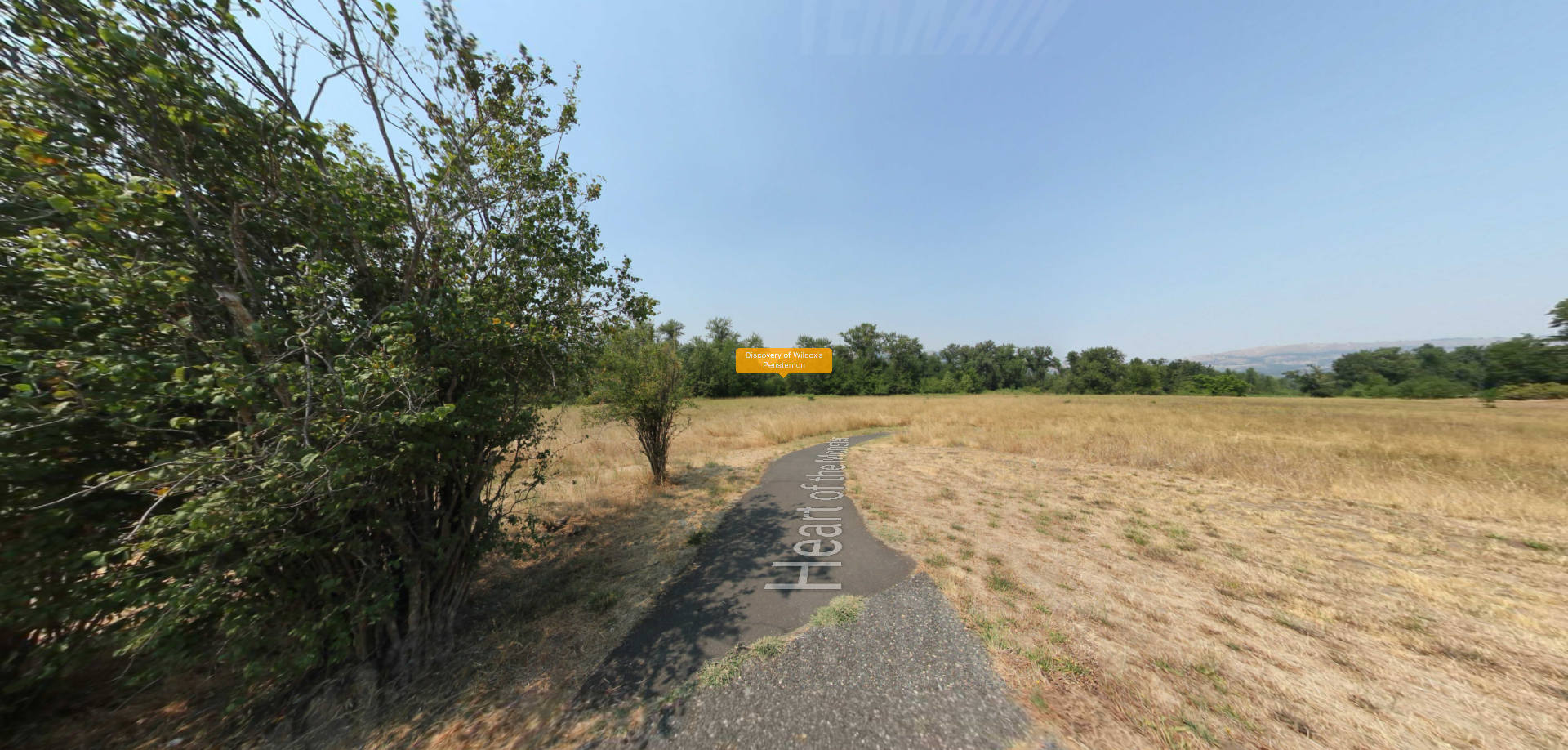
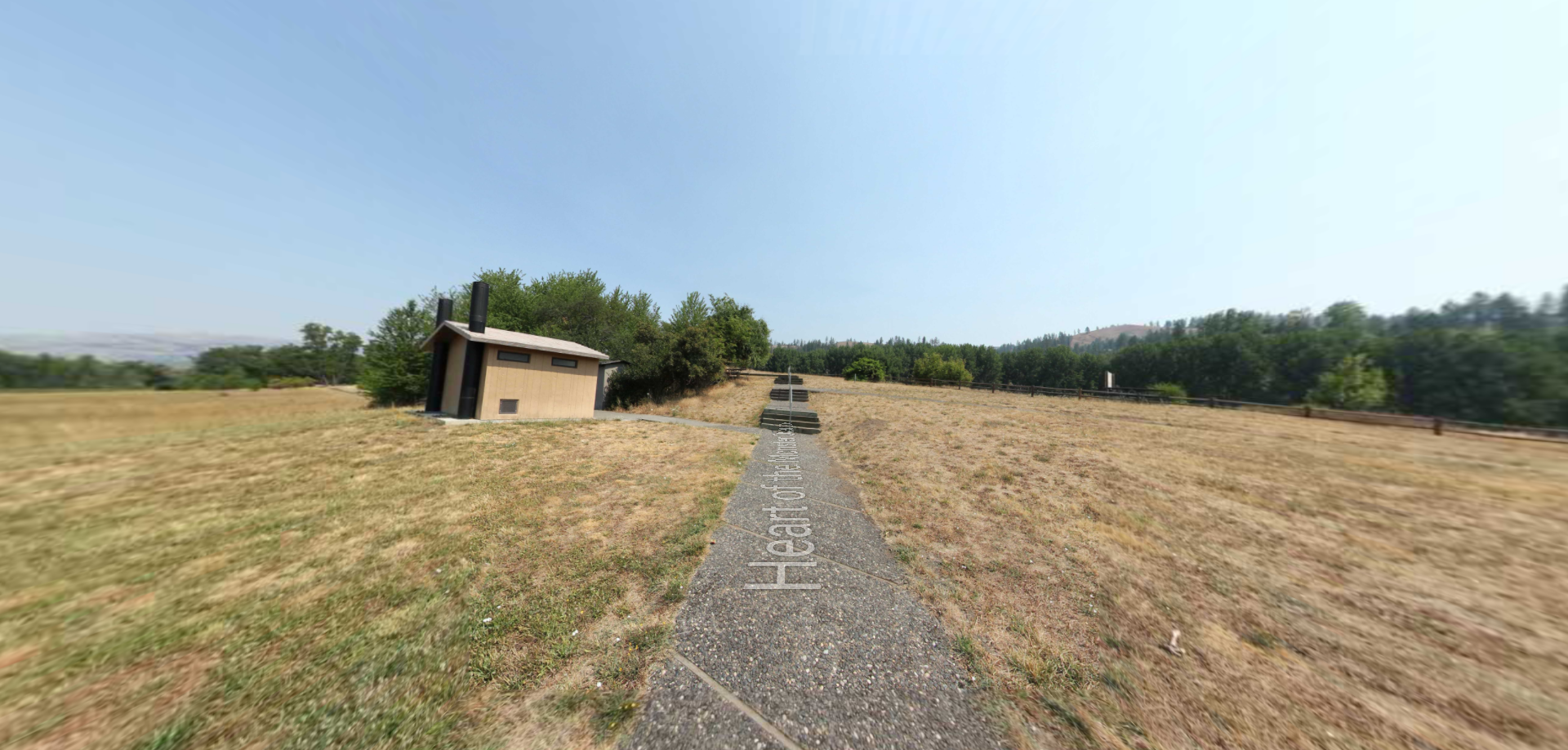
3–Ethnobotanical Walkway

Until the 17 th century, this landscape was a patchwork of prairie, forest and wetlands. Native plant species from these distinct habitats are now showcased along the Land Bridge walkway, identified by a series of interpretive panels.

Timeline

The Land Bridge was dedicated on August 23, 2008. The event featured remarks by Maya Lin and the site architect, Johnpaul Jones, of Seattle.

Project Partners

Construction of the $12.25 million Vancouver Land Bridge project is a partnership of Confluence Project members, the National Park Service, the City of Vancouver, and the Washington State Department of Commerce, and made possible through federal, state, and private funding.

Directions to Vancouver Land Bridge

There are two entrances to the Land Bridge in Vancouver, WA. The south entrance is on Columbia Way Blvd. at Old Apple Tree Park. From I-5, take Highway 14 east and take Exit 1 for SE Columbia Way toward Vancouver National Historic Reserve. Keep right, follow signs for S/Southeast Columbia Way. Turn right and drive west to the sign for Old Apple Tree Park. Park and walk under the overpass to the welcome gate of the Land Bridge.

The north entrance to the Land Bridge is just west of Fort Vancouver. From I-5, take Mill Plain Blvd east. Turn right at Fort Vancouver Way. Stay on Fort Vancouver Way through the roundabout and turn left on East 5th Street. The path to the Land Bridge will be on your right.

Watch

Watch Virtual Tour of Vancouver Land Bridge on Confluence’s Digital Library.

Watch Tanna Engdahl: We Were Excellent Land Managers on Confluence’s Digital Library.

About Confluence:

Confluence connects you to the history, living cultures, and ecology of the Columbia River system through Indigenous voices. We are a community-supported nonprofit that works through six art landscapes, educational programs, and public gatherings in collaboration with northwest tribes, communities, and the celebrated artist Maya Lin.

Nearby Attractions

Distance Unit:

Nearby Trails

Distance Unit:

Heart of the Monster

lat: 45.8164674 long: -116.2673554
Heart of the Monster Overlook

lat: 45.8164674 long: -116.2673554
Send Feedback

Instagram Feed